Liste des chapelles du Morbihan (N-Z)
Pour des raisons de taille de la page, la liste des chapelles du Morbihan a été scindée en deux, suivant les initiales des communes où se situent ces monuments :
- Liste des chapelles du Morbihan (A-M)
- Liste des chapelles du Morbihan (N-Z)
La liste des chapelles du Morbihan (N-Z) recense ainsi de manière non exhaustive les chapelles situées sur le territoire des communes du département français du Morbihan, dont les initiales sont comprises entre les lettres N et Z. Il est fait état des diverses protections dont elles peuvent bénéficier, et notamment les inscriptions et classements au titre des monuments historiques.
Liste
| Monument | Commune | Adresse | Coordonnées | Notice | Protection | Date | Illustration |
|---|---|---|---|---|---|---|---|
| Chapelle Notre-Dame | Néant-sur-Yvel | Kernéant | 48° 02′ 19″ nord, 2° 20′ 52″ ouest |
Image manquante | |||
| Chapelle Saint-Fiacre | Néant-sur-Yvel | Le Bois-Bily | 48° 02′ 20″ nord, 2° 17′ 54″ ouest |
Image manquante | |||
| Chapelle Saint-Louis | Néant-sur-Yvel | Kermagaro | 48° 00′ 33″ nord, 2° 21′ 16″ ouest |
Image manquante | |||
| Ancienne église Sainte-Anne du Bois de la Roche | Néant-sur-Yvel | Le Bois de la Roche | 48° 02′ 37″ nord, 2° 19′ 55″ ouest |
Image manquante | |||
| Chapelle du château du Fresne | Néant-sur-Yvel | Le Fresne | 48° 01′ 51″ nord, 2° 18′ 25″ ouest |
Image manquante | |||
| Chapelle Notre-Dame | Neulliac | Carmès | 48° 06′ 44″ nord, 2° 59′ 21″ ouest | « PA00091462 » | Classé | 1980 | 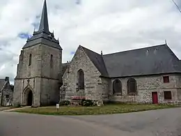 |
| Chapelle Notre-Dame-de-Délivrance | Neulliac | Le Roz | 48° 06′ 13″ nord, 2° 56′ 19″ ouest | « IA00009925 » | Inventorié | 1986 |
Image manquante |
| Chapelle Saint-Corentin | Neulliac | Le Moustoir | 48° 07′ 01″ nord, 2° 57′ 10″ ouest | « IA00009920 » | Inventorié | 1986 |
Image manquante |
| Chapelle Saint-Éloi | Neulliac | Saint-Éloi | 48° 09′ 37″ nord, 2° 59′ 40″ ouest | « IA00009926 » | Inventorié | 1986 |
Image manquante |
| Chapelle Saint-Samson | Neulliac | Saint-Samson | 48° 05′ 35″ nord, 2° 58′ 32″ ouest | « IA00009927 » | inscrit | 2021[1] |
Image manquante |
| Chapelle Saint-Cry | Nivillac | Saint-Cry | 47° 33′ 43″ nord, 2° 13′ 04″ ouest | 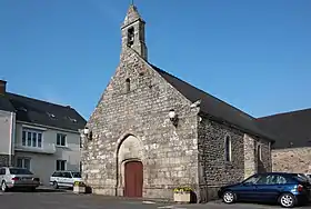 | |||
| Chapelle Sainte-Marie | Nivillac | Sainte-Marie | 47° 31′ 02″ nord, 2° 13′ 21″ ouest | 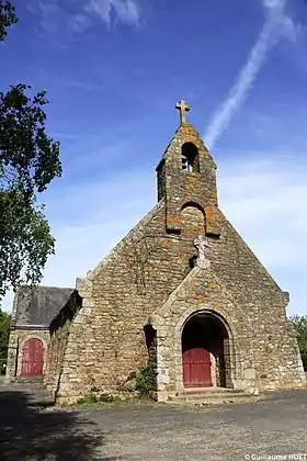 | |||
| Chapelle Notre-Dame-de-Grâces du château de Lourmois | Nivillac | Lourmois | 47° 32′ 09″ nord, 2° 16′ 44″ ouest |
Image manquante | |||
| Chapelle Notre-Dame | Nostang | Légevin | 47° 44′ 58″ nord, 3° 09′ 21″ ouest | « PA00091466 » | Inscrit | 1925 |  |
| Chapelle Notre-Dame-de-Bonne-Nouvelle | Nostang | Rue de la Côte | 47° 44′ 57″ nord, 3° 10′ 41″ ouest | « PA00091465 » | Classé | 2005 |  |
| Chapelle Saint-Bieuzy-et-Saint-Georges | Nostang | Rue de l'École-Sainte-Anne | 47° 45′ 07″ nord, 3° 11′ 13″ ouest |
Image manquante | |||
| Chapelle Saint-Cado | Nostang | Kergoh | 47° 44′ 58″ nord, 3° 11′ 35″ ouest | _4060.JPG.webp) | |||
| Chapelle Saint-Maurice-et-Saint-Symphorien | Nostang | Saint-Symphorien | 47° 46′ 09″ nord, 3° 11′ 06″ ouest |
Image manquante | |||
| Chapelle Notre-Dame | Noyal-Muzillac | Rue du Bengué | 47° 35′ 31″ nord, 2° 27′ 29″ ouest |
Image manquante | |||
| Chapelle Notre-Dame | Noyal-Muzillac | Kerrio | 47° 35′ 04″ nord, 2° 27′ 03″ ouest |
Image manquante | |||
| Chapelle Notre-Dame-de-l'Assomption | Noyal-Muzillac | Brangolo | 47° 37′ 14″ nord, 2° 27′ 47″ ouest |
Image manquante | |||
| Chapelle Notre-Dame-de-Grâces | Noyal-Muzillac | Grâce | 47° 33′ 52″ nord, 2° 26′ 04″ ouest |
Image manquante | |||
| Chapelle Saint-Arnould de Noyal-Pontivy | Noyal-Pontivy | Kergoff | 48° 04′ 11″ nord, 2° 50′ 13″ ouest | « IA00010378 » | Inventorié | 1986 |
Image manquante |
| Chapelle Sainte-Barbe de Noyal-Pontivy | Noyal-Pontivy | Poulvern | 48° 00′ 22″ nord, 2° 53′ 56″ ouest | « PA56000086 » | Classé | 2018 |  |
| Chapelle Sainte-Noyale | Noyal-Pontivy | Sainte-Noyale | 48° 04′ 58″ nord, 2° 54′ 05″ ouest | « PA00091467 » | Classé |
1943 1965 |
_Chapelle_Sainte-Noyale_016.JPG.webp) |
| Oratoire Saint-Jean | Noyal-Pontivy | Sainte-Noyale | 48° 04′ 58″ nord, 2° 54′ 04″ ouest | « PA00091467 » | Classé | 1965 | 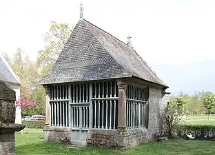 |
| Chapelle Notre-Dame | Le Palais | Rue de Verdun | 47° 20′ 45″ nord, 3° 09′ 21″ ouest | « IA00008194 » | Inventorié | 1986 |
Image manquante |
| Chapelle Notre-Dame-de-Miséricorde | Le Palais | Rue Joseph-Le-Brix | 47° 20′ 48″ nord, 3° 09′ 36″ ouest | « IA00008183 » | Inventorié | 1986 |
Image manquante |
| Chapelle Saint-André | Péaule | Saint-André | 47° 35′ 17″ nord, 2° 19′ 03″ ouest |
Image manquante | |||
| Chapelle Saint-Cornély | Péaule | Saint-Cornély | 47° 34′ 14″ nord, 2° 18′ 18″ ouest |
Image manquante | |||
| Chapelle Saint-Leufroy | Péaule | Saint-Leufroy | 47° 36′ 17″ nord, 2° 20′ 13″ ouest |
Image manquante | |||
| Chapelle Saint-Michel | Péaule | Rue Saint-Michel | 47° 34′ 46″ nord, 2° 21′ 22″ ouest | .jpg.webp) | |||
| Chapelle de la Congrégation | Peillac | Rue de la Cité-des-Fleurs Rue de la Mairie |
47° 42′ 48″ nord, 2° 13′ 11″ ouest |  | |||
| Chapelle Notre-Dame-de-Liesse | Peillac | Maubran | 47° 42′ 58″ nord, 2° 15′ 00″ ouest | 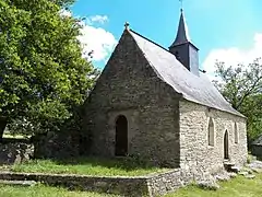 | |||
| Chapelle Saint-Julien | Peillac | La Boulaie | 47° 42′ 38″ nord, 2° 11′ 48″ ouest |  | |||
| Chapelle Saint-Yves | Pénestin | 30 rue du Port Tréhiguier |
47° 29′ 38″ nord, 2° 26′ 27″ ouest | %252C_ancienne_chapelle_saint-Yves%252C_Tr%C3%A9higuier.JPG.webp) | |||
| Chapelle Notre-Dame | Persquen | Le Pénéty | 47° 59′ 49″ nord, 3° 13′ 56″ ouest | « IA00008355 » | Inventorié | 1986 |
Image manquante |
| Chapelle Saint-Vincent-Ferrier | Persquen | Saint-Vincent | 47° 59′ 37″ nord, 3° 14′ 12″ ouest | « IA00008357 » | Inventorié | 1986 |
Image manquante |
| Chapelle du château de Penvern | Persquen | Penvern | 48° 00′ 54″ nord, 3° 14′ 13″ ouest | « PA00091472 » | Inscrit | 2009 |
Image manquante |
| Chapelle de la Madeleine | Plaudren | Le Moustoiric | 47° 44′ 53″ nord, 2° 43′ 32″ ouest | « IA00009433 » | Inventorié | 1986 |  |
| Chapelle Notre-Dame-des-Fleurs | Plaudren | Le Mené | 47° 49′ 04″ nord, 2° 40′ 58″ ouest | « IA00009441 » | Inventorié | 1986 |
Image manquante |
| Chapelle Saint-Bily | Plaudren | Saint-Bily | 47° 46′ 40″ nord, 2° 38′ 14″ ouest | « IA00009438 » | Inventorié | 1986 | 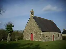 |
| Chapelle de la Sainte-Famille du manoir de Kergolher | Plaudren | Kergolher | 47° 46′ 47″ nord, 2° 42′ 18″ ouest | « IA00009436 » | Inventorié | 1986 |
Image manquante |
| Chapelle Notre-Dame | Plescop | Lézurgan | 47° 41′ 43″ nord, 2° 50′ 41″ ouest | « PA00091475 » | Inscrit | 1951 |  |
| Chapelle Saint-Barthélémy | Plescop | Le Gusquel | 47° 41′ 28″ nord, 2° 51′ 47″ ouest | « IA00009468 » | Inventorié | 1986 |
Image manquante |
| Chapelle Saint-Hamon | Plescop | Route de Kerizouet | 47° 41′ 49″ nord, 2° 48′ 04″ ouest | « IA00009467 » | Inventorié | 1986 |
Image manquante |
| Chapelle Saint-Barthélémy | Pleucadeuc | Saint-Barthélémy | 47° 46′ 29″ nord, 2° 24′ 38″ ouest | 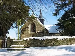 | |||
| Chapelle Saint-Marc | Pleucadeuc | Saint-Marc | 47° 48′ 00″ nord, 2° 21′ 58″ ouest |  | |||
| Chapelle Saint-Joseph du château de la Prévostais | Pleucadeuc | La Prévotais | 47° 46′ 12″ nord, 2° 21′ 24″ ouest |
Image manquante | |||
| Chapelle Saint-Vincent-Ferrier | Pleugriffet | La Ville-Tual | 47° 39′ 52″ nord, 2° 39′ 28″ ouest |
Image manquante | |||
| Chapelle Sainte-Margeurite | Pleugriffet | Sainte-Margeurite | 48° 00′ 01″ nord, 2° 41′ 32″ ouest |
Image manquante | |||
| Chapelle Notre-Dame-de-Pitié | Ploemel | Locmaria | 47° 38′ 56″ nord, 3° 02′ 49″ ouest | « PA00091480 » | Inscrit | 1927 |  |
| Chapelle Notre-Dame-de-Recouvrance | Ploemel | Rue Joseph-Le-Pévédic | 47° 39′ 03″ nord, 3° 04′ 15″ ouest | « PA00091486 » | Inscrit | 1925 |  |
| Chapelle Saint-Cado | Ploemel | Saint-Cado | 47° 39′ 14″ nord, 3° 06′ 06″ ouest |  | |||
| Chapelle Saint-Laurent | Ploemel | Saint-Laurent | 47° 38′ 54″ nord, 3° 06′ 41″ ouest |  | |||
| Chapelle Saint-Méen | Ploemel | Saint-Méen | 47° 40′ 47″ nord, 3° 04′ 22″ ouest | « PA00091481 » | Inscrit | 1925 |  |
| Chapelle Notre-Dame-de-la-Garde | Ploemeur | Rue du Gazu Lomener |
47° 42′ 11″ nord, 3° 25′ 56″ ouest |  | |||
| Chapelle Saint-Léonard | Ploemeur | Kerguen | 47° 43′ 15″ nord, 3° 27′ 51″ ouest |
Image manquante | |||
| Chapelle Saint-Mathurin | Ploemeur | Saint-Mathurin | à géolocaliser |  | |||
| Chapelle Saint-Maudé | Ploemeur | Rue du Divit Penhoat-Quinio |
47° 44′ 47″ nord, 3° 24′ 32″ ouest |
Image manquante | |||
| Chapelle Saint-Simon-et-Saint-Jude | Ploemeur | Saint-Jude | 47° 43′ 38″ nord, 3° 29′ 08″ ouest |  | |||
| Chapelle Saint-Thual | Ploemeur | Kerdroual | 47° 43′ 49″ nord, 3° 24′ 42″ ouest |
Image manquante | |||
| Chapelle Sainte-Anne | Ploemeur | Rue Sainte-Anne Rue Saint-Deron |
47° 44′ 13″ nord, 3° 25′ 27″ ouest | « PA00091487 » | Inscrit | 1944 | 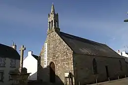 |
| Chapelle de la Madeleine | Ploërdut | La Madeleine | 48° 06′ 45″ nord, 3° 19′ 01″ ouest | « IA00008377 » | Inventorié | 1986 |
Image manquante |
| Chapelle Notre-Dame | Ploërdut | Crénénan | 48° 04′ 57″ nord, 3° 13′ 49″ ouest | « PA56000018 » | Inscrit | 1998 | _Chapelle_Notre-Dame-de-Cr%C3%A9n%C3%A9nan_03.JPG.webp) |
| Chapelle Notre-Dame-de-la-Fosse | Ploërdut | Locuon | 48° 09′ 03″ nord, 3° 18′ 10″ ouest | « IA00008376 » | Inventorié | 1986 |  |
| Chapelle Saint-Michel | Ploërdut | Quénecolet | 48° 03′ 56″ nord, 3° 17′ 23″ ouest | « IA00008378 » | Inventorié | 1986 |
Image manquante |
| Chapelle de la Trinité | Ploërdut | Lochrist | 48° 04′ 17″ nord, 3° 19′ 55″ ouest | « PA00091491 » | Inscrit | 1933 |  |
| Chapelle Notre-Dame | Ploeren | Béléan | 47° 40′ 47″ nord, 2° 49′ 05″ ouest | « PA00091493 » | Inscrit Inscrit |
1925 2010 |
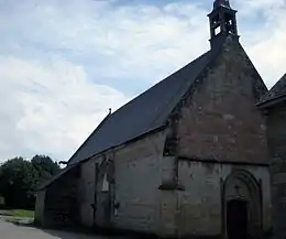 |
| Chapelle de la Congrégation | Ploërmel | Place Lamennais | 47° 55′ 54″ nord, 2° 23′ 58″ ouest | _chapelle_du_lyc%C3%A9e_Lamenaie.jpg.webp) | |||
| Chapelle de la Croix-Marie | Ploërmel | La Gaudinais | 47° 54′ 19″ nord, 2° 24′ 17″ ouest | « IA00010262 » | Inventorié | 1986 |
Image manquante |
| Chapelle Saint-Antoine | Ploërmel | Saint-Antoine | 47° 55′ 07″ nord, 2° 24′ 24″ ouest | « PA00091496 » | Inscrit | 1928 |  |
| Chapelle Saint-Denis | Ploërmel | Rue Saint-Denis | 47° 55′ 44″ nord, 2° 23′ 11″ ouest | « IA00010258 » | Inventorié | 1986 |
Image manquante |
| Chapelle Saint-Jean-Baptiste | Ploërmel | Saint-Jean-de-Villenard | 47° 54′ 47″ nord, 2° 20′ 58″ ouest | « IA00010219 » | Inventorié | 1986 |
Image manquante |
| Chapelle Saint-Joseph de Grancastel | Ploërmel | Grancastel | 47° 57′ 06″ nord, 2° 23′ 53″ ouest | « IA00010259 » | Inventorié | 1986 |
Image manquante |
| Chapelle Saint-Joseph de Roc-Brien | Ploërmel | Roc-Brien | 47° 53′ 56″ nord, 2° 25′ 49″ ouest | « IA00010222 » | Inventorié | 1986 |
Image manquante |
| Chapelle Saint-Maur | Ploërmel | Saint-Maur | 47° 56′ 58″ nord, 2° 22′ 08″ ouest | « IA00010250 » | Inventorié | 1986 |  |
| Chapelle Saint-Roch | Ploërmel | La Couardière | 47° 55′ 30″ nord, 2° 20′ 55″ ouest | « IA00010224 » | Inventorié | 1927 | 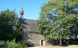 |
| Chapelle de la Trinité | Ploërmel | Clos-Havard | à géolocaliser | « IA00010223 » | Inventorié | 1986 |
Image manquante |
| Chapelle des Ursulines | Ploërmel | Rue Sénéchal-Thuault | 47° 55′ 52″ nord, 2° 23′ 44″ ouest | « PA00091495 » | Inscrit | 1928 | -MH_Chapelles_des_Ursulines-02.JPG.webp) |
| Chapelle du château de la Haute-Touche | Ploërmel | la Haute-Touche Monterrein |
47° 52′ 48″ nord, 2° 22′ 14″ ouest | « PA56000053 » | Inscrit Inscrit |
2001 2002 |
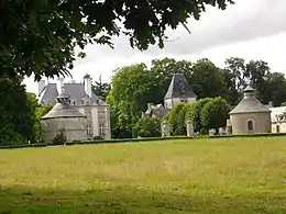 |
| Chapelle Saint-Marc du château de Malleville | Ploërmel | Malleville | 47° 55′ 25″ nord, 2° 22′ 39″ ouest | « PA00091497 » | Inscrit | 1973 |
Image manquante |
| Chapelle Saint-Nicodème du Château de la Motte | Ploërmel | La Motte | 47° 54′ 32″ nord, 2° 22′ 16″ ouest | « IA00010263 » | Inventorié | 1986 |
Image manquante |
| Chapelle du Couvent des Carmélites | Ploërmel | Rue Sénéchal-Thuault | 47° 55′ 54″ nord, 2° 23′ 39″ ouest | « PA00091498 » | Inscrit | 1987 |
Image manquante |
| Chapelle Sainte-Marie du couvent des Carmes | Ploërmel | 7,9 rue du Val | 47° 56′ 01″ nord, 2° 23′ 58″ ouest | « IA00010240 » | Inventorié | 1986 | _Ste-Marie-des-Carmes1.JPG.webp) |
| Chapelle Notre-Dame-des-Fleurs | Plouay | Coëtulaire-Creïz | 47° 56′ 24″ nord, 3° 16′ 43″ ouest | « PA00091513 » | Inscrit | 1925 | _Chapelle_Notre-Dame-des-Fleurs_02.JPG.webp) |
| Chapelle Notre-Dame-de-Grâce | Plouay | Locmaria | 47° 53′ 21″ nord, 3° 23′ 46″ ouest | « PA00091512 » | Inscrit | 1975 | .jpg.webp) |
| Chapelle Notre-Dame-de-Vrai-Secours | Plouay | Ty-Henry | 47° 54′ 34″ nord, 3° 16′ 38″ ouest | « IA00009206 » | Inventorié | 1986 |  |
| Chapelle Saint-Hubert | Plouay | Cunffio | 47° 57′ 52″ nord, 3° 18′ 48″ ouest | « IA00009208 » | Inventorié | 1986 |
Image manquante |
| Chapelle Saint-Sauveur | Plouay | Ty-Narhoz | 47° 57′ 44″ nord, 3° 19′ 09″ ouest | « IA00009209 » | Inventorié | 1986 |  |
| Chapelle Saint-Sébastien | Plouay | Kerbonalen | 47° 57′ 44″ nord, 3° 19′ 09″ ouest | « IA00009210 » | Inventorié | 1986 |
Image manquante |
| Chapelle Saint-Vincent-Ferrier | Plouay | Le Guerveur | 47° 56′ 10″ nord, 3° 22′ 00″ ouest | « IA00009211 » | Inventorié | 1986 | .jpg.webp) |
| Chapelle Sainte-Anne-du-Scorff | Plouay | Kermignan | 47° 54′ 13″ nord, 3° 24′ 20″ ouest | « IA00009207 » | Inventorié | 1986 |
Image manquante |
| Chapelle Notre-Dame-de-Sion du château de Ménéhouarn | Plouay | Rue des Acacias | 47° 55′ 03″ nord, 3° 20′ 47″ ouest | « IA00009216 » | Inventorié | 1986 |
Image manquante |
| Oratoire Notre-Dame | Plouay | Bécherel | 47° 55′ 30″ nord, 3° 17′ 54″ ouest | « IA00009202 » | Inventorié | 1986 |
Image manquante |
| Oratoire Notre-Dame-de-Délivrance | Plouay | Penterff | 47° 55′ 31″ nord, 3° 17′ 53″ ouest |
Image manquante | |||
| Chapelle Saint-Thuriau | Plougoumelen | Lestréviau | 47° 38′ 34″ nord, 2° 54′ 31″ ouest |
Image manquante | |||
| Chapelle Notre-Dame-des-Fleurs | Plouharnel | Rue Notre-Dame-des-Fleurs | 47° 35′ 46″ nord, 3° 06′ 49″ ouest | « PA00091519 » | Inscrit | 1925 |  |
| Chapelle Saint-Antoine | Plouharnel | Kerarno | 47° 36′ 53″ nord, 3° 07′ 40″ ouest |  | |||
| Chapelle Saint-Gilles | Plouharnel | Cosquer | 47° 37′ 12″ nord, 3° 06′ 08″ ouest |  | |||
| Chapelle Sainte-Barbe | Plouharnel | Sainte-Barbe | 47° 36′ 24″ nord, 3° 08′ 07″ ouest | « PA00091520 » | Inscrit | 1925 |  |
| Chapelle Notre-Dame-de-Pitié | Plouhinec | Kervarlay | 47° 40′ 39″ nord, 3° 12′ 39″ ouest |
Image manquante | |||
| Chapelle Saint-Cornély | Plouhinec | Kerprat | 47° 40′ 27″ nord, 3° 14′ 27″ ouest |
Image manquante | |||
| Chapelle Saint-Fiacre | Plouhinec | Kervener | 47° 43′ 09″ nord, 3° 13′ 57″ ouest |
Image manquante | |||
| Chapelle Saint-Guillaume | Plouhinec | Saint-Guillaume | 47° 41′ 27″ nord, 3° 11′ 24″ ouest |
Image manquante | |||
| Chapelle Notre-Dame | Plouray | Locmaria | 48° 08′ 04″ nord, 3° 20′ 28″ ouest | « IA00009315 » | Inventorié | 1986 |
Image manquante |
| Chapelle Saint-Guénin | Plouray | Miné-Groëz | 48° 08′ 00″ nord, 3° 24′ 13″ ouest | « IA00008922 » | Inventorié | 1986 |
Image manquante |
| Chapelle Sainte-Hélène-et-Sainte-Ursule | Plouray | La Villeneuve-Runello | 48° 07′ 00″ nord, 3° 25′ 00″ ouest | « IA00008921 » | Inventorié | 1986 |
Image manquante |
| Chapelle Notre-Dame | Pluherlin | Cartudo | 47° 41′ 57″ nord, 2° 24′ 43″ ouest | « IA00008745 » | Inventorié | 1986 |
Image manquante |
| Chapelle Notre-Dame-de-la-Barre | Pluherlin | Le Gué-de-la-Barre | 47° 43′ 19″ nord, 2° 23′ 23″ ouest | « IA00008749 » | Inventorié | 1986 |
Image manquante |
| Chapelle Notre-Dame-de-Bon-Réconfort | Pluherlin | Bécavin | 47° 41′ 46″ nord, 2° 21′ 47″ ouest | « IA00008737 » | Inventorié | 1986 |
Image manquante |
| Chapelle Saint-Jean du château de Talhouët | Pluherlin | Talhouët | 47° 43′ 11″ nord, 2° 22′ 21″ ouest | « PA56000045 » | Inscrit | 2000 |
Image manquante |
| Chapelle Notre-Dame-de-Lorette | Plumelec | Le Bouloir | 47° 48′ 19″ nord, 2° 39′ 44″ ouest |
Image manquante | |||
| Chapelle Saint-Joseph | Plumelec | Le Moulin-de-Callac | 47° 48′ 37″ nord, 2° 34′ 45″ ouest | 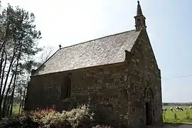 | |||
| Chapelle Saint-Joseph | Plumelec | Kerangat | 47° 50′ 46″ nord, 2° 40′ 03″ ouest |
Image manquante | |||
| Chapelle Saint-Maudé | Plumelec | La Ville-Louais | 47° 48′ 27″ nord, 2° 33′ 47″ ouest |  | |||
| Chapelle de Talcoëtmeur | Plumelec | Talcoëtmeur | 47° 48′ 57″ nord, 2° 36′ 20″ ouest |
Image manquante | |||
| Chapelle de la Madeleine | Pluméliau-Bieuzy | La Madeleine Pluméliau |
47° 56′ 33″ nord, 2° 59′ 35″ ouest |
Image manquante | |||
| Chapelle Notre-Dame | Pluméliau-Bieuzy | La Ferrière Pluméliau |
47° 58′ 24″ nord, 2° 55′ 30″ ouest |
Image manquante | |||
| Chapelle Saint-Gildas | Pluméliau-Bieuzy | Prioldy Bieuzy |
47° 58′ 43″ nord, 3° 02′ 56″ ouest | « IA56000879 » | Inventorié | 2001 | 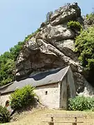 |
| Chapelle Saint-Hilaire | Pluméliau-Bieuzy | Saint-Hilaire Pluméliau |
47° 57′ 09″ nord, 3° 02′ 11″ ouest |
Image manquante | |||
| Chapelle Saint-Nicodème | Pluméliau-Bieuzy | Saint-Nicodème Pluméliau |
47° 58′ 46″ nord, 3° 00′ 47″ ouest | « PA00091546 » | Classé | 1910 | _Chapelle_Saint-Nicod%C3%A8me_06.JPG.webp) |
| Chapelle Saint-Nicolas-des-Eaux | Pluméliau-Bieuzy | Allée des Camélias Saint-Nicolas-des-Eaux Pluméliau |
47° 58′ 50″ nord, 3° 02′ 25″ ouest | « PA00091547 » | Inscrit | 1928 |  |
| Chapelle Saint-Rémi | Pluméliau-Bieuzy | Vieux-Rimaison Pluméliau |
48° 01′ 00″ nord, 2° 59′ 29″ ouest |
Image manquante | |||
| Chapelle Saint-Samson | Pluméliau-Bieuzy | Saint-Samson Bieuzy |
48° 00′ 26″ nord, 3° 01′ 53″ ouest | « IA56000878 » | Inventorié | 2001 |
Image manquante |
| Chapelle Saint-Thomas | Pluméliau-Bieuzy | Impasse du Mondo Saint-Thomas Pluméliau |
47° 57′ 21″ nord, 2° 59′ 03″ ouest |
Image manquante | |||
| Chapelle de la Trinité | Pluméliau-Bieuzy | Castennec Bieuzy |
47° 58′ 53″ nord, 3° 02′ 42″ ouest | « PA56000093 » | Inscrit | 2020 | 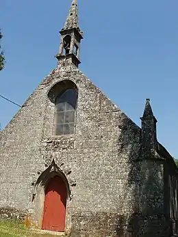 |
| Chapelle de la Vraie-Croix | Pluméliau-Bieuzy | La Vraie-Croix Bieuzy |
47° 59′ 35″ nord, 3° 01′ 17″ ouest | « IA56000871 » | Inventorié | 2001 |
Image manquante |
| Chapelle Saint-Jean-du-Poteau | Plumelin | Saint-Jean-du-Poteau | 47° 53′ 41″ nord, 2° 54′ 38″ ouest |
Image manquante | |||
| Chapelle conventuelle Saint-Joseph des Filles de Jésus | Plumelin | Saint-Quidy | 47° 52′ 46″ nord, 2° 51′ 14″ ouest |  | |||
| Chapelle Saint-Quidy | Plumelin | Saint-Quidy | 47° 50′ 58″ nord, 2° 55′ 07″ ouest |
Image manquante | |||
| Chapelle Notre-Dame | Plumergat | Gornévec | 47° 42′ 41″ nord, 2° 56′ 52″ ouest | « PA00091552 » | Inscrit | 1925 | 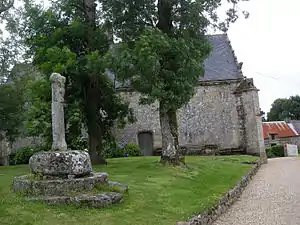 |
| Chapelle Saint-Maurice | Plumergat | Locmaria | 47° 43′ 07″ nord, 2° 56′ 41″ ouest |
Image manquante | |||
| Chapelle Saint-Michel | Plumergat | Kervaly | 47° 43′ 49″ nord, 2° 54′ 07″ ouest |
Image manquante | |||
| Chapelle Saint-Roch | Plumergat | Rue de la Paix Mériadec |
47° 41′ 53″ nord, 2° 54′ 10″ ouest |  | |||
| Chapelle Saint-Servais | Plumergat | Rue René-Donias Rue des Trois-Clochers |
47° 44′ 31″ nord, 2° 55′ 02″ ouest | « PA56000075 » | Inscrit[2] | 2015 | _4550.JPG.webp) |
| Chapelle Sainte-Brigide | Plumergat | Rue Hent-er-Fetan-Laimer Laimer |
47° 43′ 04″ nord, 2° 57′ 56″ ouest |
Image manquante | |||
| Chapelle de la Trinité | Plumergat | Rue René-Donias Rue des Trois-Clochers |
47° 44′ 31″ nord, 2° 55′ 02″ ouest | « PA00091554 » | Inscrit Inscrit |
1925 2015 |
_4523.JPG.webp) |
| Chapelle de la Vraie-Croix | Plumergat | Langroix | 47° 43′ 59″ nord, 2° 58′ 18″ ouest | « PA00091553 » | Inscrit | 1925 | _4586.JPG.webp) |
| Chapelle Sainte-Avoye | Pluneret | Sainte-Avoye | 47° 39′ 04″ nord, 2° 56′ 43″ ouest | « PA00091560 » | Classé | 1932 |  |
| Chapelle Notre-Dame-de-Miséricorde | Pluvigner | Kerven-Miséricorde | 47° 45′ 35″ nord, 2° 57′ 53″ ouest |
Image manquante | |||
| Ruines de la Chapelle Notre-Dame des Orties | Pluvigner | Place Notre-Dame-des-Orties | 47° 46′ 29″ nord, 3° 00′ 39″ ouest | « PA00091562 » | Inscrit | 1925 | .JPG.webp) |
| Chapelle Notre-Dame-des-Pins | Pluvigner | Kermorvano | 47° 45′ 35″ nord, 2° 57′ 53″ ouest |
Image manquante | |||
| Chapelle Saint-Adrien | Pluvigner | Place Notre-Dame-des-Orties Rue Ler-Paris |
47° 46′ 28″ nord, 3° 00′ 39″ ouest | .JPG.webp) | |||
| Chapelle Saint-Bihui | Pluvigner | Rue Abbé-Raller Bieuzy-Lanvaux |
47° 48′ 18″ nord, 2° 56′ 16″ ouest |
Image manquante | |||
| Chapelle Saint-Colomban | Pluvigner | Saint-Colomban | 47° 44′ 46″ nord, 2° 57′ 46″ ouest |  | |||
| Chapelle Saint-Fiacre | Pluvigner | Trélécan | 47° 48′ 12″ nord, 3° 03′ 41″ ouest | « PA00091563 » | Inscrit | 1925 | _5854.JPG.webp) |
| Chapelle Saint-Goal | Pluvigner | Minio-Braz | 47° 46′ 09″ nord, 3° 03′ 00″ ouest |
Image manquante | |||
| Chapelle Saint-Guénaël | Pluvigner | Le Parc | 47° 47′ 15″ nord, 3° 00′ 11″ ouest |
Image manquante | |||
| Chapelle Saint-Guyon | Pluvigner | Chancho | 47° 46′ 51″ nord, 3° 03′ 51″ ouest |
Image manquante | |||
| Chapelle Saint-Mériadec | Pluvigner | Saint-Mériadec | 47° 48′ 59″ nord, 2° 56′ 17″ ouest |
Image manquante | |||
| Chapelle Sainte-Brigitte | Pluvigner | Kerizan-Sainte-Brigitte | 47° 48′ 13″ nord, 2° 58′ 18″ ouest |
Image manquante | |||
| Chapelle de la Trinité | Pluvigner | Le Moustoir | 47° 47′ 04″ nord, 2° 58′ 30″ ouest |
Image manquante | |||
| Chapelle funéraire de la famille de Saint-Georges | Pluvigner | Cimetière | 47° 46′ 37″ nord, 3° 00′ 46″ ouest |
Image manquante | |||
| Chapelle du château de Kergluyar | Pluvigner | Rue de la Gare | 47° 46′ 14″ nord, 3° 01′ 06″ ouest |
Image manquante | |||
| Chapelle Saint-Joseph du château de Keronic | Pluvigner | Keronic | 47° 47′ 20″ nord, 3° 01′ 55″ ouest | « PA56000082 » | Inscrit | 2017 |
Image manquante |
| Chapelle du manoir de la Villeneuve | Pluvigner | La Villeneuve | 47° 46′ 26″ nord, 3° 04′ 13″ ouest |
Image manquante | |||
| Chapelle Saint-Aubin | Pont-Scorff | Lesbin | 47° 50′ 09″ nord, 3° 24′ 41″ ouest | « IA56000212 » | Inventorié Inventorié |
1975 1997 |
 |
| Chapelle Saint-Gildas | Pont-Scorff | Keryaquel | 47° 49′ 20″ nord, 3° 24′ 41″ ouest | « IA56000211 » | Inventorié Inventorié |
1975 1997 |
Image manquante |
| Chapelle Saint-Servais | Pont-Scorff | Saint-Servais | 47° 50′ 26″ nord, 3° 26′ 08″ ouest | « PA00091583 » | Inscrit | 1934 | 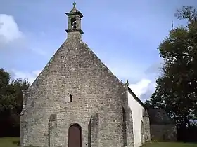 |
| Chapelle conventuelle de la Madeleine | Pontivy | Avenue Napoléon-Ier | 48° 03′ 54″ nord, 2° 57′ 52″ ouest | « IA00010394 » | Inventorié | 1986 |
Image manquante |
| Chapelle Notre-Dame | Pontivy | La Houssaye | 48° 02′ 48″ nord, 2° 56′ 59″ ouest | « PA00091566 » | Inscrit | 1935 | _Chapelle_Notre-Dame_de_la_Houssaye_03.JPG.webp) |
| Chapelle Saint-Ivy | Pontivy | Rue Saint-Ivy | 48° 04′ 05″ nord, 2° 58′ 00″ ouest | « IA00010390 » | Inventorié | 1986 |
Image manquante |
| Chapelle conventuelle Saint-Thomas | Pontivy | Place Ernest-Jan | 48° 04′ 10″ nord, 2° 58′ 02″ ouest | « IA00010393 » | Inventorié | 1986 |  |
| Chapelle Sainte-Tréphine | Pontivy | Sainte-Tréphine | 48° 03′ 51″ nord, 2° 59′ 12″ ouest | « PA00091567 » | Classé | 1968 | 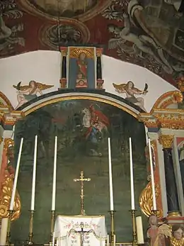 |
| Chapelle | Pontivy | Rue du Médecin-Général-Robic | 48° 04′ 09″ nord, 2° 57′ 45″ ouest |
Image manquante | |||
| Chapelle Notre-Dame | Porcaro | Rue Yves-Corbel | 47° 54′ 33″ nord, 2° 11′ 52″ ouest |
Image manquante | |||
| Chapelle Sainte-Anne du château des Touches | Porcaro | Le Beau-Chêne | 47° 55′ 12″ nord, 2° 11′ 22″ ouest | « IA00009191 » | Inventorié | 1986 |
Image manquante |
| Chapelle Saint-Pierre | Port-Louis | Place Saint-Pierre | 47° 42′ 26″ nord, 3° 21′ 10″ ouest | _4133.JPG.webp) | |||
| Chapelle Sainte-Marguerite | Port-Louis | Place Pen-er-Run | 47° 42′ 21″ nord, 3° 20′ 51″ ouest |
Image manquante | |||
| Chapelle de l'Hôpital | Port-Louis | Rue de Gâvres | 47° 42′ 18″ nord, 3° 21′ 13″ ouest |
Image manquante | |||
| Chapelle de la Madeleine | Priziac | Le Rest | 48° 04′ 20″ nord, 3° 25′ 45″ ouest | « IA00008480 » | Inventorié | 1986 | 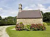 |
| Chapelle Notre-Dame | Priziac | Pellah | 48° 02′ 17″ nord, 3° 24′ 07″ ouest | « IA00008478 » | Inventorié | 1986 | 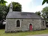 |
| Chapelle Notre-Dame-de-Lotavy | Priziac | Ty-Lotavy | 48° 02′ 17″ nord, 3° 24′ 07″ ouest | « IA00008481 » | Inventorié | 1986 | 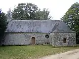 |
| Chapelle Saint-Guénolé | Priziac | Kerlen | 48° 01′ 58″ nord, 3° 27′ 24″ ouest | « IA00008476 » | Inventorié | 1986 | 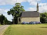 |
| Chapelle Saint-Michel | Priziac | Saint-Michel | 48° 01′ 58″ nord, 3° 27′ 24″ ouest |
Image manquante | |||
| Chapelle Saint-Nicolas | Priziac | Kerviguen | 48° 02′ 31″ nord, 3° 25′ 55″ ouest | « PA00091590 » | Classé | 1922 | _Chapelle_Saint-Nicolas_05.JPG.webp) |
| Chapelle Saint-Yves | Priziac | Mené-Penmeur | 48° 04′ 16″ nord, 3° 27′ 02″ ouest | « PA00091591 » | Inscrit | 1975 | 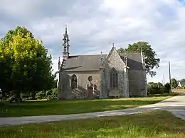 |
| Chapelle Notre-Dame-des-Neiges | Questembert | Bodan | 47° 38′ 17″ nord, 2° 26′ 11″ ouest |
Image manquante | |||
| Chapelle Notre-Dame-de-l'O | Questembert | Bréhardec | 47° 38′ 09″ nord, 2° 24′ 02″ ouest |
Image manquante | |||
| Chapelle Saint-Jean-Baptiste | Questembert | Rue des Chevaliers Saint-Jean |
47° 38′ 21″ nord, 2° 27′ 53″ ouest |
Image manquante | |||
| Chapelle Saint-Michel | Questembert | Cimetière Saint-Michel | 47° 39′ 40″ nord, 2° 27′ 04″ ouest | « PA00091594 » | Classé | 1922 | 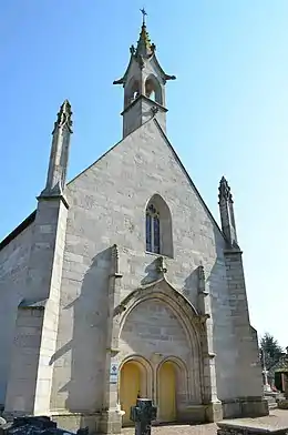 |
| Chapelle Saint-Vincent | Questembert | Saint-Doué | 47° 40′ 25″ nord, 2° 29′ 05″ ouest | _-_Questembert.jpg.webp) | |||
| Chapelle Sainte-Suzanne | Questembert | Sainte-Suzanne | 47° 40′ 02″ nord, 2° 23′ 32″ ouest |
Image manquante | |||
| Chapelle Sainte-Noyale | Questembert | Lesnoyal | 47° 41′ 57″ nord, 2° 27′ 29″ ouest | 1938 |
Image manquante | ||
| Chapelle Notre-Dame-de-Bon-Secours | Quéven | Bon-Secours | 47° 48′ 05″ nord, 3° 23′ 24″ ouest |  | |||
| Chapelle Saint-Éloi | Quéven | Rue Professeur-Lote | 47° 47′ 13″ nord, 3° 24′ 50″ ouest |
Image manquante | |||
| Chapelle Saint-Nicodème | Quéven | Saint-Nicodème | 47° 46′ 43″ nord, 3° 25′ 30″ ouest |
Image manquante | |||
| Chapelle de la Trinité | Quéven | La Trinité | 47° 46′ 57″ nord, 3° 26′ 05″ ouest | « PA00091604 » | Inscrit Radié[3] |
1933 2014 |
.jpg.webp) |
| Chapelle Saint-Clément | Quiberon | Rue de Saint-Clément | 47° 28′ 35″ nord, 3° 06′ 20″ ouest | .JPG.webp) | |||
| Chapelle Saint-Julien | Quiberon | Rue des Goélands Saint-Julien |
47° 29′ 39″ nord, 3° 07′ 09″ ouest | .jpg.webp) | |||
| Chapelle Notre-Dame-du-Cloître | Quistinic | Le Cloître | 47° 55′ 56″ nord, 3° 06′ 59″ ouest | « PA00091626 » | Inscrit | 1973 | 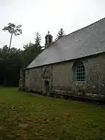 |
| Chapelle Notre-Dame-de-la-Trinité | Quistinic | Quistinic | 47° 55′ 01″ nord, 3° 06′ 25″ ouest | « PA00091625 » | Inscrit | 1925 | _Chapelle_de_Locmaria_01.JPG.webp) |
| Chapelle Saint-Guénolé | Quistinic | Locunolé | 47° 54′ 03″ nord, 3° 10′ 28″ ouest | « IA00009282 » | Inventorié | 1986 |
Image manquante |
| Chapelle Saint-Jean-Baptiste | Quistinic | Le Temple | 47° 54′ 30″ nord, 3° 04′ 47″ ouest | « IA00009286 » | Inventorié | 1986 |
Image manquante |
| Chapelle Saint-Mathurin | Quistinic | Place Saint-Mathurin | 47° 54′ 16″ nord, 3° 08′ 06″ ouest | « IA00009281 » | Inventorié | 1986 | _Chapelle_Saint-Mathurin_01.JPG.webp) |
| Chapelle Saint-Roch | Quistinic | RD 3 | 47° 54′ 08″ nord, 3° 06′ 36″ ouest | « IA00009285 » | Inventorié | 1986 |
Image manquante |
| Chapelle Saint-Tugdual | Quistinic | Saint-Tugdual | 47° 55′ 41″ nord, 3° 05′ 32″ ouest | « IA00009287 » | Inventorié | 1986 |
Image manquante |
| Chapelle Sainte-Barbe | Quistinic | Porh-Men | 47° 53′ 15″ nord, 3° 06′ 18″ ouest | « IA00009284 » | Inventorié | 1986 |
Image manquante |
| Chapelle Saint-Fiacre | Radenac | Saint-Fiacre | 47° 57′ 44″ nord, 2° 43′ 41″ ouest | « PA00091629 » | Classé | 1931 | 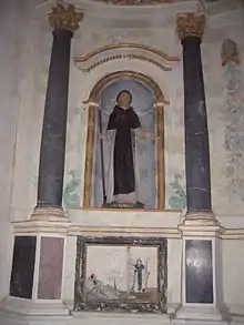 |
| Chapelle Saint-Malo | Réguiny | Locmalo | 48° 00′ 21″ nord, 2° 46′ 09″ ouest |
Image manquante | |||
| Chapelle Saint-Jean | Riantec | Locjan | 47° 43′ 14″ nord, 3° 17′ 24″ ouest |
Image manquante | |||
| Chapelle de la Trinité | Riantec | Rue de Kerner Rue Fernande-Uzel |
47° 42′ 25″ nord, 3° 18′ 20″ ouest |
Image manquante | |||
| Chapelle de la Vraie-Croix | Riantec | Rue des Écoles | 47° 42′ 35″ nord, 3° 19′ 01″ ouest | .jpg.webp) | |||
| Chapelle du cimetière de Riantec | Riantec | Cimetière | 47° 42′ 44″ nord, 3° 18′ 44″ ouest |
Image manquante | |||
| Chapelle Saint-Sébastien | Rieux | Tréfin | 47° 35′ 55″ nord, 2° 09′ 31″ ouest |
Image manquante | |||
| Chapelle du château de la Bousselais | Rieux | La Bousselais | 47° 37′ 26″ nord, 2° 07′ 42″ ouest |
Image manquante | |||
| Chapelle Notre-Dame | La Roche-Bernard | Rue Haute-Notre-Dame | 47° 31′ 09″ nord, 2° 18′ 14″ ouest | .jpg.webp) | |||
| Chapelle Saint-Michel | Rochefort-en-Terre | Rue de la Grêle | 47° 41′ 54″ nord, 2° 20′ 19″ ouest | « IA00008647 » | Inventorié | 1986 |
Image manquante |
| Chapelle Saint-Roch | Rochefort-en-Terre | Rue Saint-Roch | 47° 41′ 59″ nord, 2° 20′ 38″ ouest | « IA00008648 » | Inventorié | 1986 | .jpg.webp) |
| Chapelle Saint-Jean-l'Évangéliste du château de Rochefort-en-Terre | Rochefort-en-Terre | Rue du Château | 47° 42′ 00″ nord, 2° 20′ 22″ ouest | « PA00091638 » | Inscrit | 1990 | .jpg.webp) |
| Chapelle Notre-Dame-de-Bonne-Encontre | Rohan | Rue du Point-du-Jour | 48° 04′ 06″ nord, 2° 44′ 58″ ouest | « PA00091646 » | Classé | 1922 |  |
| Chapelle Saint-Martin | Rohan | Cimetière | 48° 04′ 00″ nord, 2° 45′ 05″ ouest |
Image manquante | |||
| Chapelle Saint-Michel | Roudouallec | Rue Nicolas-Le-Grand | 48° 06′ 17″ nord, 3° 40′ 26″ ouest | « IA00008938 » | Inventorié | 1986 |
Image manquante |
| Chapelle Notre-Dame-de-la-Pitié | Ruffiac | Le Prieuré | 47° 49′ 24″ nord, 2° 15′ 37″ ouest |
Image manquante | |||
| Chapelle Saint-André | Ruffiac | La Hervaie | 47° 49′ 35″ nord, 2° 19′ 02″ ouest | « IA00010065 » | Inventorié | 1986 |
Image manquante |
| Chapelle Saint-Jacques-Saint-Philippe | Ruffiac | La Souriçaie | 47° 48′ 42″ nord, 2° 19′ 45″ ouest | « IA00010064 » | Inventorié | 1986 |
Image manquante |
| Chapelle Saint-Jean-Baptiste | Ruffiac | La Chapelle-Saint-Jean | 47° 47′ 35″ nord, 2° 14′ 59″ ouest | « IA00010073 » | Inventorié | 1986 |
Image manquante |
| Chapelle Notre-Dame-de-Lourdes | Le Saint | Bruscoase | 48° 06′ 28″ nord, 3° 33′ 33″ ouest |
Image manquante | |||
| Ruines de la chapelle Saint-Adrien | Le Saint | Bouthiry | 48° 06′ 56″ nord, 3° 33′ 53″ ouest | « IA00008895 » | Inventorié | 1986 |  |
| Chapelle prieurale Saint-Gilles | Le Saint | Saint-Gilles | 48° 03′ 03″ nord, 3° 33′ 26″ ouest | « IA00008899 » | Inventorié | 1986 |  |
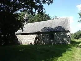
| Chapelle Saint-Méen | Le Saint | Saint-Méen | 48° 06′ 26″ nord, 3° 35′ 31″ ouest | « IA00008896 » | Inventorié |
1934 1986 |
 |
| Chapelle Saint-Tremeur | Le Saint | Goasquellec | 48° 04′ 54″ nord, 3° 35′ 31″ ouest | « IA00008898 » | Inventorié | 1986 |  |
| Chapelle Sainte-Jeanne | Le Saint | Sainte-Jeanne | 48° 06′ 28″ nord, 3° 33′ 33″ ouest | « IA00008897 » | Inventorié | 1986 |
Image manquante |
| Chapelle Saint-Ignace | Saint-Aignan | Forêt de Quénécan | 48° 11′ 14″ nord, 3° 06′ 10″ ouest | « IA00009943 » | Inventorié | 1986 |
Image manquante |
| Chapelle Saint-Marc | Saint-Aignan | Lanmeur | 48° 10′ 58″ nord, 3° 03′ 55″ ouest | « IA00009944 » | Inventorié | 1986 |
Image manquante |
| Chapelle Sainte-Tréphine | Saint-Aignan | Castel-Finans | 48° 11′ 39″ nord, 3° 01′ 23″ ouest | « IA00009945 » | Inventorié | 1986 |  |
| Chapelle Notre-Dame-du-Loc | Saint-Avé | Place Notre-Dame-du-Loc | 47° 41′ 23″ nord, 2° 43′ 50″ ouest | « PA00091661 » | Classé Classé |
1922 1932 |
 |
| Chapelle Saint-Michel | Saint-Avé | Saint-Michel | 47° 43′ 08″ nord, 2° 45′ 01″ ouest | « PA00091662 » | Inscrit | 1929 | .JPG.webp) |
| Chapelle Saint-Jean-de-Dieu | Saint-Avé | Lesvellec | 47° 41′ 53″ nord, 2° 45′ 17″ ouest | « IA00114311 » | Inventorié | 1987 |
Image manquante |
| Chapelle Sainte-Anne du château de Kerozer | Saint-Avé | Kerozer | 47° 42′ 02″ nord, 2° 44′ 11″ ouest | « IA00114035 » | Inventorié | 1987 |
Image manquante |
| Chapelle Saint-Adrien | Saint-Barthélemy | Saint-Adrien | 47° 54′ 45″ nord, 3° 04′ 33″ ouest | « PA00091665 » | Classé | 1932 | _Chapelle_Saint-Adrien_01.JPG.webp) |
| Chapelle Saint-Fiacre | Saint-Barthélemy | Saint-Fiacre | 47° 55′ 05″ nord, 3° 02′ 34″ ouest | « IA56001277 » | Inventorié | 2002 |
Image manquante |
| Chapelle Saint-Guen | Saint-Barthélemy | Saint-Guen | 47° 56′ 36″ nord, 3° 01′ 59″ ouest | « IA56001067 » | Inventorié | 2002 |
Image manquante |
| Chapelle Saint-Thuriau | Saint-Barthélemy | Saint-Thuriau | 47° 56′ 40″ nord, 3° 02′ 59″ ouest | « IA56001284 » | Inventorié | 2002 |
Image manquante |
| Chapelle Notre-Dame-de-Toute-Aide | Saint-Brieuc-de-Mauron | La Ville-Tual | 48° 05′ 20″ nord, 2° 21′ 49″ ouest |
Image manquante | |||
| Chapelle Saint-Cado | Saint-Caradec-Trégomel | Saint-Cado | 48° 02′ 14″ nord, 3° 20′ 53″ ouest | « IA00008391 » | Inventorié | 1986 | 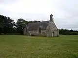 |
| Chapelle Notre-Dame | Saint-Congard | Quemper | 47° 44′ 35″ nord, 2° 18′ 07″ ouest | « IA00008761 » | Inventorié | 1986 |
Image manquante |
| Chapelle Notre-Dame-de-Lorette | Saint-Congard | Lotissement de Lorette | 47° 46′ 15″ nord, 2° 19′ 02″ ouest | « IA00008760 » | Inventorié | 1986 |
Image manquante |
| Ruines de la chapelle Saint-Jacques du manoir de Foveno | Saint-Congard | Foveno | 47° 48′ 25″ nord, 2° 21′ 07″ ouest | « IA00008756 » | Inventorié | 1986 |
Image manquante |
| Chapelle Sainte-Anne | Saint-Dolay | Sainte-Anne | 47° 33′ 55″ nord, 2° 11′ 44″ ouest | « PA00091670 » | Classé | 1930 |  |
| Chapelle Saint-Drédeno | Saint-Gérand | Saint-Drédeno | 48° 06′ 54″ nord, 2° 54′ 24″ ouest | « IA00010463 » | Inventorié | 1986 |
Image manquante |
| Chapelle Saint-Sixte | Saint-Gravé | La Bogerais | 47° 42′ 35″ nord, 2° 19′ 09″ ouest | « IA00008772 » | Inventorié | 1986 |
Image manquante |
| Chapelle Saint-Maurice | Saint-Guyomard | Rue de la Chapelle | 47° 46′ 51″ nord, 2° 30′ 13″ ouest | « IA00010046 » | Inventorié | 1986 | 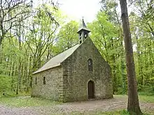 |
| Chapelle du château de Brignac | Saint-Guyomard | Brignac | 47° 47′ 37″ nord, 2° 31′ 31″ ouest | « IA00010042 » | Inventorié | 1986 |
Image manquante |
| Chapelle Notre-Dame-du-Pont-d'Arz | Saint-Jacut-les-Pins | Le Val | 47° 41′ 37″ nord, 2° 12′ 36″ ouest |
Image manquante | |||
| Chapelle Saint-Barnabé | Saint-Jacut-les-Pins | Couesnongle | 47° 40′ 50″ nord, 2° 10′ 12″ ouest |
Image manquante | |||
| Chapelle Saint-Laurent | Saint-Jacut-les-Pins | Cimetière | 47° 41′ 02″ nord, 2° 12′ 46″ ouest |
Image manquante | |||
| Chapelle Sainte-Marie-Madeleine | Saint-Jacut-les-Pins | La Graë | 47° 40′ 08″ nord, 2° 14′ 19″ ouest |
Image manquante | |||
| Chapelle Saint-Marc | Saint-Jean-Brévelay | Le Moustoir | 47° 48′ 57″ nord, 2° 44′ 00″ ouest | .jpg.webp) | |||
| Chapelle Saint-Nicolas | Saint-Jean-Brévelay | Saint-Nicolas | 47° 49′ 02″ nord, 2° 42′ 33″ ouest |
Image manquante | |||
| Chapelle Saint-Roch | Saint-Jean-Brévelay | Saint-Roch | 47° 50′ 17″ nord, 2° 45′ 55″ ouest |
Image manquante | |||
| Chapelle Saint-Thuriau | Saint-Jean-Brévelay | Saint-Thuriau | 47° 49′ 08″ nord, 2° 46′ 03″ ouest |
Image manquante | |||
| Chapelle Sainte-Geneviève | Saint-Marcel | Sainte-Geneviève | 47° 48′ 42″ nord, 2° 25′ 26″ ouest | « IA00010131 » | Inventorié | 1986 |
Image manquante |
| Chapelle Saint-Léonard | Saint-Martin-sur-Oust | Saint-Léonard | 47° 46′ 15″ nord, 2° 15′ 14″ ouest |
Image manquante | |||
| Chapelle Saint-Mathurin | Saint-Martin-sur-Oust | Saint-Mathurin | 47° 45′ 26″ nord, 2° 17′ 57″ ouest |
Image manquante | |||
| Chapelle Saint-Amand | Saint-Nolff | Saint-Amand | 47° 44′ 01″ nord, 2° 39′ 51″ ouest |
Image manquante | |||
| Chapelle Saint-Colomban | Saint-Nolff | Saint-Colombier | 47° 41′ 41″ nord, 2° 40′ 48″ ouest | 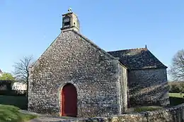 | |||
| Chapelle Sainte-Anne | Saint-Nolff | Place du Calvaire | 47° 42′ 10″ nord, 2° 39′ 01″ ouest | « PA00091698 » | Inscrit | 1929 |  |
| Chapelle Notre-Dame | Saint-Pierre-Quiberon | Avenue de Saint-Malo Avenue du Petit-Thouars Penthièvre |
47° 33′ 20″ nord, 3° 08′ 02″ ouest |  | |||
| Chapelle Notre-Dame-de-Lotivy | Saint-Pierre-Quiberon | Place de la Chapelle Portivy |
47° 31′ 39″ nord, 3° 08′ 38″ ouest |  | |||
| Chapelle Saint-Gobrien | Saint-Servant | Saint-Gobrien | 47° 55′ 39″ nord, 2° 30′ 54″ ouest | « PA00091715 » | Inscrit Inscrit Classé |
1927 1945 1996 |
 |
| Chapelle Saint-Julien | Saint-Servant | Le Bois-du-Gué | 47° 52′ 44″ nord, 2° 32′ 39″ ouest | « IA00121444 » | Inventorié | 1990 |
Image manquante |
| Chapelle du château de Castel | Saint-Servant | Castel | 47° 53′ 51″ nord, 2° 28′ 08″ ouest | « PA56000015 » | Inscrit | 1997 |  |
| Chapelle Notre-Dame-de-Joie | Saint-Thuriau | Gohazé | 48° 01′ 21″ nord, 2° 58′ 23″ ouest | « PA00091720 » | Inscrit | 1925 | 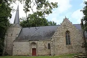 |
| Chapelle Saint-Mathias | Saint-Thuriau | Saint-Mathias | 48° 01′ 23″ nord, 2° 56′ 17″ ouest | « IA00010475 » | Inventorié | 1986 |
Image manquante |
| Chapelle Saint-Guen | Saint-Tugdual | Saint-Guen | 48° 05′ 18″ nord, 3° 22′ 25″ ouest | « PA00091723 » | Inscrit | 1927 | 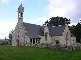 |
| Chapelle de l'Immaculée de Sainte-Anne-d'Auray | Sainte-Anne-d'Auray | Rue de Vannes | 47° 42′ 15″ nord, 2° 57′ 09″ ouest | « PA00091658 » | Inscrit | 2013 |
Image manquante |
| Chapelle | Sainte-Anne-d'Auray | Rue de Ker-Anna | 47° 42′ 12″ nord, 2° 57′ 28″ ouest |
Image manquante | |||
| Chapelle Saint-Joseph | Sainte-Brigitte | Le Gouvello | 48° 10′ 12″ nord, 3° 05′ 52″ ouest | « IA00009956 » | Inventorié | 1986 |
Image manquante |
| Chapelle Notre-Dame-de-Pitié | Sainte-Hélène | Kerdavid | 47° 42′ 34″ nord, 3° 10′ 31″ ouest |
Image manquante | |||
| Chapelle Notre-Dame-de-la-Côte | Sarzeau | Route de la Chapelle Penvins |
47° 29′ 36″ nord, 2° 40′ 51″ ouest | « IA00127662 » | Inventorié | 1992 |
Image manquante |
| Chapelle Saint-Jacques | Sarzeau | Rue Tal-er-Chapel Trévenaste |
47° 30′ 01″ nord, 2° 46′ 54″ ouest | « IA00127659 » | Inventorié | 1992 |
Image manquante |
| Chapelle Saint-Joseph | Sarzeau | Route du Stang Rue Saint-Germain Saint-Colombier |
47° 32′ 48″ nord, 2° 43′ 22″ ouest | « IA00127653 » | Inventorié | 1992 |
Image manquante |
| Chapelle Saint-Martin | Sarzeau | Route de la Pointe-du-Ruault Saint-Martin |
47° 32′ 33″ nord, 2° 47′ 17″ ouest | « IA00127656 » | Inventorié | 1992 |
Image manquante |
| Chapelle Saint-Maur | Sarzeau | Rue Abbé-Dréan Brillac |
47° 32′ 27″ nord, 2° 49′ 01″ ouest | « IA00127601 » | APPB Inventorié |
1992 1992 |
Image manquante |
| Chapelle Saint-Sébastien | Sarzeau | Place du Porh-Keribat Kerguet |
47° 31′ 26″ nord, 2° 44′ 12″ ouest | « IA00127622 » | Inventorié | 1992 |
Image manquante |
| Chapelle du château de Kerlevénan | Sarzeau | Kerlevenan | 47° 32′ 26″ nord, 2° 43′ 42″ ouest | « PA00091727 » | Classé | 1982 |
Image manquante |
| Chapelle du château de Truscat | Sarzeau | Truscat | 47° 32′ 15″ nord, 2° 46′ 07″ ouest | « IA00127660 » | Inventorié | 1992 |
Image manquante |
| Chapelle Notre-Dame | Séglien | Locmaria | 48° 06′ 49″ nord, 3° 08′ 59″ ouest | « PA00091736 » | Inscrit | 1927 | _7920.JPG.webp) |
| Chapelle Saint-Germain | Séglien | Saint-Germain | 48° 06′ 00″ nord, 3° 11′ 34″ ouest | « PA56000068 » | Inscrit | 2008 |  |
| Chapelle Saint-Jean | Séglien | 48° 05′ 06″ nord, 3° 07′ 23″ ouest | « PA00091737 » | Inscrit | 1935 | .JPG.webp) | |
| Chapelle Saint-Zénon | Séglien | Saint-Zénon | 48° 04′ 21″ nord, 3° 08′ 37″ ouest | « IA00009984 » | Inventorié | 1986 |
Image manquante |
| Oratoire du Clandy | Séglien | Rue du Clandy | 48° 05′ 06″ nord, 3° 07′ 23″ ouest |
Image manquante | |||
| Chapelle Notre-Dame-du-Bon-Voyage | Séné | Route de Kerleguen Kerarden |
47° 36′ 02″ nord, 2° 42′ 50″ ouest | « IA00114347 » | Inventorié | 1988 |
Image manquante |
| Chapelle Saint-Laurent | Séné | Chemin de Saint-Laurent Saint-Laurent |
47° 36′ 22″ nord, 2° 45′ 29″ ouest | « IA00114362 » | Inventorié | 1988 |
Image manquante |
| Chapelle Saint-Vital | Séné | Île de Boëd | 47° 36′ 22″ nord, 2° 45′ 29″ ouest |
Image manquante | |||
| Chapelle Sainte-Anne | Séné | Rue de Bellevue Le Méniech |
47° 37′ 12″ nord, 2° 46′ 20″ ouest |
Image manquante | |||
| Chapelle de Boëdic | Séné | Île de Boëdic | 47° 37′ 04″ nord, 2° 47′ 05″ ouest | 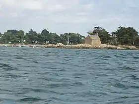 | |||
| Chapelle Saint-François-Xavier du château de Limur | Séné | Rue de Limur | 47° 38′ 47″ nord, 2° 43′ 40″ ouest | « IA00114354 » | Inventorié | 1989 |
Image manquante |
| Chapelle Notre-Dame-de-Toute-Aide | Sérent | Bréhélan | 47° 47′ 49″ nord, 2° 28′ 35″ ouest | « IA00010028 » | Inventorié | 1986 |
Image manquante |
| Chapelle Saint-Barnabé | Sérent | Les Trégouëts | 47° 49′ 13″ nord, 2° 29′ 09″ ouest | « IA00010030 » | Inventorié | 1986 |
Image manquante |
| Chapelle Saint-Jacques | Sérent | Launay-Guéného | 47° 48′ 14″ nord, 2° 32′ 39″ ouest | « IA00010036 » | Inventorié | 1986 |
Image manquante |
| Chapelle Saint-Sébastien | Sérent | Lescouët | 47° 49′ 57″ nord, 2° 26′ 32″ ouest | « IA00010020 » | Inventorié | 1986 |
Image manquante |
| Chapelle Saint-Symphorien | Sérent | Couësboux | 47° 50′ 04″ nord, 2° 33′ 11″ ouest | « IA00010029 » | Inventorié | 1986 |
Image manquante |
| Chapelle Sainte-Suzanne | Sérent | Tréviet | 47° 50′ 42″ nord, 2° 30′ 31″ ouest | « PA00091742 » | Classé | 1977 | .JPG.webp) |
| Chapelle | Sérent | Rue Merlin | 47° 49′ 22″ nord, 2° 30′ 48″ ouest |
Image manquante | |||
| Chapelle Saint-Laurent | Silfiac | Saint-Laurent | 48° 08′ 04″ nord, 3° 09′ 17″ ouest | « PA00091744 » | Inscrit | 1925 | 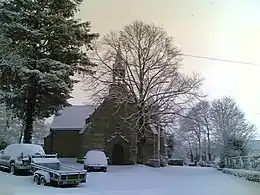 |
| Chapelle Saint-Jean | Le Sourn | Saint-Jean | 48° 01′ 21″ nord, 2° 59′ 45″ ouest | « IA00010485 » | Inventorié | 1986 |
Image manquante |
| Chapelle Saint-Michel | Le Sourn | Saint-Michel | 48° 02′ 36″ nord, 2° 59′ 31″ ouest | « IA00010486 » | Inventorié | 1986 |  |
| Chapelle Saint-Roch | Sulniac | Cimetière Le Gorvello |
47° 38′ 24″ nord, 2° 35′ 39″ ouest |  | |||
| Chapelle Sainte-Marguerite | Sulniac | Sainte-Marguerite | 47° 39′ 40″ nord, 2° 31′ 59″ ouest |
Image manquante | |||
| Chapelle Notre-Dame-de-Recouvrance | Surzur | Rue de la Chapelle | 47° 34′ 35″ nord, 2° 37′ 47″ ouest | « IA00114374 » | Inventorié | 1970 |
Image manquante |
| Chapelle Saint-Marc | Surzur | Trémoyec | 47° 33′ 30″ nord, 2° 35′ 57″ ouest | « IA00114395 » | Inventorié | 1970 |
Image manquante |
| Chapelle Sainte-Anne-Grappon | Surzur | Le Cosquer | 47° 32′ 44″ nord, 2° 38′ 59″ ouest | « IA00114397 » | Inventorié | 1970 |  |
| Chapelle Sainte-Hélène | Surzur | Brarun | 47° 34′ 19″ nord, 2° 37′ 34″ ouest | « PA00091749 » | Inscrit | 1973 | 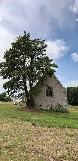 |
| Chapelle du château du Grégo | Surzur | Le Grégo | 47° 36′ 04″ nord, 2° 37′ 22″ ouest | « IA00114383 » | Inventorié | 1970 |
Image manquante |
| Chapelle du château de Pembulzo | Surzur | Pembulzo | 47° 35′ 01″ nord, 2° 36′ 18″ ouest | « IA00114393 » | Inventorié | 1987 |
Image manquante |
| Chapelle Saint-Étienne | Taupont | Rue du Carouge Crémenan |
47° 57′ 52″ nord, 2° 26′ 38″ ouest | « IA00010270 » | Inventorié | 1986 |
Image manquante |
| Chapelle Saint-Gildas-et-Saint-Mathurin | Taupont | Rue Saint-Mathurin Quelneuc |
47° 58′ 06″ nord, 2° 25′ 00″ ouest | « IA00010279 » | Inventorié | 1986 |
Image manquante |
| Chapelle Sainte-Anne | Taupont | Rue de la Chapelle Lézillac |
47° 57′ 46″ nord, 2° 25′ 57″ ouest | « IA00010286 » | Inventorié | 1986 |
Image manquante |
| Chapelle de la Salette | Théhillac | Rue de l'École | 47° 34′ 15″ nord, 2° 06′ 32″ ouest |
Image manquante | |||
| Chapelle Notre-Dame-la-Blanche | Theix-Noyalo | Rue de la Chapelle Place de la Chapelle Theix |
47° 37′ 43″ nord, 2° 39′ 01″ ouest | « PA00091755 » | Inscrit | 1925 |
Image manquante |
| Chapelle Saint-Joseph de Theix | Theix-Noyalo | Calzac-Église Theix |
47° 38′ 49″ nord, 2° 36′ 28″ ouest | « IA00114414 » | Inventorié | 1971 |
Image manquante |
| Chapelle Saint-Léonard de Theix | Theix-Noyalo | Saint-Léonard Theix |
47° 38′ 56″ nord, 2° 42′ 33″ ouest | « IA00114440 » | Inventorié | 1970 |
Image manquante |
| Chapelle Saint-Michel de Theix | Theix-Noyalo | Brangolo Theix |
47° 39′ 09″ nord, 2° 37′ 03″ ouest | « PA00091754 » | Inscrit | 1925 |
Image manquante |
| Chapelle Sainte-Barbe de Theix | Theix-Noyalo | Moustoir-Lorho Theix |
47° 36′ 27″ nord, 2° 38′ 35″ ouest | « IA00114433 » | Inventorié | 1970 | .jpg.webp) |
| Chapelle du manoir de Caden | Le Tour-du-Parc | Caden | 47° 32′ 26″ nord, 2° 40′ 37″ ouest | « IA00127672 » | Inventorié | 1992 | 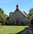 |
| Chapelle Saint-Cornély | Tréal | Le Vieux-Bourg | 47° 50′ 40″ nord, 2° 12′ 28″ ouest | « IA00009804 » | Inventorié | 1986 |  |
| Chapelle Saint-Nicolas | Trédion | La Métairie-du-Croc | 47° 47′ 37″ nord, 2° 33′ 22″ ouest |
Image manquante | |||
| Chapelle Notre-Dame-de-Bon-Secours | Treffléan | Cran | 47° 39′ 58″ nord, 2° 36′ 03″ ouest | « PA00091759 » | Classé | 1962 | 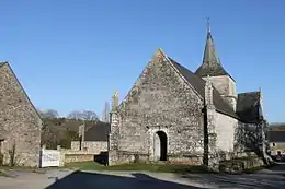 |
| Chapelle Sainte-Apolinne | Treffléan | Randrécard | 47° 40′ 22″ nord, 2° 37′ 56″ ouest |  | |||
| Chapelle Saint-Yves | La Trinité-Porhoët | Rue Saint-Yves | 48° 05′ 55″ nord, 2° 32′ 48″ ouest |
Image manquante | |||
| Chapelle Saint-Méen de La Chapelle-Caro | Val-d'Oust | Saint-Méen La Chapelle-Caro |
47° 49′ 18″ nord, 2° 23′ 54″ ouest | « PA00091149 » | Inscrit | 1973 | 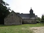 |
| Chapelle Notre-Dame-de-Bonne-Nouvelle du manoir du Val-Néant | Val-d'Oust | Le Val-Néant Le Roc-Saint-André |
47° 51′ 37″ nord, 2° 27′ 23″ ouest | « IA00010140 » | Inventorié | 1986 |
Image manquante |
| Chapelle Notre-Dame | Vannes | Le Rohic | 47° 39′ 51″ nord, 2° 43′ 03″ ouest | « PA00091773 » | Classé | 1929 | 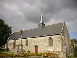 |
| Chapelle conventuelle du Père-Éternel | Vannes | Place Théodore-Decker Rue Madame-Molé |
47° 39′ 05″ nord, 2° 45′ 35″ ouest | .jpg.webp) | |||
| Ruines de la chapelle Saint-Guen | Vannes | Place Colonel-Le-Menach | 47° 40′ 14″ nord, 2° 45′ 21″ ouest | « PA00091774 » | Inscrit | 1939 | 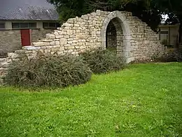 |
| Chapelle Saint-Yves | Vannes | Place Maurice Marchais | 47° 39′ 32″ nord, 2° 45′ 37″ ouest | « PA00091778 » | Inscrit | 1929 | _Chapelle_Saint-Yves_06.JPG.webp) |
| Chapelle Sainte-Anne | Vannes | 20 rue Aristide-Briand | 47° 39′ 28″ nord, 2° 44′ 53″ ouest |
Image manquante | |||
| Chapelle Sainte-Catherine (dite aussi chapelle de la Congrégation) |
Vannes | Place Sainte-Catherine | 47° 39′ 35″ nord, 2° 45′ 16″ ouest |  | |||
| Chapelle de la Sainte-Vierge | Vannes | Centre hospitalier Avenue Favrel et Lincy |
47° 39′ 54″ nord, 2° 44′ 29″ ouest | .jpg.webp) | |||
| Chapelle des Carmélites | Vannes | Couvent des Carmélites 35 rue Jean Gougaud |
47° 39′ 29″ nord, 2° 45′ 59″ ouest |
Image manquante | |||
| Chapelle des Carmes déchaussés | Vannes | Place Thédore-Decker | 47° 39′ 07″ nord, 2° 45′ 37″ ouest | 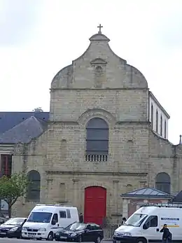 | |||
| Chapelle des Ursulines | Vannes | 3 rue Thiers | 47° 39′ 14″ nord, 2° 45′ 36″ ouest | « PA00091779 » | Classé | 1988 | _Chapelle_des_Ursulines_01.JPG.webp) |
| Chapelle du collège Notre-Dame-le-Ménimur | Vannes | Rue de Metz | 47° 40′ 02″ nord, 2° 45′ 54″ ouest |
Image manquante | |||
| Chapelle du lycée Saint-François-Xavier | Vannes | Rue Thiers | 47° 39′ 12″ nord, 2° 45′ 38″ ouest | .jpg.webp) | |||
| Chapelle du Mené | Vannes | Couvent des Dames de la Retraite du Mené >br>12 avenue Victor-Hugo | à géolocaliser |
Image manquante | |||
| Chapelle du château de Meudon | Vannes | Meudon | 47° 40′ 01″ nord, 2° 41′ 48″ ouest |
Image manquante | |||
| Chapelle du manoir de Larmor | Vannes | Avenue René-de-Kerviler | 47° 38′ 26″ nord, 2° 45′ 25″ ouest | .jpg.webp) | |||
| Chapelle de la Vraie-Croix | La Vraie-Croix | Place du Palais Rue des Templiers |
47° 41′ 22″ nord, 2° 32′ 36″ ouest | « PA00091807 » | Inscrit | 1926 | .JPG.webp) |
Notes et références
- Arrêté du 18 février 2021 portant inscription au titre des monuments historiques de la chapelle Saint-Samson à Neulliac (Morbihan)
- JORF n°0095 du 22 avril 2016 texte n° 55 Liste des immeubles protégés au titre des monuments historiques en 2015
- JORF n°0146 du 26 juin 2015 page 10778 texte n° 45 Liste des immeubles protégés au titre des monuments historiques en 2014