Liste des lieux patrimoniaux du Manitoba
Cet article recense les lieux patrimoniaux du Manitoba inscrits au répertoire des lieux patrimoniaux du Canada, qu'ils soient de niveau provincial, fédéral ou municipal.
En outre, les villes suivantes possèdent leurs propres listes :
- Pour Winnipeg, voir la liste des lieux patrimoniaux de Winnipeg.
Liste
| [1] | Lieu patrimonial | Illustration | Municipalité | Adresse | Coordonnées | No | Constr. | Prot.[2] | Rec. | Notes |
|---|---|---|---|---|---|---|---|---|---|---|
| M | Bureau de poste d'Alexander | 
|
Alexander | 415 - 2nd Avenue West | 49.8298 -100.296 |
2774 | 1887 | Municipal Heritage Site | 1993 | |
| M | Centre d'interpretive de Friesen | 
|
Altona | 89 Road 1 West | 49.0421 -97.286 |
3367 | 1901 | Municipal Heritage Site | 2002 | |
| M | Maison Klippenstein | 
|
Altona | 14 Centre Avenue East | 49.1057 -97.5522 |
6827 | 1916 | Municipal Heritage Site | 1992 | |
| M | Maison Schwartz | 
|
Altona | 245 10th Avenue NW | 49.1113 -97.5698 |
5444 | 1902 | Municipal Heritage Site | 1988 | |
| M | Maison du gardien de troupeau | 
|
Altona | 89 Road 1 West | 49.1 -97.55 |
3369 | 1890 | Municipal Heritage Site | 2002 | |
| M | Waisenamt Bergthaler | 
|
Altona | 48 Main Street | 49.1067 -97.5576 |
3214 | 1916 | Municipal Heritage Site | 1992 | |
| M | Gare du Canadien Pacifique d'Arborg | 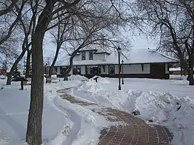 |
Arborg | 292 Main Street | 50.9081 -97.2153 |
3219 | 1910 | Municipal Heritage Site | 1992 | |
| M | Maison Fjelsted | 
|
Arborg | 210 Main Street | 50.9054 -97.2169 |
3325 | 1912 | Municipal Heritage Site | 1999 | |
| M | Monument Johann Magnus Bjarnason | 
|
Arborg | 50.905 -97.1197 |
6583 | Municipal Heritage Site | 1989 | |||
| M | Église catholique ukrainienne St. Demetrius | 
|
Arborg | 50.9692 -97.2238 |
6260 | 1921 | Municipal Heritage Site | 2005 | ||
| M | Église unitarienne d'Arborg | 
|
Arborg | 242 Ingolfs Street | 50.9072 -97.2154 |
6588 | 1927 | Municipal Heritage Site | 1998 | |
| M | Maison Fowler | 
|
Argyle | 111 Elizabeth Avenue East | 49.3843 -99.2415 |
6909 | 1897 | Municipal Heritage Site | 2000 | |
| M | Maison patrimoniale de Marringhurst | 
|
Argyle | NW 20-3-12 W | 49.2344 -99.0636 |
3886 | 1910 | Municipal Heritage Site | 1994 | |
| M | Édifice Fowler | 
|
Argyle | 225 Elizabeth Avenue East | 49.3853 -99.2429 |
4881 | 1899 | Municipal Heritage Site | 1995 | |
| M | Édifice Thomas Poole | 
|
Argyle | 215 Elizabeth Avenue East | 49.3853 -99.2457 |
4882 | 1910 | Municipal Heritage Site | 1997 | |
| M | Église anglicane St. George's | 
|
Argyle | Provincial Road 253 | 49.2523 -99.1543 |
5483 | 1889 | Municipal Heritage Site | 1987 | |
| P | Église luthérienne Frelsis (Liberty) | 
|
Argyle | NW 12-6-14W | 49.467 -99.243 |
3855 | 1889 | Provincial Heritage Site | 1990 | |
| M | Église unie de Baldur | 
|
Argyle | 202 Second Street South | 49.3871 -99.2447 |
5079 | 1904 | Municipal Heritage Site | 1996 | |
| M | Église Peace Lutheran | 
|
Armstrong | First Avenue & PR #419 | 50.7844 -97.5733 |
5922 | 1924 | Municipal Heritage Site | 1999 | |
| M | Église catholique grecque Holy Cross | 
|
Armstrong | 50.5209 -97.3682 |
8690 | 1915 | Municipal Heritage Site | 1999 | ||
| M | Église catholique romaine St. Michael's of Archangels | 
|
Armstrong | 50.7282 -97.2194 |
6097 | 1918 | Municipal Heritage Site | 1989 | ||
| M | Église catholique ukrainienne de la Vierge Marie bénie | 
|
Armstrong | NW 16-18-2 EPM | 50.549 -97.274 |
3532 | 1938 | Municipal Heritage Site | 2002 | |
| M | École Coultervale | 
|
Arthur | 49.0296 -101.026 |
5991 | 1915 | Municipal Heritage Site | 2000 | ||
| M | École Verona | 
|
Arthur | 49.1327 -100.888 |
5992 | 1918 | Municipal Heritage Site | 2000 | ||
| P | Site de la Manitoba Glass Company | 
|
Beausejour | James Avenue | 50.0326 -96.3141 |
6745 | Provincial Heritage Site | 1989 | ||
| M | Bâtiment de la North American Lumber Company | 
|
Binscarth | 162 - 2nd Street | 50.6259 -101.287 |
3218 | 1893 | Municipal Heritage Site | 1991 | |
| M | Édifice de la Union Bank de Birtle | 
|
Birtle | 738 Main Street | 50.4226 -101.043 |
3884 | 1902 | Municipal Heritage Site | 1990 | |
| M | Édifice Welch | 
|
Boissevain | 410-412 South Railway Street | 49.2305 -100.054 |
4876 | 1900 | Municipal Heritage Site | 1990 | |
| P | Église unie St. Paul | 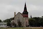 |
Boissevain | 590, rue Johnson | 49.2306 -100.053 |
3489 | 1893 | Provincial Heritage Site | 1989 | |
| M | Homestead Armstrong | 
|
Boissevain | 49.1964 -100.05 |
5096 | 1914 | Municipal Heritage Site | 1995 | ||
| M | Hôtel de ville de Boissevain | 
|
Boissevain | 578 Cook Street | 49.223 -100.057 |
3685 | 1910 | Municipal Heritage Site | 1988 | |
| M | Maison Cottingham | 
|
Boissevain | 49.2199 -100.036 |
5304 | 1904 | Municipal Heritage Site | 1999 | ||
| M | Maison Dow | 
|
Boissevain | 721 Mill Road | 49.2341 -100.059 |
5375 | 1910 | Municipal Heritage Site | 1995 | |
| M | Maison McKinney | 
|
Boissevain | 49.1722 -100.139 |
5083 | 1904 | Municipal Heritage Site | 1996 | ||
| P | Ancien édifice de la Merchants Bank | 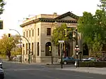 |
Brandon | 1043, avenue Rosser | 49.85 -99.95 |
3495 | 1907 | Provincial Heritage Site | 1987 | |
| P | Ancienne résidence des infirmières du Centre de santé mentale de Brandon | 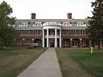 |
Brandon | 49.8687 -99.9374 |
5301 | 1923 | Provincial Heritage Site | 2001 | ||
| P | Bâtiment Citizens' Science de Brandon | 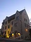 |
Brandon | 270, 18th Street | 49.843 -99.963 |
3882 | 1923 | Provincial Heritage Site | 1992 | |
| P | Bâtiments Brandon College et Clark Hall | 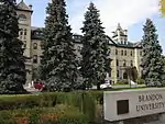 |
Brandon | 270, 18th Street | 49.847 -99.962 |
3881 | 1906 | Provincial Heritage Site | 1992 | |
| M | Bloc Burchill et Howey | 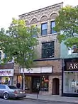 |
Brandon | 908, avenue Rosser | 49.8475 -99.9574 |
4925 | 1906 | Municipal Heritage Site | 1990 | |
| M | Bloc Fraser | 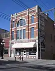 |
Brandon | 1031 Rosser Avenue | 49.8485 -99.9518 |
2968 | 1890 | Municipal Heritage Site | 1988 | |
| M | Caserne centrale (Brandon) | 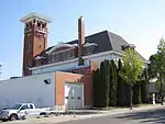 |
Brandon | 637, avenue Princess | 49.85 -99.95 |
3336 | 1911 | Municipal Heritage Site | 2000 | |
| P | Cathédrale anglicane St. Matthew's | 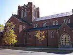 |
Brandon | 403, 13th Street | 49.844 -99.9545 |
3918 | 1913 | Provincial Heritage Site | 1999 | |
| M | Clôture de pierre | 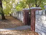 |
Brandon | 17e Rue Avenue Princess |
49.8429 -99.949 |
3400 | 1904 | Municipal Heritage Site | 2003 | |
| P | Commonwealth Air Training Plan Hangar | 
|
Brandon | 300 Commonwealth Way Brandon MB | 49.9025 -99.9418 |
2578 | 1941 | Provincial Heritage Site | 2003 | |
| M | Domaine Johnston | 
|
Brandon | 547 13th Street | 49.8415 -99.9547 |
5331 | 1881 | Municipal Heritage Site | 2003 | |
| P | École normale de Brandon | 
|
Brandon | 1129 Queens Avenue | 49.8296 -99.9529 |
5357 | 1913 | Provincial Heritage Site | 1985 | |
| P | Édifice de la société A.E. McKenzie | 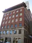 |
Brandon | 30, 9e Rue | 49.8485 -99.9504 |
3487 | 1911 | Provincial Heritage Site | 1988 | |
| M | Édifice LaPlont | 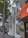 |
Brandon | 924, avenue Rosser | 49.8485 -99.9546 |
3329 | 1892 | Municipal Heritage Site | 1995 | |
| F | Édifice fédéral | 
|
Brandon | 1039 Princess Avenue | 49.8472 -99.9524 |
4793 | 1930 | Recognized Federal Heritage Building | 1991 | |
| M | Épicerie Zink's | 
|
Brandon | 361 1st Street | 49.84 -99.94 |
3382 | 1932 | Municipal Heritage Site | 1999 | |
| F | Gare ferroviaire du Canadien Pacifique | 
|
Brandon | Pacific Avenue (at 10th St.) | 49.85 -99.951 |
4558 | 1912 | Heritage Railway Station | 1992 | |
| P | Hangar du Programme d'entraînement du Commonwealth |  |
Brandon | 300 Commonwealth Way | 49.9025 -99.9418 |
7333 | 1941 | Provincial Heritage Site | 2003 | |
| M | Hangar no 1- Musée du PEAC |  |
Brandon | McGill Field | 49.8997 -99.9417 |
3351 | 1941 | Municipal Heritage Site | 2000 | |
| F | Lieu historique national du Canada du Bâtiment d'exposition n° 2 de l'Exposition du Dominion | 
|
Brandon | Provincial Exhibition Grounds | 49.8313 -99.9586 |
7411 | 1913 | National Historic Site of Canada | 1998 | |
| F | Lieu historique national du Canada du Hangar-Numéro-Un-du-PEACB |  |
Brandon | Brandon Municipal Airport | 49.9097 -99.9508 |
7753 | 1941 | National Historic Site of Canada | 2001 | |
| M | Lorne Terrace | 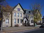 |
Brandon | 1133-1137, avenue Lorne | 49.8454 -99.9384 |
5303 | 1892 | Municipal Heritage Site | 2000 | |
| M | Maison B.J. Hales | 
|
Brandon | 1312 10th Street | 49.8395 -99.9364 |
8847 | 1912 | Municipal Heritage Site | 2007 | |
| M | Maison Christie | 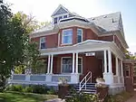 |
Brandon | 404, 13e Rue | 49.8449 -99.9559 |
4912 | 1905 | Municipal Heritage Site | 1989 | |
| M | Maison Daly | 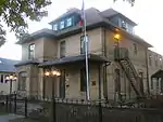 |
Brandon | 122, 18e Rue | 49.85 -99.96 |
3353 | 1882 | Municipal Heritage Site | 2000 | |
| M | Maison Johnson | 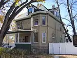 |
Brandon | 446, 7th Street | 49.8429 -99.9504 |
3911 | 1906 | Municipal Heritage Site | 2002 | |
| M | Maison Maley | 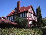 |
Brandon | 1605, avenue Victoria | 49.8431 -99.9545 |
3220 | 1912 | Municipal Heritage Site | 1992 | |
| M | Maison McKenzie | 
|
Brandon | 436 Victoria Avenue | 49.8436 -99.9764 |
3210 | 1901 | Municipal Heritage Site | 1993 | |
| P | Maison Paterson-Matheson |  |
Brandon | 1039 Louise Avenue | 49.844 -99.949 |
8124 | 1893 | Provincial Heritage Site | 1984 | |
| M | Maison Shillinglaw | 
|
Brandon | 302 Russell Street | 49.84 -99.94 |
3427 | 1882 | Municipal Heritage Site | 2003 | |
| M | Maison Yates | 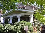 |
Brandon | 431, 16e Rue | 49.8431 -99.9588 |
4872 | 1914 | Municipal Heritage Site | 2001 | |
| F | Manège militaire | 
|
Brandon | 1116 Victoria Avenue | 49.8419 -99.953 |
9615 | 1909 | Recognized Federal Heritage Building | 1994 | |
| P | Palais de justice et prison de Brandon | 
|
Brandon | 525 Victoria Avenue East | 49.8433 -99.9323 |
8121 | 1883 | Provincial Heritage Site | 1985 | |
| P | Site Stott | 
|
Brandon | 49.52 -100.05 |
7293 | Provincial Heritage Site | 1948 | |||
| P | Villa Louise | 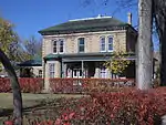 |
Brandon | 707, avenue Louise | 49.844 -99.9531 |
5067 | 1888 | Provincial Heritage Site | 1991 | |
| M | École Napinka | 
|
Brenda | Souris Street | 49.3214 -100.843 |
6617 | 1900 | Municipal Heritage Site | 1994 | |
| M | Clocher de l'église catholique ukrainienne St. Michael the Archangel | 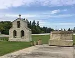 |
Brokenhead | 50.077 -96.6565 |
5599 | 1917 | Municipal Heritage Site | 1993 | ||
| P | Magasin général Gabel | 
|
Brokenhead | 50.1806 -96.496 |
6590 | 1931 | Provincial Heritage Site | 1991 | ||
| M | Église orthodoxe ukrainienne Saint-Pierre-et-Saint-Paul | 
|
Brokenhead | 50.0885 -96.6573 |
16347 | 1933 | Municipal Heritage Site | 2009 | ||
| M | Ancien hôtel de ville | 
|
Carberry | 122 Main Street | 49.7429 -99.3515 |
9463 | 1907 | Municipal Heritage Site | 2007 | |
| M | Ancien lieu du Rex Café | 
|
Carberry | 50 Main Street | 49.8697 -99.3552 |
10346 | Municipal Heritage Site | 2007 | ||
| M | Ancienne Banque de Montréal | 
|
Carberry | 33 Main Street | 49.7429 -99.3515 |
9887 | 1902 | Municipal Heritage Site | 2007 | |
| M | Appartements Moon | 
|
Carberry | 30 Main Street | 49.8697 -99.3552 |
10442 | 1890 | Municipal Heritage Site | 2007 | |
| M | Bibliothèque de Carberry-North Cypress | 
|
Carberry | 115 Main Street | 49.8697 -99.3552 |
10739 | 1938 | Municipal Heritage Site | 2007 | |
| M | Boulangerie Modern | 
|
Carberry | 42 Main Street | 49.8697 -99.3552 |
10448 | 1890 | Municipal Heritage Site | 2007 | |
| M | Bâtiment Charlie Sear | 
|
Carberry | 19-21 Main Street | 49.8697 -99.3552 |
10568 | 1905 | Municipal Heritage Site | 2007 | |
| M | Bâtiment Davidson | 
|
Carberry | 109 Main Street | 49.8697 -99.3552 |
10780 | 1885 | Municipal Heritage Site | 2007 | |
| M | Bâtiment Murphy | 
|
Carberry | 29 Main Street | 49.8697 -99.3552 |
10569 | 1886 | Municipal Heritage Site | 2007 | |
| M | Bâtiment Nelson Butt | 
|
Carberry | 31 Main Street | 49.7429 -99.3515 |
9859 | 1896 | Municipal Heritage Site | 2007 | |
| M | Bâtiment Waters | 
|
Carberry | 125 Main Street | 49.8697 -99.3552 |
10779 | 1901 | Municipal Heritage Site | 2007 | |
| M | Bâtiment du Carberry News Express | 
|
Carberry | 34 Main Street | 49.7429 -99.3515 |
9864 | 1890 | Municipal Heritage Site | 2007 | |
| M | C.V.M. Café | 
|
Carberry | 24 Main Street | 49.8697 -99.3552 |
15849 | 1890 | Municipal Heritage Site | 2007 | |
| M | Centre-ville historique de Carberry | 
|
Carberry | 316 Fourth Avenue; 9 - 145 Main Street | 49.8697 -99.3608 |
9891 | 1903 | Municipal Heritage Site | 2008 | |
| M | Flower Shop | 
|
Carberry | 110 Main Street | 49.8697 -99.3552 |
15839 | 1902 | Municipal Heritage Site | 2007 | |
| M | Hôtel Nelson | 
|
Carberry | 9 Main Street | 49.8697 -99.3552 |
10330 | 1909 | Municipal Heritage Site | 2007 | |
| M | Le Style Shop | 
|
Carberry | 41 Main Street | 49.8697 -99.3552 |
10332 | 1900 | Municipal Heritage Site | 2007 | |
| M | Légion royale canadienne | 
|
Carberry | 25 Main Street | 49.8697 -99.3552 |
10567 | 1890 | Municipal Heritage Site | 2007 | |
| M | Magasin Switzer's Red and White | 
|
Carberry | 39 Main Street | 49.8697 -99.3552 |
10331 | 1900 | Municipal Heritage Site | 2007 | |
| M | Maison White | 
|
Carberry | 510 Fourth Avenue | 49.8661 -99.3576 |
5784 | 1900 | Municipal Heritage Site | 2005 | |
| P | Pavillon d'exposition de la société agricole de Carberry | 
|
Carberry | Carberry Fairgrounds | 49.868 -99.3594 |
4873 | 1893 | Provincial Heritage Site | 1998 | |
| M | Ray's Diner | 
|
Carberry | 43 Main Street | 49.8697 -99.3552 |
10333 | 1900 | Municipal Heritage Site | 2007 | |
| P | Terrain d'entraînement militaire du Camp Hughes | 
|
Carberry | 49.8828 -99.5503 |
7745 | Provincial Heritage Site | 1994 | |||
| M | Édifice A.E. Gardiner | 
|
Carberry | 116 Main Street | 49.868 -99.3594 |
5392 | 1915 | Municipal Heritage Site | 1997 | |
| M | Édifice Forbes | 
|
Carberry | 40 Main Street | 49.8697 -99.3552 |
10440 | 1890 | Municipal Heritage Site | 2007 | |
| M | Édifice Kowalchuk | 
|
Carberry | 38 Main Street | 49.8697 -99.3552 |
10433 | 1890 | Municipal Heritage Site | 2007 | |
| M | Édifice McCullough | 
|
Carberry | 48 Main Street | 49.8697 -99.3552 |
10443 | 1896 | Municipal Heritage Site | 2007 | |
| M | Édifice Wright | 
|
Carberry | 46 Main Street | 49.8697 -99.3552 |
10446 | 1890 | Municipal Heritage Site | 2007 | |
| M | Édifice de la pharmacie | 
|
Carberry | 44 Main Street | 49.8697 -99.3552 |
10447 | 1890 | Municipal Heritage Site | 2007 | |
| M | Édifice de réseau téléphonique du Manitoba | 
|
Carberry | 121 Main Street | 49.8697 -99.3552 |
10348 | 1941 | Municipal Heritage Site | 2007 | |
| M | Église Calvary Pentecostal | 
|
Carberry | 141 Main Street | 49.8697 -99.3552 |
10343 | 1942 | Municipal Heritage Site | 2007 | |
| M | Bureau de poste Dominion de Carman | 
|
Carman | 15 1st Avenue SW | 49.5072 -98.0031 |
4259 | 1915 | Municipal Heritage Site | 1990 | |
| M | Gare du chemins de fer nationaux du Canada de Carman | 
|
Carman | 38 Centre Avenue West | 49.5071 -98.0086 |
2769 | 1902 | Municipal Heritage Site | 2003 | |
| M | Hall Memorial | 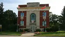 |
Carman | 12-2nd Avenue SW | 49.5063 -98.0031 |
3327 | 1920 | Municipal Heritage Site | 1995 | |
| M | Maison Rodmond Roblin | 
|
Carman | NE 24-6-4 WPM | 49.4968 -97.868 |
2768 | 1912 | Municipal Heritage Site | 2003 | |
| M | Maison Sexsmith | 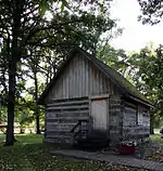 |
Carman | 18 Kings Park Road | 49.5028 -98.017 |
3176 | 1875 | Municipal Heritage Site | 1998 | |
| M | École Boyne |  |
Carman | 49.5024 -97.9294 |
5053 | 1930 | Municipal Heritage Site | 1988 | ||
| M | Église unie de Carman |  |
Carman | 143 First Street SW | 49.5036 -98.0032 |
4566 | 1907 | Municipal Heritage Site | 1988 | |
| M | Couvent des Sœurs Grises | 
|
Cartier | 1060 Highway 26 | 49.9124 -97.5393 |
3885 | 1916 | Municipal Heritage Site | 1994 | |
| M | Magasin Qually Brothers | 
|
Cartier | 48 Qually Road | 49.88 -97.63 |
9953 | 1936 | Municipal Heritage Site | 2001 | |
| M | Forge (Cartwright) | 
|
Cartwright | North Railway Street | 49.095 -99.337 |
3748 | 1888 | Municipal Heritage Site | 1989 | |
| M | Maison Menarey | 
|
Cartwright | 49.1292 -99.4158 |
5476 | 1910 | Municipal Heritage Site | 1999 | ||
| M | École Mount Prospect | 
|
Cartwright | 350 Broadway Avenue | 49.09 -99.3419 |
5475 | 1884 | Municipal Heritage Site | 1992 | |
| M | Édifice Manitoba Telephone System | 
|
Cartwright | 350 Broadway Avenue | 49.0909 -99.3446 |
5482 | 1929 | Municipal Heritage Site | 1995 | |
| M | Église anglicane Christ | 
|
Cartwright | 49.0963 -99.3405 |
6659 | 1898 | Municipal Heritage Site | 2003 | ||
| F | Aérogare, bâtiment H-7 |  |
Churchill | Churchill Airport | 58.7372 -94.0562 |
9709 | 1951 | Recognized Federal Heritage Building | 1989 | |
| F | Gare de Via Rail et du CN | 
|
Churchill | 58.7694 -94.173 |
9525 | 1930 | Recognized Federal Heritage Building | 2000 | ||
| F | Lieu historique national du Canada de la Base-de-Lancement-de-Fusées-de-Recherche-de-Churchill | 
|
Churchill | 58.7774 -93.7185 |
12776 | 1956 | National Historic Site of Canada | 1988 | ||
| F | VIA Rail - Gare ferroviaire de Canadien National | 
|
Churchill | 1st Street & Railway Ave. | 58.769 -94.173 |
6727 | 1930 | Heritage Railway Station | 1992 | |
| M | Carrière d'Oak Point - parc du patrimoine Notre Dame | 
|
Coldwell | 50.5068 -98.1741 |
14521 | Municipal Heritage Site | 2009 | |||
| M | Église luthérienne Stony Hill-Otto | 
|
Coldwell | 50.6838 -97.879 |
5989 | 1913 | Municipal Heritage Site | 1991 | ||
| M | Église unie de Lily Bay | 
|
Coldwell | 50.7299 -98.2275 |
5988 | 1906 | Municipal Heritage Site | 1994 | ||
| F | VIA Rail/Canadien National, gare de | 
|
Cranberry Portage | Railway Avenue | 54.586 -101.382 |
4548 | 1929 | Heritage Railway Station | 1992 | |
| M | Site de l'église catholique de la réserve de Crane River | 
|
Crane River 51 | 51.5147 -99.2608 |
15147 | Municipal Heritage Site | 2009 | |||
| P | Bâtiment du Courier Publishing Company | 
|
Crystal City (en) | 218 Broadway Street | 49.1463 -98.9483 |
9402 | Provincial Heritage Site | 1994 | ||
| M | Bâtiment du Crystal City Courier | 
|
Crystal City (en) | 218 Broadway Street | 49.146 -98.948 |
3759 | 1881 | Municipal Heritage Site | 1991 | |
| M | Cimetière Thomas Greenway | 
|
Crystal City (en) | 49.1534 -98.9531 |
6430 | Municipal Heritage Site | 1989 | |||
| M | Maison McGregor | 
|
Daly | 49.8965 -100.113 |
5011 | 1914 | Municipal Heritage Site | 1992 | ||
| P | Gare Canadien National de Dauphin | 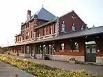 |
Dauphin | 103 1st Avenue | 51.1499 -100.051 |
3921 | 1912 | Provincial Heritage Site | 1998 | |
| P | Hôtel de ville de Dauphin | 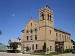 |
Dauphin | 104 1st Avenue NW | 51.1508 -100.051 |
3974 | 1905 | Provincial Heritage Site | 1992 | |
| F | L'ancienne gare du Chemin de fer Canadien du Nord | 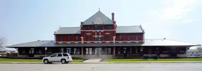 |
Dauphin | 101 1st Avenue NW | 51.15 -100.051 |
6496 | 1912 | Heritage Railway Station | 1989 | |
| F | Lieu historique national du Canada de l'Église-Catholique-Ukrainienne-de-la-Résurrection | 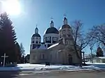 |
Dauphin | 1106 First Street SW | 51.1419 -100.062 |
12283 | 1939 | National Historic Site of Canada | 1996 | |
| M | Salle communautaire Rhodes | 
|
Dauphin | 51.4753 -100.533 |
8456 | 1933 | Municipal Heritage Site | 1999 | ||
| P | Église catholique ukrainienne St. Michael's | 
|
Dauphin | NW 20-26-20 WPM | 51.2701 -100.249 |
4107 | 1898 | Provincial Heritage Site | 1999 | |
| P | Église catholique ukrainienne historique de la Résurrection |  |
Dauphin | 1106 First Street SW | 51.1408 -100.061 |
3917 | 1939 | Provincial Heritage Site | 1994 | |
| M | Église orthodoxe russe Holy Resurrection |  |
Dauphin | Ogryzlo Street | 51.3602 -100.139 |
6259 | 1926 | Municipal Heritage Site | 2005 | |
| M | Église ukrainienne grecque orthodoxe Saint-Pierre-et-Saint-Paul | 
|
Dauphin | 51.0133 -100.203 |
9422 | 1921 | Municipal Heritage Site | 2005 | ||
| M | Chambre forte du vieux Deloraine | 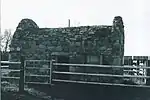 |
Deloraine | 49.1593 -100.408 |
4829 | 1883 | Municipal Heritage Site | 1993 | ||
| P | Sentier de la Boundary Commission - traversée du ruisseau Turtlehead | 
|
Deloraine | 49.1344 -100.401 |
8149 | Provincial Heritage Site | 1995 | |||
| M | Église presbytérienne de Deloraine | 
|
Deloraine | 220 South Railway Avenue West | 49.1924 -100.496 |
5377 | 1897 | Municipal Heritage Site | 1992 | |
| M | École Roseisle | 
|
Dufferin (en) | 1st Avenue | 49.4988 -98.3424 |
6933 | 1921 | Municipal Heritage Site | 1989 | |
| M | École Eunola | 
|
Edward | SE 11-4-29 WPM | 49.2821 -101.28 |
5787 | 1937 | Municipal Heritage Site | 1992 | |
| M | Église unie d'Elkhorn | 
|
Elkhorn | 102 Foxford Avenue East | 49.9783 -101.238 |
4899 | 1903 | Municipal Heritage Site | 1994 | |
| M | Grange Anderson | 
|
Elton | 49.9397 -99.9035 |
5084 | 1903 | Municipal Heritage Site | 1999 | ||
| M | Maison patrimoniale d'Elton | 
|
Elton | Justice Road | 49.9739 -99.986 |
2772 | 1909 | Municipal Heritage Site | 2003 | |
| F | Gare ferroviaire du Canadien Pacifique | 
|
Emerson | 6th Street (at Morris St.) | 49.005 -97.203 |
4559 | 1914 | Heritage Railway Station | 1992 | |
| F | Lieu historique national du Canada Fort-Dufferin | 
|
Emerson | Highway 75, 3 miles north of Emerson | 49.0314 -97.2039 |
12688 | 1873 | National Historic Site of Canada | 1937 | |
| M | Loge maçonnique | 
|
Emerson | 1 First Street | 49.0065 -97.2132 |
3330 | 1921 | Municipal Heritage Site | 1997 | |
| M | Maison Bryce | 
|
Emerson | 99 Assiniboine Street | 49.0065 -97.2118 |
3217 | 1883 | Municipal Heritage Site | 1993 | |
| P | Palais de justice et l'hôtel de ville d'Emerson | 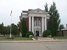 |
Emerson | 104 Church Street | 49.0056 -97.2119 |
3431 | 1918 | Provincial Heritage Site | 1985 | |
| M3 | Résidence du pasteur de l'église presbytérienne | 
|
Emerson | 129 Park Street | 49.0074 -97.2145 |
8234 | 1905 | Municipal Heritage Site | 1993 | |
| M | Presbytère de l'église luthérienne Bethlehem | 
|
Erickson | Queen Elizabeth Road | 50.5036 -99.9127 |
6596 | 1898 | Municipal Heritage Site | 1987 | |
| M | Crémerie d'Eriksdale | 
|
Eriksdale | Station Lane at Main Street | 50.8625 -98.1056 |
4146 | 1912 | Municipal Heritage Site | 1995 | |
| F | Lieu historique national du Canada du Fort-Prince-de-Galles |  |
Eskimo Point | PO Box 127 | 58.7932 -94.2119 |
7760 | 1771 | National Historic Site of Canada | 1920 | |
| M | École Ruskin | 
|
Ethelbert (en) | 51.5136 -100.439 |
8230 | 1926 | Municipal Heritage Site | 1999 | ||
| M | Édifice de la Banque de Montréal | 
|
Ethelbert (en) | 5 Railway Avenue North | 51.53 -100.4 |
4174 | 1922 | Municipal Heritage Site | 1996 | |
| M | Église ukrainienne grecque orthodoxe St. John the Baptist | 
|
Ethelbert (en) | 51.6545 -100.46 |
8864 | 1929 | Municipal Heritage Site | 1997 | ||
| M | Église unie de Garland | 
|
Ethelbert (en) | 51.6525 -100.46 |
8865 | 1916 | Municipal Heritage Site | 1999 | ||
| M | Gare du Canadian National Railway de Fisher Branch | 
|
Fisher (en) | Railway Avenue | 51.0842 -97.6222 |
5923 | 1915 | Municipal Heritage Site | 2002 | |
| M | Église catholique ukrainienne St. Nicholas | 
|
Fisher (en) | #44 High Plains Road | 50.8898 -97.6106 |
6162 | 1913 | Municipal Heritage Site | 1997 | |
| M | Église ukrainienne grecque orthodoxe Holy Trinity | 
|
Fisher (en) | #19 High Plains Road | 50.8898 -97.6061 |
6752 | 1942 | Municipal Heritage Site | 1989 | |
| M | Cimetière de Dominion City | 
|
Franklin | 49.1429 -97.1462 |
8139 | Municipal Heritage Site | 2006 | |||
| M | Cimetière de Green Ridge | 
|
Franklin | 49.0879 -97.0064 |
8151 | Municipal Heritage Site | 2002 | |||
| M | Cimetière indépendant d'Overstoneville | 
|
Franklin | 50.9697 -96.9361 |
6434 | Municipal Heritage Site | 2000 | |||
| M | Cimetières luthériens de Fredensthal | 
|
Franklin | 49.0181 -97.0449 |
7913 | Municipal Heritage Site | 2002 | |||
| M | Pont en Béton | 
|
Franklin | 49.1636 -96.9222 |
6420 | 1917 | Municipal Heritage Site | 2000 | ||
| M | Pont en béton | 
|
Franklin | 49.1679 -96.9659 |
6359 | 1920 | Municipal Heritage Site | 2000 | ||
| M | Pont suspendu de l'école Senkiw | 
|
Franklin | 49.1988 -96.8823 |
6376 | 1930 | Municipal Heritage Site | 2000 | ||
| M | Église anglicane All Saints | 
|
Franklin | 48 Centennial Drive | 49.1432 -97.1548 |
6323 | 1879 | Municipal Heritage Site | 1993 | |
| M | Église unie et cimetière d'Arnaud | 
|
Franklin | Main Street East | 49.2591 -97.1009 |
8057 | 1904 | Municipal Heritage Site | 2002 | |
| M | Église unie St. Andrews | 
|
Garson (en) | 50.0761 -96.7055 |
4173 | 1910 | Municipal Heritage Site | 1990 | ||
| P | Maison Negrych | 
|
Gilbert Plains | SE 14-27-22 W | 51.3066 -100.452 |
3912 | 1910 | Provincial Heritage Site | 1992 | |
| M | Édifice de la coopérative d'abattage de Gilbert Plains | 
|
Gilbert Plains | 51.0932 -100.463 |
8388 | 1923 | Municipal Heritage Site | 2006 | ||
| F | VIA Rail/Canadien National, gare de | 
|
Gillam | 252 Railway Ave. | 56.347 -94.7 |
4549 | 1930 | Heritage Railway Station | 1992 | |
| M | Cimetière des colons islandais | 
|
Gimli | Highway 9 and PR 231 | 50.6513 -96.9803 |
8504 | Municipal Heritage Site | 2007 | ||
| P | H.P. Tergesen & Sons General Merchant | 
|
Gimli | 82 1st Avenue Gimli Manitoba | 50.6318 -96.9868 |
2581 | 1899 | Provincial Heritage Site | 1989 | |
| P | Magasin général H.P. Tergesen et fils | 
|
Gimli | 82 1st Avenue | 50.6318 -96.9868 |
13432 | 1899 | Provincial Heritage Site | 1989 | |
| M | Maison Jonasson | 
|
Gimli | 48 3rd Avenue | 50.6355 -96.9895 |
3558 | 1906 | Municipal Heritage Site | 1997 | |
| M | Pavillon de danse de Gimli | 
|
Gimli | Gimli Park | 50.6436 -96.992 |
3559 | 1911 | Municipal Heritage Site | 1997 | |
| M | École publique de Gimli | 
|
Gimli | 62 2nd Street | 50.6345 -96.9881 |
3213 | 1915 | Municipal Heritage Site | 1991 | |
| M | Église catholique romaine Sts. Cyril and Methodius | 
|
Gimli | 50.6379 -97.0883 |
6711 | 1921 | Municipal Heritage Site | 2000 | ||
| M | Église catholique ukrainienne St. Mary's | 
|
Gimli | 50.6705 -97.0404 |
6640 | 1906 | Municipal Heritage Site | 2002 | ||
| M | Église catholique ukrainienne St. Michael's | 
|
Gimli | 50.5806 -97.0978 |
5332 | 1904 | Municipal Heritage Site | 2003 | ||
| M | Église unitarienne de Gimli | 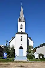 |
Gimli | 72 2nd Avenue | 50.6319 -96.9883 |
3557 | 1905 | Municipal Heritage Site | 1996 | |
| P | Magasin à rayons des frères Galloway | 
|
Gladstone | 37 Morris Avenue | 50.2283 -98.9499 |
3490 | 1902 | Provincial Heritage Site | 1989 | |
| M | Élévateur de la ferme Smith/Arthur | 
|
Gladstone | 50.2219 -98.9752 |
6892 | 1905 | Municipal Heritage Site | 2004 | ||
| M | Cimetière Millford | 
|
Glenboro | 49.62 -99.5641 |
7662 | Municipal Heritage Site | 2001 | |||
| M | Maison Buztynski | 
|
Grahamdale | Railway Avenue | 51.2888 -98.4307 |
5990 | 1900 | Municipal Heritage Site | 2005 | |
| M | École Hilbre | 
|
Grahamdale | Hilbre School Road and Dillabough Road | 51.5073 -98.5854 |
6098 | 1916 | Municipal Heritage Site | 1997 | |
| M | Église anglicane St. Helen's | 
|
Grahamdale | 51.5983 -98.6954 |
9440 | 1917 | Municipal Heritage Site | 2003 | ||
| M | Église luthérienne St. Paul's Evangelical | 
|
Grahamdale | New Home Road and Little Mud Lake Road | 51.2585 -98.4443 |
6007 | 1921 | Municipal Heritage Site | 1999 | |
| M | Site de l'usine T.A. Burrows | 
|
Grandview | 51.1797 -100.713 |
11501 | Municipal Heritage Site | 2007 | |||
| M | École Tamarisk | 
|
Grandview | 51.0962 -100.67 |
6159 | 1909 | Municipal Heritage Site | 1995 | ||
| P | École Tamarisk | 
|
Grandview | 51.0962 -100.67 |
15281 | 1919 | Provincial Heritage Site | 2008 | ||
| P | Église unie de Tamarisk | 
|
Grandview | 50.1961 -100.648 |
5097 | 1907 | Provincial Heritage Site | 1989 | ||
| M | Maison Winkler | 
|
Gretna (en) | 590 Hespeler Avenue | 49.0051 -97.5633 |
3328 | 1900 | Municipal Heritage Site | 1996 | |
| M | École Fannystelle | 
|
Grey (en) | 49.745 -97.7776 |
6589 | 1951 | Municipal Heritage Site | 1987 | ||
| M | Église catholique romaine du Sacré Cœur de Jésus | 
|
Grey (en) | 37 Church Avenue | 49.7456 -97.78 |
8495 | 1913 | Municipal Heritage Site | 1991 | |
| P | Site de la pierre dressée de la rivière Arrow | 
|
Hamiota | 50.93 -100.524 |
7329 | Provincial Heritage Site | 1962 | |||
| M | Édifice de la Union Bank | 
|
Hamiota | 39 Maple Avenue East | 50.1796 -100.596 |
4072 | 1903 | Municipal Heritage Site | 1995 | |
| M | École Willow Plain | 
|
Hanover | SE 20-5-6 E | 49.3995 -96.7441 |
2764 | 1911 | Municipal Heritage Site | 2003 | |
| M | Maison Chastko | 
|
Harrison | 50.4925 -100.092 |
8227 | 1898 | Municipal Heritage Site | 1992 | ||
| M | Église catholique ukrainienne St. Nicholas | 
|
Harrison | 50.4678 -100.095 |
4830 | 1933 | Municipal Heritage Site | 1998 | ||
| M | Old English Church | 
|
Hartney | 602 River Avenue | 49.4798 -100.519 |
16351 | 1894 | Municipal Heritage Site | 2009 | |
| F | Lieu historique national du Canada des Élévateurs-à-Grains-d'Inglis | 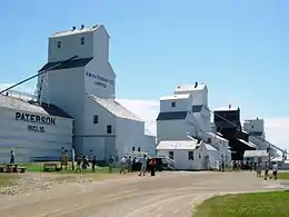 |
Inglis (en) | 50.9441 -101.249 |
7875 | 1941 | National Historic Site of Canada | 1995 | ||
| M | Chapelle Charlebois | 
|
Kelsey (Carrot Valley) | 108 First Street West | 53.8215 -101.246 |
9315 | 1897 | Municipal Heritage Site | 2005 | |
| P | Édifice Palais de justice et salle communautaire | 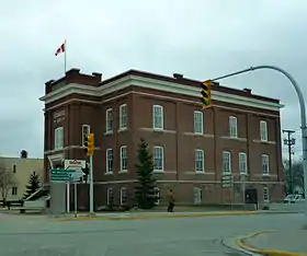 |
Kelsey (Carrot Valley) | 306 Fischer Avenue | 53.8188 -101.249 |
9314 | 1917 | Provincial Heritage Site | 1999 | |
| M | Édifice de la Banque de Commerce | 
|
Kelsey (Carrot Valley) | 162 Fischer Avenue | 53.8188 -101.249 |
9313 | 1912 | Municipal Heritage Site | 2005 | |
| M | Maison Hay | 
|
Killarney-Turtle Mountain | 402 Clark Avenue | 49.1813 -99.6673 |
5772 | 1904 | Municipal Heritage Site | 1993 | |
| M | Maison Shaver | 
|
Killarney-Turtle Mountain | 49.2238 -99.6294 |
5065 | 1901 | Municipal Heritage Site | 1992 | ||
| M | Maison de ferme-pilote | 
|
Killarney-Turtle Mountain | 44 Water Street | 49.1731 -99.6713 |
4233 | 1915 | Municipal Heritage Site | 1992 | |
| M | Église catholique Saint-Joachim | 
|
La Broquerie | 107 rue Principale | 49.53 -96.53 |
4109 | 1898 | Municipal Heritage Site | 2000 | |
| M | Cabane Erickson | 
|
Lac du Bonnet | 50.2671 -96.0167 |
8316 | 1937 | Municipal Heritage Site | 2005 | ||
| M | Maison Lecoy | 
|
Lac du Bonnet | Amy's Cove | 50.291 -95.9903 |
8050 | 1907 | Municipal Heritage Site | 1991 | |
| M | École Riverland | 
|
Lac du Bonnet | 50.252 -95.9798 |
14503 | 1924 | Municipal Heritage Site | 2008 | ||
| M | Grange Moffatt | 
|
Lakeview (en) | 50.2514 -98.7283 |
8156 | 1910 | Municipal Heritage Site | 1998 | ||
| M | Église luthérienne Grace Evangelical | 
|
Lakeview (en) | 408 Main Street | 50.3844 -98.6755 |
6756 | 1929 | Municipal Heritage Site | 1994 | |
| P | Butte et terrain de campement Arden | 
|
Lansdowne | 50.2333 -96.2542 |
6974 | Provincial Heritage Site | 1948 | |||
| M | Maison Scott | 
|
Lansdowne | 50.4102 -99.355 |
7013 | 1903 | Municipal Heritage Site | 2003 | ||
| M | École Tenby | 
|
Lansdowne | Main Street | 50.5008 -99.1329 |
5774 | 1904 | Municipal Heritage Site | 1995 | |
| M | Église catholique grecque ruthène Blessed Virgin Mary | 
|
Lawrence | 51.4547 -99.5271 |
6264 | 1937 | Municipal Heritage Site | 1998 | ||
| M | Église catholique romaine Toutes Aides | 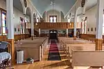 |
Lawrence | 51.487 -99.5333 |
6262 | 1935 | Municipal Heritage Site | 1990 | ||
| F | Lieu historique national du Canada du Pont-Barrage-à-Rideaux-Caméré-St. Andrews | 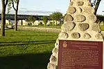 |
Lockport | St. Andrews Rapids, Red River / Highway #44 | 50.0831 -96.9444 |
4441 | 1910 | National Historic Site of Canada | 1990 | |
| M | Église catholique Sainte-Thérèse | 
|
Lorne | 49.4942 -98.5543 |
7398 | 1939 | Municipal Heritage Site | 1989 | ||
| P | Château d'eau de la gare Canadien Pacifique à Clearwater | 
|
Louise | 11th Street | 49.1328 -99.0374 |
5114 | 1904 | Provincial Heritage Site | 1996 | |
| M | Cabane en bois | 
|
Manitou | Highway Number 3 and Main Street Junction | 49.2342 -98.5361 |
3361 | 1884 | Municipal Heritage Site | 2002 | |
| M | Hôtel de ville de Manitou | 
|
Manitou | 325 Main Street | 49.2398 -98.5374 |
3324 | 1930 | Municipal Heritage Site | 1997 | |
| P | École Mowbray | 
|
Manitou | 49.0302 -98.4355 |
6853 | 1906 | Provincial Heritage Site | 2004 | ||
| F | Ancienne gare du Chemin de fer Canadien du Nord | 
|
McCreary | Railway St. (between 1st and 2nd Ave.) | 50.773 -99.49 |
6630 | 1912 | Heritage Railway Station | 1991 | |
| M | Maison Satterthwaite | 
|
McCreary | 50.7094 -99.4862 |
5082 | 1895 | Municipal Heritage Site | 1994 | ||
| M | École Canal | 
|
McCreary | Railway Street | 50.7741 -99.4925 |
5798 | 1918 | Municipal Heritage Site | 1999 | |
| F | Lieu historique national du Canada des Monticules-Linéaires | 
|
Melita | 49.1166 -101.021 |
10475 | National Historic Site of Canada | 1973 | |||
| M | Maison Kaye | 
|
Melita | 17 Government Allowance Road | 49.282 -100.994 |
2781 | 1908 | Municipal Heritage Site | 1998 | |
| M | Presbytère de l'église unie de Melita | 
|
Melita | 79 Ash Street | 49.2722 -100.99 |
4898 | 1904 | Municipal Heritage Site | 1997 | |
| M | Sourisford Park |  |
Melita | 49.1356 -101.008 |
8152 | Municipal Heritage Site | 1990 | |||
| M | École Belfry | 
|
Melita | SW 5-4-27 WPM | 49.2667 -101.098 |
3359 | 1891 | Municipal Heritage Site | 2001 | |
| F | Lieu historique national du Canada de la Gare du Canadian Northern à Miami | 
|
Miami | 49.3711 -98.2439 |
4229 | 1905 | National Historic Site of Canada | 1976 | ||
| M | Bureau de poste de Minnedosa | 
|
Minnedosa | 103 Main Street South | 50.2471 -99.8393 |
5362 | 1915 | Municipal Heritage Site | 1987 | |
| M | Gare du Canadien Pacifique de Minnedosa | 
|
Minnedosa | Railway Avenue | 50.2506 -99.8401 |
7330 | 1910 | Municipal Heritage Site | 2001 | |
| F | Gare ferroviaire du Canadien Pacifique | 
|
Minnedosa | Railway Ave. (at Hway 16A and 2nd Ave.) | 50.25 -99.839 |
4557 | 1910 | Heritage Railway Station | 1992 | |
| M | Maison McKay | 
|
Minnedosa | 110 4th Street SE | 50.247 -99.8323 |
3556 | 1892 | Municipal Heritage Site | 1995 | |
| M | Maison Myers | 
|
Minnedosa | 149-2nd Avenue SW | 50.2469 -99.8433 |
2712 | 1901 | Municipal Heritage Site | 1986 | |
| M | Maison Sprague | 
|
Minnedosa | 100 Heritage Park Crescent | 50.254 -99.8301 |
5373 | 1910 | Municipal Heritage Site | 1999 | |
| P | Pavillon d'exposition de la société agricole de Minnedosa | 
|
Minnedosa | Agricultural Society Fairgrounds | 50.2573 -99.8451 |
5092 | 1904 | Provincial Heritage Site | 1990 | |
| M | Tanner's Crossing | 
|
Minnedosa | 50.2484 -99.8315 |
6551 | Municipal Heritage Site | 1993 | |||
| M | Édifice de la Manitoba Power Commission | 
|
Minnedosa | 100 Heritage Park Crescent | 50.2542 -99.8294 |
3319 | 1920 | Municipal Heritage Site | 1994 | |
| P | Couvent des Sœurs des Saints Noms de Jésus et de Marie | 
|
Montcalm | 144 Caron Street | 49.57 -97.18 |
4171 | 1897 | Provincial Heritage Site | 1997 | |
| M | Bureau de poste de Morden | 
|
Morden | 352 Stephen Street | 49.1905 -98.1001 |
3187 | 1915 | Municipal Heritage Site | 1988 | |
| M | Maison McConnell | 
|
Morden | 577 Stephen Street | 49.1899 -98.1077 |
6628 | 1899 | Municipal Heritage Site | 1989 | |
| M | Maison McElroy | 
|
Morden | 645 Thornhill Street | 49.1924 -98.1095 |
6814 | 1895 | Municipal Heritage Site | 1995 | |
| M | Maison Stodders | 
|
Morden | 180 Nelson Street | 49.1921 -98.1031 |
5129 | 1895 | Municipal Heritage Site | 1990 | |
| M | École Maple Leaf | 
|
Morden | 555 Thornhill Avenue | 49.1923 -98.1055 |
3188 | 1928 | Municipal Heritage Site | 1988 | |
| M | Maison Hooper | 
|
Morris (en) | 35161, Road 10W | 49.529 -97.6834 |
8505 | 1900 | Municipal Heritage Site | 2007 | |
| M | Église unie d'Union Point | 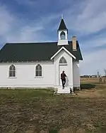 |
Morris (en) | 49.5229 -97.2275 |
15746 | 1940 | Municipal Heritage Site | 2009 | ||
| M | Église anglicane St. Margaret | 
|
Mountain (North) | 112 Willow Avenue | 52.6822 -101.11 |
9025 | 1940 | Municipal Heritage Site | 2004 | |
| P | Église catholique romaine Our Lady of Seven Sorrows | 
|
Mountain (South) | 52.0041 -100.151 |
6266 | 1912 | Provincial Heritage Site | 1991 | ||
| P | Bâtiment de l'Independent Order of Odd Fellows | 
|
Neepawa | 376 Mountain Avenue | 50.2292 -99.4659 |
3966 | 1903 | Provincial Heritage Site | 1995 | |
| M | Cinéma Roxy | 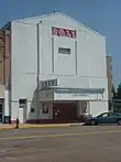 |
Neepawa | 291, rue Hamilton | 50.2286 -99.4649 |
6169 | 1906 | Municipal Heritage Site | 2006 | |
| F | Gare ferroviaire de la Canadien National | 
|
Neepawa | 5th Avenue (at Hamilton Street) | 50.2287 -99.474 |
7886 | 1902 | Heritage Railway Station | 1996 | |
| M | Maison Davidson | 
|
Neepawa | 344 Main Street East | 50.2237 -99.463 |
3172 | 1887 | Municipal Heritage Site | 2000 | |
| M | Maison Drysdale | 
|
Neepawa | SW 35-14-14 WPM - Highway 16 | 50.2245 -99.4686 |
6644 | 1915 | Municipal Heritage Site | 2001 | |
| P | Maison de Margaret Laurence | 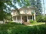 |
Neepawa | 312 First Avenue | 50.2287 -99.4641 |
4235 | 1894 | Provincial Heritage Site | 1987 | |
| F | Palais de justice de Neepawa / Palais de justice du comté de Beautiful Plains | 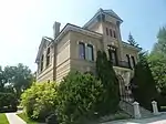 |
Neepawa | 282, rue Hamilton | 50.2284 -99.4655 |
12302 | 1884 | LHN | 1980 | [3] |
| P | Palais de justice du comté de Beautiful Plains | 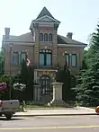 |
Neepawa | 282, rue Hamilton | 50.2283 -99.4645 |
3544 | 1884 | Provincial Heritage Site | 1983 | [4] |
| P | Église presbytérienne Knox | 
|
Neepawa | 396 First Street | 50.2301 -99.4673 |
3491 | 1892 | Provincial Heritage Site | 1989 | |
| M | Église unie et presbytère de Sidney | 
|
North Norfolk | Maple Street | 49.8982 -99.0812 |
4253 | 1898 | Municipal Heritage Site | 2002 | |
| F | Lieu historique national du Canada Norway House | 
|
Norway House | 53.9886 -97.819 |
12041 | 1855 | National Historic Site of Canada | 1932 | ||
| P | Entrepôt à arcade, la prison et les vestiges de la poudrière | 
|
Norway House 17 | 53.9816 -97.8365 |
15866 | 1856 | Provincial Heritage Site | 1984 | ||
| M | Maison Leitch | 
|
Oak Lake | 44 Fourth Avenue | 49.7636 -100.629 |
5372 | 1899 | Municipal Heritage Site | 1987 | |
| M | Église anglicane St. Alban's | 
|
Oak Lake | 174 Assiniboine Street West | 49.7673 -100.622 |
5080 | 1890 | Municipal Heritage Site | 1999 | |
| F | Résidence du personnel, bâtiment B-15 | 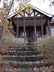 |
Parc national du Mont-Riding | 150, promenade Ta-wa-pit | 50.686 -99.968 |
3459 | 1935 | Recognized Federal Heritage Building | 1988 | |
| M | École Horod | 
|
Park (South) | NE 22-19-21W | 50.652 -100.3 |
3749 | 1909 | Municipal Heritage Site | 1989 | |
| M | Église catholique romaine St. Peter et Paul | 
|
Park (South) | SE 7-19-21 WPM | 50.6178 -100.37 |
4828 | 1917 | Municipal Heritage Site | 1991 | |
| M | Église catholique ukrainienne Assumption of the Blessed Virgin Mary | 
|
Park (South) | 50.7114 -100.439 |
6256 | 1912 | Municipal Heritage Site | 1993 | ||
| M | Église orthodoxe ukrainienne Saint-Pierre-et-Saint-Paul | 
|
Park (South) | 50.6826 -100.485 |
6654 | 1939 | Municipal Heritage Site | 2003 | ||
| M | Église ruthène catholique grecque de l'Ascension | 
|
Park (South) | 50.6387 -100.171 |
6291 | 1940 | Municipal Heritage Site | 1989 | ||
| P | Gare du Canadien Pacifique de La Rivière | 
|
Pembina (en) | 49.2977 -98.6373 |
5797 | 1898 | Provincial Heritage Site | 1994 | ||
| M | Maison Lea | 
|
Pembina (en) | 49.1303 -98.5906 |
5993 | 1890 | Municipal Heritage Site | 1998 | ||
| P | Parc commémoratif de Darlingford | 
|
Pembina (en) | Mountain Avenue | 49.2054 -98.38 |
6731 | 1921 | Provincial Heritage Site | 1991 | |
| M | École de Star Mound | 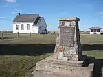 |
Pembina (en) | SE 27-1-10 WPM | 49.0597 -98.7249 |
5844 | 1886 | Municipal Heritage Site | 1995 | |
| M | École regroupée Darlingford | 
|
Pembina (en) | 20 Bradburn Street | 49.205 -98.381 |
3755 | 1910 | Municipal Heritage Site | 1987 | |
| M | Église unie Archibald | 
|
Pembina (en) | 49.2977 -98.6373 |
5833 | 1898 | Municipal Heritage Site | 1998 | ||
| M | École Spurgrave | 
|
Piney | 49.2266 -95.992 |
5115 | 1909 | Municipal Heritage Site | 2002 | ||
| P | Église orthodoxe ukrainienne St-Élie et clocher | 
|
Piney | 49.0153 -96.251 |
7335 | 1909 | Provincial Heritage Site | 2005 | ||
| M | Dépôt de locomotives du Canadien Pacifique de Reston | 
|
Pipestone | 49.5546 -101.097 |
5793 | 1906 | Municipal Heritage Site | 1996 | ||
| M | Maison Berry | 
|
Pipestone | 408 First Avenue | 49.5582 -101.095 |
8228 | 1900 | Municipal Heritage Site | 1999 | |
| M | Maison Mutter | 
|
Pipestone | 116 2nd Avenue | 49.5581 -101.098 |
2724 | 1909 | Municipal Heritage Site | 1997 | |
| P | Édifice municipal Pipestone | 
|
Pipestone | 401 - 3rd Avenue | 49.5591 -101.094 |
5112 | 1917 | Provincial Heritage Site | 1999 | |
| M | Église unie Cromer | 
|
Pipestone | 1st Street W and 1st Avenue | 49.7309 -101.237 |
4827 | 1911 | Municipal Heritage Site | 1992 | |
| M | Bureau de poste de Portage la Prairie | 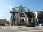 |
Portage la Prairie | 97, avenue Saskatchewan | 49.9725 -98.2864 |
5485 | 1898 | Municipal Heritage Site | 1990 | |
| M | Cimetière de pionniers Macdonald | 
|
Portage la Prairie | 50.0633 -98.4692 |
7754 | Municipal Heritage Site | 1991 | |||
| M | Gare du Canadian Pacific Railway Company de Portage-la-Prairie | 
|
Portage la Prairie | 301 3rd Street NE | 49.5845 -98.1768 |
4506 | 1893 | Municipal Heritage Site | 2004 | |
| F | Gare ferroviaire du Canadien Pacifique | 
|
Portage la Prairie | 301 Pacific Ave (at 3rd St. NE.) | 49.978 -98.286 |
4556 | 1893 | Heritage Railway Station | 1992 | |
| M | Hill's Drug Store | 
|
Portage la Prairie | 200 Saskatchewan Avenue East | 49.58 -98.17 |
16350 | 1901 | Municipal Heritage Site | 2009 | |
| F | Lieu historique national du Canada de l'Édifice-Public-de Portage La Prairie | 
|
Portage la Prairie | 55 Saskatchewan Avenue West | 49.9729 -98.2918 |
7543 | 1898 | National Historic Site of Canada | 1983 | |
| M | Maison McCowan | 
|
Portage la Prairie | 39 2nd Street SW | 49.9697 -98.2934 |
8848 | 1903 | Municipal Heritage Site | 2007 | |
| M | Maison Taylor | 
|
Portage la Prairie | 102 1st Street SW | 49.5811 -98.1735 |
4505 | 1913 | Municipal Heritage Site | 2004 | |
| F | Manège militaire de Portage la Prarie | 
|
Portage la Prairie | 143 Second Street | 49.9761 -98.293 |
9512 | 1913 | Recognized Federal Heritage Building | 1998 | |
| M | Patinoire commémorative de Poplar Point et son district | 
|
Portage la Prairie | 39 Aspen Drive | 50.0317 -97.5839 |
4900 | 1949 | Municipal Heritage Site | 2002 | |
| P | Retranchement Dakota de Flee Island | 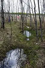 |
Portage la Prairie | 50.06 -98.0904 |
7303 | Provincial Heritage Site | 1954 | |||
| P | Retranchement Dakota de Saint-Ambroise | 
|
Portage la Prairie | 50.13 -98.04 |
7304 | Provincial Heritage Site | 1954 | |||
| F | VIA Rail/Canadien National, gare de | 
|
Portage la Prairie | Fisher Avenue East | 49.977 -98.289 |
15788 | 1908 | Heritage Railway Station | 1992 | |
| P | Édifice des titres fonciers de Portage-la-Prairie | 
|
Portage la Prairie | 103 3rd Street NE | 49.9743 -98.285 |
5848 | 1889 | Provincial Heritage Site | 1996 | |
| P | Église anglicane St. Anne's | 
|
Portage la Prairie | 50.0426 -98.0242 |
5398 | 1864 | Provincial Heritage Site | 1997 | ||
| M | Église anglicane St. Anne's | 
|
Portage la Prairie | 50.0426 -98.0242 |
5399 | 1864 | Municipal Heritage Site | 1996 | ||
| P | Église anglicane St. Mary's la Prairie | 
|
Portage la Prairie | 36 Second Street SW | 49.9726 -98.2934 |
4297 | 1897 | Provincial Heritage Site | 2003 | |
| P | Église anglicane Christ | 
|
Powerview | 50.5923 -96.2737 |
15881 | 1870 | Provincial Heritage Site | 2009 | ||
| M | Maison McKenzie | 
|
Rapid City | 50.1247 -99.9405 |
5054 | 1892 | Municipal Heritage Site | 1990 | ||
| M | Midwinter School | 
|
Reynolds | 49.622 -95.6121 |
6171 | 1917 | Municipal Heritage Site | 1990 | ||
| F | Lieu historique national du Canada Village-de-Neubergthal | 
|
Rhineland | Provincial Road 421 | 49.075 -97.482 |
13161 | 1880 | National Historic Site of Canada | 1989 | |
| M | Maison Hamm | 
|
Rhineland | #68 Road 2 West | 49.0421 -97.286 |
4501 | 1880 | Municipal Heritage Site | 2004 | |
| F | Kiosque à musique (B9) | 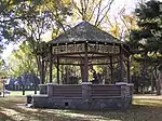 |
Riding Mountain | 50.8833 -100.25 |
4278 | 1935 | Recognized Federal Heritage Building | 1988 | ||
| F | Pavillon du tennis (B-6) | 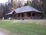 |
Riding Mountain | 50.8833 -100.25 |
4284 | 1935 | Recognized Federal Heritage Building | 1988 | ||
| F | Poste de gardes de parc / résidence no 1, bâtiment B-18 | 
|
Riding Mountain | 50.8833 -100.25 |
4271 | Recognized Federal Heritage Building | 1985 | |||
| F | Bâtiment de l'entrée est | 
|
Riding Mountain National Park | Highway 10 | 50.6833 -99.5554 |
9479 | 1933 | Recognized Federal Heritage Building | 1987 | |
| F | Caserne de pompiers (B3) | 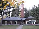 |
Riding Mountain National Park | 126 Tawapit Drive | 50.8833 -100.25 |
9480 | 1936 | Recognized Federal Heritage Building | 1988 | |
| F | Pavillon de golf (B7) | 
|
Riding Mountain National Park / Parc national du Canada du Mont-Riding | 50.8833 -100.25 |
9783 | 1933 | Recognized Federal Heritage Building | 1988 | ||
| F | Centre d'inscription de l'entrée Est du parc du Mont-Riding | 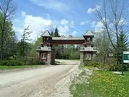 |
Parc national du Mont-Riding | Norgate Road | 50.6833 -99.5554 |
10550 | 1936 | National Historic Site of Canada | 1992 | |
| F | Résidence du directeur et garage-atelier | 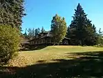 |
Riding Mountain National Park of Canada | 50.6757 -99.9141 |
3457 | 1933 | Recognized Federal Heritage Building | 1985 | ||
| F | Centre d'interprétation B1 | 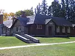 |
Riding Mountain National Park of Canada / Parc national du Canada du Mont-Riding | 50.8833 -100.25 |
14829 | 1933 | Classified Federal Heritage Building | 1988 | ||
| F | Résidence du gardien (B20) | 
|
Riding Mountain National Park of Canada / Parc national du Canada du Mont-Riding | 50.6832 -99.5562 |
11181 | 1934 | Recognized Federal Heritage Building | 1988 | ||
| F | Résidence des gardes du parc de Whirlpool | 
|
Riding Mountain Park East Gate Registration Complex National Historic Site of Canada \ Lieu historique national du Canada du Centre-d'Inscription-de-l'Entree-Est-du-Parc-du-Mont-Riding | 50.6832 -99.5562 |
9918 | 1934 | Recognized Federal Heritage Building | 1988 | ||
| F | Gare du Canadien National | 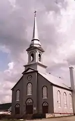 |
Rivers | 50.029 -100.236 |
4324 | 1917 | Heritage Railway Station | 1992 | ||
| M | Église presbytérienne Knox Bellafield | 
|
Riverside (en) | 49.3566 -99.6765 |
5010 | 1906 | Municipal Heritage Site | 1991 | ||
| M | Parc des pionniers de Ledwyn | 
|
Riverton | 55.9762 -97.9403 |
6584 | Municipal Heritage Site | 2003 | |||
| M | Tombe de Betsey Ramsay | 
|
Riverton | 50.9697 -96.9361 |
6581 | Municipal Heritage Site | 1989 | |||
| F | Ancienne gare du Chemin de fer Canadien du Nord | 
|
Roblin | 126 First Avenue | 51.229 -101.352 |
6547 | 1906 | Heritage Railway Station | 1991 | |
| M | Cromarty School | 
|
Roblin | 51.2278 -101.469 |
8457 | 1904 | Municipal Heritage Site | 1999 | ||
| P | Maison Elaschuk | 
|
Roblin | 51.2292 -101.252 |
4172 | 1910 | Provincial Heritage Site | 1988 | ||
| M | Maison Ridgeway et poste d'attente Gunton | 
|
Rockwood | 50.063 -97.4438 |
8802 | 1886 | Municipal Heritage Site | 2006 | ||
| P | École Brant Consolidated | 
|
Rockwood | Government Road Allowance | 50.1829 -97.4484 |
3486 | 1914 | Provincial Heritage Site | 1999 | |
| M | Édifice de la Banque Royale | 
|
Roland | 72-3rd Street | 49.3678 -97.9397 |
5077 | 1902 | Municipal Heritage Site | 1989 | |
| M | Maison Yerex | 
|
Rosedale | SE 1/4 21-15-16 WPM | 50.2904 -99.6065 |
2765 | 1916 | Municipal Heritage Site | 1991 | |
| M | Armstrong Farm Site | 
|
Rossburn (en) | 50.5993 -100.789 |
6257 | 1905 | Municipal Heritage Site | 2005 | ||
| M | Cabane Torsky | 
|
Rossburn (en) | 50.7449 -100.807 |
6158 | 1926 | Municipal Heritage Site | 2005 | ||
| M | Our Lady of the Assumption Roman Catholic Church | 
|
Rossburn (en) | 50.639 -100.554 |
6290 | 1929 | Municipal Heritage Site | 1991 | ||
| M | Tombe collective de pionniers ukrainiens | 
|
Rossburn (en) | 50.6412 -100.594 |
6258 | Municipal Heritage Site | 1990 | |||
| M | École Glen Elmo | 
|
Rossburn (en) | 50.8443 -100.834 |
6916 | 1929 | Municipal Heritage Site | 1996 | ||
| M | École Marconi | 
|
Rossburn (en) | NW 23-20-23 WPM | 50.74 -100.576 |
3750 | 1922 | Municipal Heritage Site | 1990 | |
| M | Église catholique ukrainienne Saint-Pierre-et-Saint-Paul | 
|
Rossburn (en) | 50.6992 -100.676 |
6263 | 1904 | Municipal Heritage Site | 1991 | ||
| M | Église catholique ukrainienne St. Michael's | 
|
Rossburn (en) | 50.6694 -100.555 |
6673 | 1904 | Municipal Heritage Site | 1990 | ||
| M | Église ukrainienne grecque orthodoxe Assumption of St. Mary | 
|
Rossburn (en) | 50.7855 -100.857 |
6491 | 1928 | Municipal Heritage Site | 1991 | ||
| M | Magasin Smellie Bros. et Co. | 
|
Russell | 300 Main Street | 50.2469 -99.8433 |
2715 | 1885 | Municipal Heritage Site | 1996 | |
| F | Bastion sud-ouest | 
|
Selkirk | Highway 9 | 50.112 -96.933 |
4774 | Recognized Federal Heritage Building | 1990 | ||
| F | Entrepôt | 
|
Selkirk | Highway 9 | 50.1123 -96.931 |
3654 | 1838 | Recognized Federal Heritage Building | 1990 | |
| F | Entrepôt de fourrures et magasin | 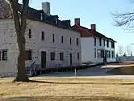 |
Selkirk | Highway 9 | 50.1116 -96.9318 |
14666 | 1831 | Classified Federal Heritage Building | 1990 | |
| F | La grande maison | 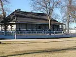 |
Selkirk | Highway 9 | 50.1121 -96.9316 |
11339 | 1832 | Classified Federal Heritage Building | 1990 | |
| F | Lower Fort Garry | .JPG.webp) |
Selkirk | Highway 9 | à géolocaliser | 4224 | 1850 | LHN | 1950 | |
| P | Maison Colcleugh | 
|
Selkirk | 102 Pacific Avenue | 50.1378 -96.8747 |
3972 | 1872 | Provincial Heritage Site | 1993 | |
| M | Maison Stuart | 
|
Selkirk | 478 Eveline Street | 50.1352 -96.8804 |
3312 | 1904 | Municipal Heritage Site | 1997 | |
| F | Maison des hommes | 
|
Selkirk | Highway 9 | 50.1125 -96.9322 |
4792 | Recognized Federal Heritage Building | 1990 | ||
| P | Presbytère de l'église anglicane St. Peter's Dynevor | 
|
Selkirk | 1147 Breezy Point Road | 50.1832 -96.8447 |
8750 | 1865 | Provincial Heritage Site | 1988 | |
| M | Édifice de la Traders Bank | 
|
Selkirk | 389-391 Eveline Street | 50.144 -96.8688 |
5012 | 1907 | Municipal Heritage Site | 1989 | |
| P | Édifice de la poste et des douanes de Selkirk | 
|
Selkirk | 406 Main Street | 50.1441 -96.873 |
5481 | 1909 | Provincial Heritage Site | 1990 | |
| M | Hall de Makaroff | 
|
Shell River | 51.3509 -101.508 |
8455 | 1922 | Municipal Heritage Site | 1999 | ||
| M | Église unie de Tummel | 
|
Shell River | 51.1401 -101.398 |
9441 | 1907 | Municipal Heritage Site | 1993 | ||
| P | Inglis Grain Elevator Row | 
|
Shellmouth-Boulton | Railway Avenue | 50.9442 -101.247 |
4166 | 1941 | Provincial Heritage Site | 1999 | |
| P | Maison Paulencu | 
|
Shellmouth-Boulton | 50.9932 -101.27 |
6435 | 1906 | Provincial Heritage Site | 1993 | ||
| P | [[Église
orthodoxe roumaine St. Elijah]] |

|
Shellmouth-Boulton | SW 24-23-24 W | 50.9932 -101.269 |
3907 | 1908 | Provincial Heritage Site | 1986 | |
| M | Église unie de Shellmouth | 
|
Shellmouth-Boulton | 50.9334 -101.478 |
5371 | 1905 | Municipal Heritage Site | 2000 | ||
| M | Église unie ukrainienne Sts. Peter and Paul | 
|
Shellmouth-Boulton | 51.0075 -101.214 |
6533 | 1930 | Municipal Heritage Site | 1995 | ||
| M | Site funéraire de la famille Thompson | 
|
Shoal Lake | 101 Elizabeth Street | 50.437 -100.599 |
8048 | Municipal Heritage Site | 1988 | ||
| P | Église unie de Griswold | 
|
Sifton | Patterson Street | 49.7261 -100.52 |
4306 | 1896 | Provincial Heritage Site | 1989 | |
| M | Maison ukrainienne du peuple Ivan Franko | 
|
Silver Creek | Wright Avenue | 50.7343 -101.018 |
2910 | 1934 | Municipal Heritage Site | 1992 | |
| M | Édifice municipal d'Angusville | 
|
Silver Creek | 235 Main Street | 50.7343 -101.02 |
8235 | 1938 | Municipal Heritage Site | 2000 | |
| M | Église catholique ukrainienne de Lakedale Holy Ghost | 
|
Silver Creek | 50.7835 -100.974 |
14523 | 1904 | Municipal Heritage Site | 2009 | ||
| M | Église ukrainienne orthodoxe grecque de l'Ascension | 
|
Silver Creek | 50.7349 -101.017 |
9026 | 1935 | Municipal Heritage Site | 2005 | ||
| M | Église luthérienne Frikirkju (Bru) | 
|
Somerset | NE 30-6-12 WPM | 49.5124 -99.0722 |
3902 | 1910 | Municipal Heritage Site | 1997 | |
| M | Bureau de poste de Souris | 
|
Souris | 21 Crescent Avenue | 49.6162 -100.259 |
3201 | 1912 | Municipal Heritage Site | 1991 | |
| M | Maison Dolmage | 
|
Souris | 44-4th Avenue | 49.6188 -100.263 |
13546 | 1890 | Municipal Heritage Site | 1998 | |
| M | Maison F. Sowden | 
|
Souris | 26 Crescent Avenue | 49.6162 -100.256 |
3196 | 1911 | Municipal Heritage Site | 1990 | |
| M | Maison Wright | 
|
Souris | 114 Sowden Street | 49.6179 -100.256 |
2770 | 1896 | Municipal Heritage Site | 1997 | |
| M | Église anglicane St. Luke's | 
|
Souris | 140 First Street South | 49.6162 -100.255 |
8609 | 1883 | Municipal Heritage Site | 1992 | |
| M | École Northfield | 
|
South Cypress | 49.5775 -99.5758 |
5078 | 1933 | Municipal Heritage Site | 1995 | ||
| F | Lieu historique national du Canada de l'Église-Catholique-Ukrainienne-Church of the Immaculate Conception | 
|
Springfield | à géolocaliser | 13013 | 1938 | National Historic Site of Canada | 1996 | ||
| M | Maison Speer | 
|
Springfield | 49.9476 -96.8998 |
5440 | 1882 | Municipal Heritage Site | 1998 | ||
| P | Église ukrainienne catholique Immaculate Conception | 
|
Springfield | 50.0046 -96.7731 |
5391 | 1952 | Provincial Heritage Site | 1986 | ||
| M | Maison Goulet | 
|
St-Pierre-Jolys | 432 Joubert Street | 49.4455 -96.9917 |
4897 | 1870 | Municipal Heritage Site | 1988 | |
| F | Lieu historique national du Canada de l'Église-Anglicane-St. Andrew's | 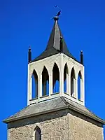 |
St. Andrews | 3 St. Andrews Road | 50.0672 -96.9773 |
4440 | 1849 | National Historic Site of Canada | 1970 | |
| F | Lieu historique national du Canada du Pensionnat-de-Miss Davis / Twin Oaks | 
|
St. Andrews | River Road, Lot 51 | 50.0672 -96.9773 |
12704 | National Historic Site of Canada | 1962 | ||
| F | Lieu historique national du Canada du Presbytère-St. Andrew's | 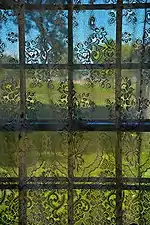 |
St. Andrews | 374 River Road and St. Andrew's Road | 50.0655 -96.9809 |
11805 | 1854 | National Historic Site of Canada | 1962 | |
| P | Maison Captain William Kennedy | 
|
St. Andrews | 417 River Road | 50.0658 -96.9687 |
5442 | 1866 | Provincial Heritage Site | 1985 | |
| P | Maison Cox | 
|
St. Andrews | 7348 Henderson Highway | 50.0608 -96.8921 |
8053 | 1862 | Provincial Heritage Site | 1994 | |
| P | Maison Firth | 
|
St. Andrews | 546 River Road | 50.0771 -96.9515 |
8671 | 1890 | Provincial Heritage Site | 1987 | |
| M | Maison Summerscales | 
|
St. Andrews | 1168 River Road | 50.12 -96.92 |
3368 | 1913 | Municipal Heritage Site | 2001 | |
| P | Église unie Little Britain | 
|
St. Andrews | 5879 PTH No. 9 | 50.1027 -96.9397 |
6646 | 1874 | Provincial Heritage Site | 1989 | |
| P | Église anglicane St. Andrew's on the Red |  |
St. Andrews | 3 St. Andrew's Road | 50.0668 -96.9757 |
5389 | 1849 | Provincial Heritage Site | 1990 | |
| M | Musée Geôle de Saint-Claude | 
|
St. Claude | 5 Provincial Road & 240 N. | 49.6651 -98.3449 |
6429 | 1912 | Municipal Heritage Site | 2005 | |
| P | Ancienne église de pierre St. Peter, Dynevor | 
|
St. Clements | River Lot 212, 8 Stone Church Road | 50.183 -96.8391 |
6940 | 1854 | Provincial Heritage Site | 1963 | |
| P | Maison Bunn | 
|
St. Clements | RL 97 Bunn's Road | 50.1246 -96.8893 |
5387 | 1864 | Provincial Heritage Site | 1992 | |
| M | Église presbytérienne MacKenzie | 
|
St. Clements | 50.1371 -96.8341 |
4252 | 1930 | Municipal Heritage Site | 2002 | ||
| M | Forge Warkentin | 
|
St. Francois Xavier | 2172 PTH 26 | 49.9639 -97.6284 |
2739 | 1931 | Municipal Heritage Site | 1994 | |
| M | Église anglicane St. Paul's | 
|
St. Francois Xavier | 4813 PTH 26 | 50.0498 -97.8369 |
2735 | 1910 | Municipal Heritage Site | 1994 | |
| M | Hôtel de ville de Saint-Laurent | 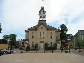 |
St. Laurent | 436 Veterans Memorial Road | 50.4104 -97.9406 |
9403 | 1902 | Municipal Heritage Site | 2002 | |
| M | Pont Piney Road | 
|
Sainte-Anne | Finnigan Road | 49.6608 -96.6363 |
4111 | 1921 | Municipal Heritage Site | 1987 | |
| M | Église catholique Sainte-Anne | 
|
Sainte-Anne | 162 avenue Centrale | 49.6673 -96.6457 |
7651 | 1915 | Municipal Heritage Site | 2006 | |
| M | Église historique de l'Enfant-Jésus | 
|
Sainte-Anne | 49.6001 -96.4 |
10549 | 1913 | Municipal Heritage Site | 2007 | ||
| M | Maison Friesen | 
|
Steinbach | 255 Hanover Street | 49.5277 -96.6856 |
5436 | 1916 | Municipal Heritage Site | 2004 | |
| M | Hôtel de ville de Stonewall | 
|
Stonewall | 293 Main Street | 50.1362 -97.3268 |
3212 | 1913 | Municipal Heritage Site | 1993 | |
| M | Maison Orange Clark | 
|
Stonewall | 214 Second Street West | 50.1345 -97.3297 |
4606 | 1918 | Municipal Heritage Site | 1994 | |
| M | Tour de ferme Langtry Fox | 
|
Stonewall | 135 Sturgeon Road | 50.1353 -97.2736 |
4262 | 1920 | Municipal Heritage Site | 2002 | |
| P | Édifice de la poste de Stonewall | 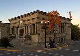 |
Stonewall | 357 Main Street | 50.14 -96.88 |
3488 | 1915 | Provincial Heritage Site | 1989 | |
| P | Église anglicane All Saints Victoria | 
|
Stonewall | 50.1968 -97.2585 |
6643 | 1877 | Provincial Heritage Site | 1997 | ||
| F | Édifice administratif A1 | 
|
Stony Mountain | Highway 7 & Highway 31, PO Box 4500 | 50.078 -97.221 |
1193 | 1947 | Recognized Federal Heritage Building | 2002 | |
| M | Kiosque à musique de la société agricole de Strathclair | 
|
Strathclair | 50.4015 -100.393 |
14522 | 1900 | Municipal Heritage Site | 2008 | ||
| M | Musée Strathclair | 
|
Strathclair | 33 Main Street | 50.4015 -100.393 |
4108 | 1900 | Municipal Heritage Site | 2003 | |
| M | Ukrainian Greek Orthodox Church of the Holy Transfiguration | 
|
Strathclair | 50.5499 -100.46 |
6936 | 1924 | Municipal Heritage Site | 1990 | ||
| P | Église catholique ukrainienne St. John the Baptist | 
|
Strathclair | NW 2-19-22 WPM | 50.6026 -100.433 |
4603 | 1907 | Provincial Heritage Site | 1992 | |
| M | Église unie - Hilton | 
|
Strathcona | 2nd Street | 49.5058 -99.5239 |
5479 | 1952 | Municipal Heritage Site | 1996 | |
| F | Lieu historique national du Canada de l'Église-Ukrainienne-St. Michael | 
|
Stuartburn | 49.0771 -96.6938 |
12762 | 1899 | National Historic Site of Canada | 1987 | ||
| P | Nouvelle église orthodoxe ukrainienne St-Élie et clocher | 
|
Stuartburn | 49.0157 -96.2505 |
8389 | 1950 | Provincial Heritage Site | 2005 | ||
| M | Pont à poutre triangulée en bois de Gardenton | 
|
Stuartburn | 49.0878 -96.6856 |
6816 | 1918 | Municipal Heritage Site | 2002 | ||
| M | Église orthodoxe ukrainienne Saint-Pierre-et-Saint-Paul | 
|
Stuartburn | PR 201 and Sundown Road North | 49.1186 -96.7883 |
14528 | 1940 | Municipal Heritage Site | 2009 | |
| P | Église ukrainienne orthodoxe grecque St. Michael's | 
|
Stuartburn | NW 28-1-6E | 49.071 -96.74 |
3762 | 1899 | Provincial Heritage Site | 1986 | |
| M | Maison Harley | 
|
Swan River | 515 2nd Street North | 52.1056 -101.265 |
16348 | 1901 | Municipal Heritage Site | 2008 | |
| M | Édifice de bureau d'avocats | 
|
Swan River | 510 Main Street | 52.1056 -101.27 |
8395 | 1910 | Municipal Heritage Site | 1990 | |
| M | Site historique Monseigneur Taché | 
|
Tache | Main Street North | 49.745 -96.5254 |
4110 | 1918 | Municipal Heritage Site | 1989 | |
| M | Ferme Nordin | 
|
Teulon (en) | NE 28-16-1 E | 50.4025 -97.3934 |
3996 | 1926 | Municipal Heritage Site | 1998 | |
| M | Maison Grahame | 
|
Teulon (en) | 40 Second Street SE | 50.3824 -97.2576 |
8720 | 1919 | Municipal Heritage Site | 2007 | |
| M | Maison du Dr. Hunter | 
|
Teulon (en) | Green Acres Park | 50.378 -97.262 |
3352 | 1905 | Municipal Heritage Site | 2000 | |
| M | Église anglicane All Saints | 
|
Teulon (en) | 50.3891 -97.576 |
6672 | 1884 | Municipal Heritage Site | 2001 | ||
| F | VIA Rail/Canadien National, gare de | 
|
The Pas | 380 Hazlewood Ave. | 53.824 -101.248 |
4547 | 1928 | Heritage Railway Station | 1992 | |
| M | Ancienne gare de la Northern Pacific and Manitoba Railway Station à Miami | 
|
Thompson | Highway 23 | 49.3555 -98.3999 |
11117 | 1889 | Municipal Heritage Site | 2008 | |
| M | Site de l'école Opawaka | 
|
Thompson | 49.311 -98.3419 |
7362 | Municipal Heritage Site | 1998 | |||
| M | Église unie de Treherne | 
|
Treherne | 186 Boyne Street | 49.628 -98.6972 |
6735 | 1908 | Municipal Heritage Site | 1988 | |
| M | Chambre forte de la banque de Toronto | 
|
Killarney-Turtle Mountain | 49.1397 -99.4844 |
6755 | 1919 | Municipal Heritage Site | 2005 | ||
| M | Église anglicane St. George's | 
|
Killarney-Turtle Mountain | 49.1354 -99.4861 |
5333 | 1908 | Municipal Heritage Site | 2002 | ||
| M | Église presbytérienne de Ninga | 
|
Killarney-Turtle Mountain | Glengarry Street and Glenco Avenue | 49.2264 -99.8877 |
6901 | 1906 | Municipal Heritage Site | 2004 | |
| P | Site archéologique de lac Wanipigow | 
|
Unorganized | , Division No. 19 | 51.0778 -95.9083 |
8980 | Provincial Heritage Site | 1980 | ||
| M | Maison Mahon | 
|
Victoria | 49.595 -98.9806 |
6480 | 1916 | Municipal Heritage Site | 2003 | ||
| M | Maison Young | 
|
Victoria | SW 27-7-12 W | 49.5924 -99.0239 |
5773 | 1900 | Municipal Heritage Site | 1997 | |
| F | Ancienne gare ferroviaire du Canadien Pacifique | 
|
Virden | 425-6th Avenue S. | 49.851 -100.929 |
6499 | 1900 | Heritage Railway Station | 1990 | |
| P | Gare du Canadien Pacifique de Virden | 
|
Virden | 425-6th Avenue South | 49.8481 -100.927 |
5397 | 1900 | Provincial Heritage Site | 1994 | |
| M | Maison Frame | 
|
Virden | 390 King Street | 49.8453 -100.932 |
5396 | 1888 | Municipal Heritage Site | 1991 | |
| M | Pharmacie et boulangerie McDonald | 
|
Virden | 237 Nelson Street West | 49.8479 -100.93 |
10982 | 1893 | Municipal Heritage Site | 2008 | |
| P | Édifice municipal et auditorium de Virden | 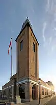 |
Virden | 228, rue Wellington | 49.8489 -100.934 |
5401 | 1912 | Provincial Heritage Site | 1986 | |
| M | Église anglicane de l'Advent de Kola | 
|
Wallace | 49.8398 -101.281 |
5361 | 1884 | Municipal Heritage Site | 1993 | ||
| F | Casa Loma, bâtiment (A2) | 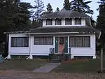 |
Wasagaming | 154, promenade Wasagaming | 50.8833 -100.25 |
4280 | 1929 | Recognized Federal Heritage Building | 1988 | |
| F | Chalet de Grey Owl (B21) | 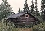 |
Wasagaming | 50.686 -99.968 |
9915 | 1931 | Recognized Federal Heritage Building | 1988 | ||
| F | Chalet de l’Aviation royale du Canada (B16) | 
|
Wasagaming | 50.8833 -100.25 |
9917 | 1934 | Recognized Federal Heritage Building | 1988 | ||
| F | Pavillon Jamboree, bâtiment B-10 | 
|
Wasagaming | 50.8833 -100.25 |
4282 | 1933 | Recognized Federal Heritage Building | 1988 | ||
| F | Résidence du comptable | 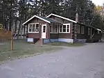 |
Wasagaming | 154, rue Columbine | 50.8833 -100.25 |
4276 | 1927 | Recognized Federal Heritage Building | 1988 | |
| F | Résidence du directeur du parc | 
|
Wasagaming | 50.686 -99.968 |
3456 | 1932 | Recognized Federal Heritage Building | 1985 | ||
| F | Résidence et clinique des médecins (C5) | 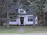 |
Wasagaming | 140 Ta-wa-pit Drive | 50.8833 -100.25 |
9483 | 1948 | Recognized Federal Heritage Building | 1988 | |
| F | Édifice administratif du parc |  |
Wasagaming | 50.9851 -100.063 |
2888 | 1956 | Recognized Federal Heritage Building | 2002 | ||
| M | Forge Amos | 
|
Waskada | 101 Second Street | 49.0972 -100.802 |
8052 | 1927 | Municipal Heritage Site | 1999 | |
| M | Édifice de la Compagnie mutuelle d'assurance Wawanesa | 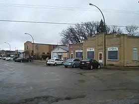 |
Wawanesa | 102 - 4th Street | 49.594 -99.6844 |
4234 | 1901 | Municipal Heritage Site | 1991 | |
| P | Édifice de la compagnie mutuelle d'assurance Wawanesa | 
|
Wawanesa | 102-4th Street | 49.594 -99.684 |
15282 | 1901 | Provincial Heritage Site | 2008 | |
| P | Église anglicane St. John the Divine | 
|
Wawanesa | 102 - 4th Street | 49.6689 -99.7973 |
4266 | 1906 | Provincial Heritage Site | 1991 | |
| M | Hôtel de ville de West St. Paul |  |
West St. Paul | 3550 Main Street | 49.9837 -97.0642 |
4605 | 1917 | Municipal Heritage Site | 1989 | |
| M | Grange Reeves | 
|
Whitehead | 49.902 -100.36 |
8664 | 1905 | Municipal Heritage Site | 1990 | ||
| M | Salle de billard et résidence d'Elma | 
|
Whitemouth | 67159 Railway Avenue (Highway 15) | 49.8695 -95.9091 |
7706 | 1900 | Municipal Heritage Site | 2005 | |
| M | Grange Graham | 
|
Whitewater | 49.3789 -100.041 |
3910 | 1898 | Municipal Heritage Site | 2001 | ||
| M | Parc Riverside | 
|
Whitewater | 49.5012 -99.9921 |
8049 | Municipal Heritage Site | 1991 | |||
| M | École Riverside | 
|
Whitewater | 49.4704 -99.9901 |
4831 | 1883 | Municipal Heritage Site | 1998 | ||
| M | Édifice de la banque canadienne impériale de commerce d'Elgin | 
|
Whitewater | 131 Main Street | 49.4442 -100.271 |
5055 | 1904 | Municipal Heritage Site | 1998 | |
| P | Château d'eau du chemin de fer Pacifique Canadien à Winnipeg Beach | 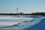 |
Winnipeg Beach | Stephenson's Point | 50.4965 -96.963 |
6815 | 1928 | Provincial Heritage Site | 1998 | |
| M | Ukrainian Catholic Church of the Immaculate Conception | 
|
Winnipegosis | 51.64 -99.9354 |
6674 | 1929 | Municipal Heritage Site | 1988 | ||
| M | École South Bay | 
|
Winnipegosis | 51.6831 -100.051 |
6170 | 1929 | Municipal Heritage Site | 1995 | ||
| M | Maison Balfour | 
|
Woodlands | 50.1553 -97.5525 |
6163 | 1900 | Municipal Heritage Site | 2001 | ||
| M | Maison Robertson | 
|
Woodlands | 50.0754 -97.7985 |
4880 | 1911 | Municipal Heritage Site | 2001 | ||
| M | École et résidence pour instituteurs d'Erinside | 
|
Woodlands | 50.3743 -97.4848 |
6173 | 1914 | Municipal Heritage Site | 2001 | ||
| M | Maison Carpentier | 
|
Woodworth | 49.8061 -100.549 |
5122 | 1907 | Municipal Heritage Site | 1989 | ||
| F | Dépôt (York Factory) | 
|
York Factory | 57.0437 -92.248 |
2969 | 1838 | Classified Federal Heritage Building | 1989 | ||
| F | Lieu historique national du Canada York Factory | 
|
York Factory | PO Box 127 | 57.0449 -92.2485 |
4481 | 1850 | National Historic Site of Canada | 1936 |
Références
- Niveau de la désignation: F: Fédéral, P: Provincial, M: Municipal
- (fr) Répertoire canadien des lieux patrimoniaux : Manuel de normes de documentation, Annexe A : Vocabulaires contrôlés, p.59-78
(en) Canadian Register of Historic Places: Documentation Standards Handbook, Appendix A: Controlled Vocabulary, p.57-75 - Reconnu site du patrimoine provincial en 1983 (Palais de justice du comté de Beautiful Plains)
- Désigné lieu historique national en 1980 (Palais de justice de Neepawa / Palais de justice du comté de Beautiful Plains)
Annexes
Articles connexes
Liens externes
- « Lieux patrimoniaux du Canada »
- « Annuaire des désignations patrimoniales fédérales », sur Parcs Canada
- « Sites provinciaux du patrimoine - Par nom de site », sur Ministère de la Culture, du Patrimoine et du Tourisme
- « Sites municipaux du patrimoine », sur Ministère de la Culture, du Patrimoine et du Tourisme
Cet article est issu de wikipedia. Text licence: CC BY-SA 4.0, Des conditions supplémentaires peuvent s’appliquer aux fichiers multimédias.