Falkirk (council area)
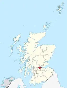
Le Falkirk est l'une des 32 divisions administratives de l'Écosse (en anglais : council area). Il est limitrophe au nord de Stirling ; au sud de North Lanarkshire et West Lothian. Il fait partie de la région de lieutenance de Stirling and Falkirk.
| Falkirk | |
| |
| Administration | |
|---|---|
| Pays | |
| Capitale administrative | Falkirk |
| ISO 3166-2 | GB-FAL |
| Code ONS | 00QQ |
| Démographie | |
| Population | 153 300 hab. (2010) |
| Densité | 516 hab./km2 |
| Rang | 11e |
| Géographie | |
| Superficie | 29 700 ha = 297 km2 |
| Rang | 22e |
| Sources | |
| Falkirk Council http://www.falkirk.gov.uk/ |
|
Villes et villages
- Airth
- Allandale
- Avonbridge
- Bainsford
- Banknock
- Blackness
- Bo'ness
- Bonnybridge
- Brightons
- California
- Camelon
- Carron
- Carronshore
- Denny
- Dennyloanhead
- Dunipace
- Dunmore
- Falkirk (town)
- Grangemouth
- Haggs
- Hallglen/Glen Village
- Larbert
- Laurieston
- Letham
- Limerigg
- Longcroft
- Maddiston
- Polmont
- Redding
- Reddingmuirhead
- Rumford
- Shieldhill
- Skinflats
- Slamannan
- Standburn
- Stenhousemuir
- Tamfourhill
- Torwood
- Wallacestone
- Westquarter
- Whitecross
- Woodlands
Article connexe
Cet article est issu de wikipedia. Text licence: CC BY-SA 4.0, Des conditions supplémentaires peuvent s’appliquer aux fichiers multimédias.