Bielany (gmina)
Bielany est une gmina rurale du powiat de Sokołów, Mazovie, dans le centre-est de la Pologne.
| Gmina Bielany | ||||
| Administration | ||||
|---|---|---|---|---|
| Pays | ||||
| Voïvodie (Région) |
Mazovie | |||
| Powiat (District) |
Sokołów | |||
| Plaque d'immatriculation | WSK | |||
| Démographie | ||||
| Population | 3 854 hab. (2006) | |||
| Densité | 35 hab./km2 | |||
| Géographie | ||||
| Coordonnées | 52° 20′ 30″ nord, 22° 14′ 45″ est | |||
| Superficie | 10 960 ha = 109,6 km2 | |||
| Localisation | ||||
| Géolocalisation sur la carte : Voïvodie de Mazovie
Géolocalisation sur la carte : Voïvodie de Mazovie
Géolocalisation sur la carte : Pologne
| ||||
| Liens | ||||
| Site web | www.gminabielany.pl/ | |||
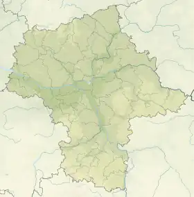
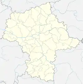
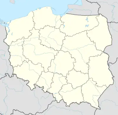
Son siège administratif (chef-lieu) est le village de Bielany, qui se situe environ 8 km au sud de Sokołów Podlaski (siège de la powiat) et 86 km à l'est de Varsovie (capitale de la Pologne).
La gmina couvre une superficie de 109,6 km2 pour une population de 3 854 habitants[1] en 2006.
Géographie
La gmina de Bielany inclut les villages et localités de :
_location_map.png.webp)
Plan de la gmina
- Bielany
- Bielany-Jarosławy
- Bielany-Wąsy
- Błonie Duże
- Błonie Małe
- Brodacze
- Dmochy-Rętki
- Dmochy-Rogale
- Korabie
- Kowiesy
- Kożuchów
- Kożuchówek
- Księżopole-Budki
- Księżopole-Komory
- Kudelczyn
- Paczuski Duże
- Patrykozy
- Patrykozy-Kolonia
- Rozbity Kamień
- Ruciany
- Ruda-Kolonia
- Sikory
- Trebień
- Wańtuchy
- Wiechetki Duże
- Wiechetki Małe
- Wojewódki Dolne
- Wojewódki Górne
- Wyszomierz
Gminy voisines
La gmina de Bielany est voisine des gminy suivantes :
Structure du terrain
D'après les données de 2002, la superficie de la commune de Kosów Lacki est de 109,6 km2, répartis comme telle :
- terres agricoles : 78 %
- forêts : 17 %
La commune représente 9,69 % de la superficie du powiat.
Démographie
Données du :
| Description | Total | Femmes | Hommes | |||
|---|---|---|---|---|---|---|
| Unité | Nombre | % | Nombre | % | Nombre | % |
| Population | 3 919 | 100 | 1 927 | 49,2 | 1 992 | 50,8 |
| Densité (hab./km²) | 35,8 | 17,6 | 18,2 | |||
Annexes
Liens internes
Références
- (en) « Area and Population in the Territorial Profile in 2012 », Głowny Urząd Statystyczny
Liens externes
Cet article est issu de wikipedia. Text licence: CC BY-SA 4.0, Des conditions supplémentaires peuvent s’appliquer aux fichiers multimédias.