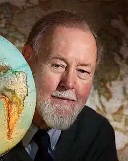
Roger Tomlinson
Roger F. Tomlinson (né le à Cambridge, mort le ) est un géographe britannique, à l'origine du concept de système d'information géographique[1].
Roger Tomlinson

| Naissance | |
|---|---|
| Décès | |
| Nationalité | |
| Domicile | |
| Formation | |
| Activité |
| A travaillé pour | |
|---|---|
| Distinctions |
Il s'est établi au Canada en 1957[1].
Il a reçu la Médaille d'or de la Société géographique royale du Canada pour son rôle dans la mise au point des systèmes d’information géographique. Il est reconnu comme étant le « père des SIG »[2] - [3].
Ouvrages
- The application of electronic computing methods and techniques to the storage, compilation, and assessment of mapped data. (thèse).
- 1968 : A Geographic Information System for Regional Planning (Un système d’information géographique pour l’aménagement du territoire)[4].
- 1976 : Computer handling of geographical data: an examination of selected geographic information systems, Roger F. Tomlinson, H. W. Calkins, Duane Francis Marble
- 1977 : Geographic Information Systems, Methods and Equipment for Land Use Planning, Hugh W. Calkins, Roger F. Tomlinson,
- 2007 : Thinking about GIS: Geographic Information System Planning for Managers, (ISBN 9781589481589)
Notes et références
- « Roger Tomlinson », sur urisa.org
- « Scientist profile: Roger Tomlinsons », sur science.ça
- (en) « Reflecting on Dr. Roger Tomlinsons contributions to gis », sur eijournal.com
- « The 50th Anniversary of GIS », ESRI (consulté le )
Liens externes
- Notice dans un dictionnaire ou une encyclopédie généraliste :
- (en) https://www.theglobeandmail.com/technology/science/roger-tomlinson-the-father-of-computerized-cartography/article17185506/
- http://global.britannica.com/biography/Roger-Tomlinson
Cet article est issu de wikipedia. Text licence: CC BY-SA 4.0, Des conditions supplémentaires peuvent s’appliquer aux fichiers multimédias.