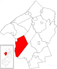
Kingwood Township
Kingwood Township est un township américain situé dans le comté de Hunterdon au New Jersey.

| Pays | |
|---|---|
| État | |
| Comté | |
| Superficie |
92,65 km2 |
| Altitude |
143 m |
| Coordonnées |
40° 29′ 41″ N, 75° 01′ 10″ O |
| Population |
3 802 hab. () |
|---|---|
| Nombre de ménages |
1 525 () |
| Densité |
41 hab./km2 () |
| Statut |
|---|
| Fondation |
|---|
| Code FIPS |
34-37065 |
|---|---|
| GNIS | |
| Site web |
(en) kingwoodtownship.com |

Géographie
Kingwood Township comprend les localités de Baptistown, Barbertown, Byram, Idell Milltown, Kingwood, Milltown, Treasure Island, Tumble et Tumble Falls[1]. Il est bordé par le Delaware et comprend plusieurs îles situées sur ce fleuve entre Frenchtown et Tumble Falls[2].
La municipalité s'étend sur 35,77 milles carrés (92,64 km2) dont 0,62 mille carré (1,61 km2) d'étendues d'eau[3].

Histoire
Le township de Kingwood est formé en 1749 à partir du township de Bethlehem. Il est officiellement constitué le . En 1845, après référendum, une partie de son territoire se détache pour former le township de Franklin. En 1876, c'est au tour de la ville de Frenchtown de devenir un borough indépendant[4].
Démographie
| Historique des recensements | |||
| Ann. | Pop. | %± | |
|---|---|---|---|
| 1810 | 2 606 | — | |
| 1820 | 2 786 | ▲ +6,91 % | |
| 1830 | 2 898 | ▲ +4,02 % | |
| 1840 | 2 947 | ▲ +1,69 % | |
| 1850 | 1 799 | ▼ −38,95 % | |
| 1860 | 2 148 | ▲ +19,4 % | |
| 1870 | 1 942 | ▼ −9,59 % | |
| 1880 | 1 694 | ▼ −12,77 % | |
| 1890 | 1 424 | ▼ −15,94 % | |
| 1900 | 1 304 | ▼ −8,43 % | |
| 1910 | 1 265 | ▼ −2,99 % | |
| 1920 | 1 160 | ▼ −8,3 % | |
| 1930 | 1 218 | ▲ +5 % | |
| 1940 | 1 253 | ▲ +2,87 % | |
| 1950 | 1 320 | ▲ +5,35 % | |
| 1960 | 1 841 | ▲ +39,47 % | |
| 1970 | 2 294 | ▲ +24,61 % | |
| 1980 | 2 772 | ▲ +20,84 % | |
| 1990 | 3 325 | ▲ +19,95 % | |
| 2000 | 3 782 | ▲ +13,74 % | |
| 2010 | 3 845 | ▲ +1,67 % | |
| Est. 2016 | 3 746 | ▼ −2,57 % | |
Lors du recensement de 2010, la population de Kingwood Township est de 3 845 habitants[3].
Notes et références
- (en) « New Jersey Locality Search », sur state.nj.us (consulté le ).
- (en) Barbara Alexander Farnham, « Kingwood History - Excerpt from "Kingwood Township of Yesteryear" », sur kingwoodtownship.com (consulté le ).
- (en) Bureau du recensement des États-Unis, « Population, Housing Units, Area, and Density: 2010 - State -- Place and (in selected states) County Subdivision 2010 Census Summary File 1 », sur factfinder.census.gov (consulté le ).
- (en) John P. Snyder, The Story of New Jersey's Civil Boundaries: 1606-1968, Trenton, Bureau of Geology and Topography, (lire en ligne), p. 1856.
Voir aussi
Article connexe
Liens externes
- Ressource relative à la géographie :