Jarisha
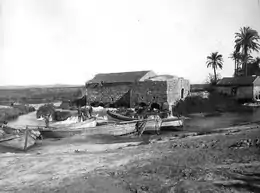
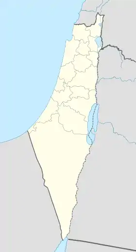
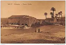
Jarisha (en arabe : جرِيشة, également translittéré Jerisha ; en hébreu : ג'רישה) était un village arabe palestinien situé à 200 m de l'ancien site de Tell Jarisha (Tel Gerisa), sur la rive sud d'Al-Awja (le fleuve Yarkon)[1] - [2]. Après la création de Tel-Aviv, c'est l'un des cinq villages arabes absorbés dans ses limites municipales[3]. Jarisha est dépeuplé à la veille de la guerre israélo-arabe de 1948, et le site est depuis « complètement recouvert par des voies express et un habitat périurbain »[2].

| Nom local |
(ar) جريشة |
|---|
| Pays | |
|---|---|
| Sous-district | |
| Superficie |
0,56 km2 |
| Coordonnées |
32° 05′ 43″ N, 34° 48′ 28″ E |
| Population |
190 hab. () |
|---|---|
| Densité |
342,3 hab./km2 () |
| Statut |
Localité disparue (d) |
|---|
 |

Histoire
Jarisha est situé à seulement 200 m de Tel Gerisa, un site archéologique datant de âge du bronze ancien (2800-2600 av. J.-C.). Durant le bronze moyen (2000-1500 av. J.-C.), le site est une localité fortifiée Hyksôs. Une colonie philistine lui succède vers le 12e siècle av. J-C[4].
Période ottomane
Les archives fiscales ottomanes de 1596 indiquent que le village est situé dans le nahiya ("sous-district") de Bani Sa'b, qui fait partie du Sandjak de Naplouse. Il compte 22 ménages musulmans ; soit environ 121 personnes. Ils payent des taxes sur les buffles, les chèvres et les ruches ; un total de 2 150 akçe[5].
En 1882, une enquête du Palestine Exploration Fund indique que le village, dont le nom est transcrit sous la forme « Jerisheh » est construit en briques d'adobe. Il est flanqué d'une oliveraie. Il possède un puits et un moulin[6]. Au sud-est du village se trouvent les vestiges d'un caravansérail, un cimetière et de quelques grottes, ainsi qu'un barrage en maçonnerie et un petit pont[7].
Période du mandat britannique
D'après le recensement de Palestine de 1922 effectué par les autorités du Mandat britannique, Jerisheh compte 57 habitants, tous musulmans[8], chiffre porté en 1931 à 183, toujours tous musulmans, se répartissant dans un total de 43 maisons[9].
Les statistiques de 1945 signalent que Jarisha compte 190 musulmans[10] - [11]. Le finage du village a une superficie de et 555 dounams. Les villageois travaillent dans le secteur des services, mais certains pratiquent l'arboriculture fruitière et le maraichage. En 1944-1945, les bananeraies et les plantations d'agrumes occupent 302 dounams de terres, 89 dounams sont irrigués ou plantés de vergers[12].
1948 et suites
Selon l'historien palestinien Walid Khalidi, l'état du site du village en 1992 était le suivant : « Le site a été complètement recouvert par les voies expess et un habitat de banlieue. »[13]
Références
- (en) Cet article est partiellement ou en totalité issu de l’article de Wikipédia en anglais intitulé « Jarisha » (voir la liste des auteurs).
- Ben-Tor and Greenberg, 1992, p. 246.
- Khalidi and Elmusa, 1992, p. 246.
- Mann, 2006, p. 246.
- Khalidi, 1992, p. 246
- Hütteroth and Abdulfattah, 1977, p. 139; cited in Khalidi, 1992, p. 246
- Conder and Kitchener, 1882, SWP II, p. 251. Cité dans Khalidi, 1992, p.246
- Conder and Kitchener, 1882, SWP II, p. 265
- Barron, 1923, Table VII, Sub-district of Jaffa, p. 20
- Mills, 1932, p. 14
- Government of Palestine, Department of Statistics. Village Statistics, avril 1945. Cité dans Hadawi, 1970, p. 52
- Department of Statistics, 1945, p. 27
- Government of Palestine, Department of Statistics. Village Statistics, avril 1945. Cité dans Hadawi, 1970, p. 95 Also in Khalidi, 1992, p.246-247
- Khalidi, 1992, p. 247
Bibliographie
- Amnon Ben-Tor et R. Greenberg, The archaeology of ancient Israel,
- Palestine: Report and General Abstracts of the Census of 1922, Government of Palestine, (lire en ligne)
- C.R. Conder et H.H. Kitchener, The Survey of Western Palestine : Memoirs of the Topography, Orography, Hydrography, and Archaeology, vol. 2, Londres, Committee of the Palestine Exploration Fund, (lire en ligne)
- Department of Statistics, Village Statistics, avril 1945, Government of Palestine, (lire en ligne)
- S. Hadawi, Village Statistics of 1945 : A Classification of Land and Area ownership in Palestine, Palestine Liberation Organization Research Center, (lire en ligne)
- (en) Wolf-Dieter Hütteroth et Kamal Abdulfattah, Historical Geography of Palestine, Transjordan and Southern Syria in the Late 16th Century, Erlangue, Erlanger Geographische Arbeiten, Sonderband 5. Erlangen, Germany: Vorstand der Fränkischen Geographischen Gesellschaft, , 225 p. (ISBN 3-920405-41-2, lire en ligne)
- (en) W. Khalidi, All that remains : the Palestinian villages occupied and depopulated by Israel in 1948, Washington, Institute for Palestine Studies, , 636 p. (ISBN 0-88728-224-5, lire en ligne)
- Barbara E. Mann, A Place in History : Modernism, Tel Aviv, and the Creation of Jewish Urban Space, Stanford University Press, , 310 p. (ISBN 978-0-8047-5019-6, lire en ligne)
- Census of Palestine 1931. Population of Villages, Towns and Administrative Areas, Jerusalem, Government of Palestine, (lire en ligne)
- B. Morris, The Birth of the Palestinian Refugee Problem Revisited, Cambridge University Press, (ISBN 0-521-00967-7, lire en ligne)
- E.H. Palmer, The Survey of Western Palestine : Arabic and English Name Lists Collected During the Survey by Lieutenants Conder and Kitchener, R. E. Transliterated and Explained by E.H. Palmer, Committee of the Palestine Exploration Fund, (lire en ligne)
Liens externes
- Welcome to Jarisha
- Jarisha, Zochrot
- Jarisha, Khalil Sakakini Cultural Center
- Survey of Western Palestine, Map 13: IAA, Wikimedia commons