Imathie
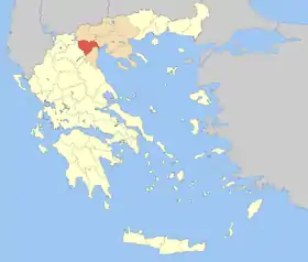
Le nome d’Imathie (en grec : νομός Ημαθίας), ou d’Émathie, est un nome de la périphérie de Macédoine-Centrale.
| Nome d’Imathie Νομός Ημαθίας | |

| |
| Administration | |
|---|---|
| Pays | |
| Périphérie | Macédoine-Centrale |
| Chef-lieu | Béroia |
| Code postal | 59x xx |
| Code d’immatriculation | ΗΜ |
| Code ISO 3166-2 | GR-53 |
| Démographie | |
| Population | 144 835 hab. (2005) |
| Densité | 85 hab./km2 |
| Géographie | |
| Superficie | 170 100 ha = 1 701 km2 |
| Rangs / 54 Nomes | |
| Superficie | 39e |
| Population | 24e |
| Densité | 11e |
| Liens | |
| Site web | www.imathia.gr |
Sa capitale est la ville de Véria, qui compte 25 000 habitants (2005).
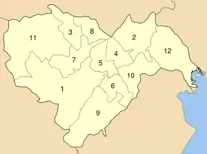
Municipalités

Les municipalités du nome d’Imathie
| Dème | YPES code | Chef-lieu (si nom différent) | Code postal | Préfixe tel. |
|---|---|---|---|---|
| Alexándria | 1801 | - | 593 00 | 23330-2 |
| Anthémia | 1802 | Kopanos | 590 35 | 23320-41 |
| Antigonídes | 1803 | Kavasila | 591 00 | 23310-39 |
| Apóstolos Pávlos | 1804 | Makrochóri (el) | 590 33 | 23310-41 |
| Dovrás | 1807 | Ágios Geórgios (el) | 591 00 | 23310-51 |
| Irinoúpoli | 1808 | - | 590 34 | 23320-4 |
| Makedonída | 1809 | Rizómata (el) | 591 00 | 23310-9 |
| Melíki | 1810 | - | 590 31 | 23310-81 |
| Náoussa | 1811 | - | 592 00 | 23320-2 |
| Platý | 1812 | - | 590 32 | 2330-63 |
| Vergína | 1805 | - | 590 31 | 23310-92 |
| Véria | 1806 | - | 591 00 | 23310 |
Cet article est issu de wikipedia. Text licence: CC BY-SA 4.0, Des conditions supplémentaires peuvent s’appliquer aux fichiers multimédias.