Drużbice (gmina)
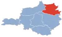
Drużbice est une gmina rurale (gmina wiejska) du powiat de Bełchatów, dans la Voïvodie de Łódź, dans le centre de la Pologne.
| Gmina Drużbice | ||||
 Héraldique |
 Drapeau |
|||
| Administration | ||||
|---|---|---|---|---|
| Pays | ||||
| Voïvodie (Région) |
Łódź | |||
| Powiat (District) |
Bełchatów | |||
| Siège | Drużbice | |||
| Plaque d'immatriculation | EBE | |||
| Démographie | ||||
| Population | 4 934 hab. (2007) | |||
| Densité | 44 hab./km2 | |||
| Géographie | ||||
| Coordonnées | 51° 28′ 00″ nord, 19° 24′ 00″ est | |||
| Superficie | 11 333 ha = 113,33 km2 | |||
| Localisation | ||||
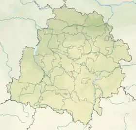
| Géolocalisation sur la carte : Voïvodie de Łódź
Géolocalisation sur la carte : Voïvodie de Łódź
Géolocalisation sur la carte : Pologne
| ||||
| Liens | ||||
| Site web | www.druzbice.pl | |||
Son siège administratif (chef-lieu) est le village de Drużbice, qui se situe à environ 12 kilomètres au nord de Bełchatów (siège du powiat) et 36 kilomètres au sud de Łódź (capitale de la voïvodie).
La gmina couvre une superficie de 113,33 km2 pour une population de 4 934 habitants[1] en 2007.
Histoire
De 1975 à 1998, la gmina est attachée administrativement à la voïvodie de Piotrków.
Depuis 1999, elle fait partie de la voïvodie de Łódź.
Géographie
La gmina inclut les villages et localités de :

- Brzezie
- Bukowie Dolne
- Bukowie Górne,
- Chynów
- Depszczyk
- Drużbice
- Drużbice-Kolonia
- Gadki
- Głupice
- Głupice-Parcela
- Gręboszów
- Helenów
- Hucisko
- Janówek
- Józefów
- Kącik
- Katarzynka
- Kazimierzów
- Kobyłki
- Łazy
- Łęczyca
- Marki
- Nowa Wieś
- Patok
- Pieńki Głupickie
- Podstoła
- Rasy
- Rawicz
- Rawicz-Podlas
- Rożniatowice
- Skrajne
- Stefanów
- Stoki
- Suchcice
- Teofilów
- Teresin
- Wadlew
- Wdowin
- Wdowin-Kolonia
- Wola Głupicka
- Wola Rożniatowska
- Wrzosy
- Zabiełłów
- Zalesie
- Żbijowa
- Zofiówka
- Zwierzyniec Duży
Gminy voisines
La gmina de Drużbice est voisine des gminy de:
Structure du terrain
D'après les données de 2007[2], la superficie de la commune de Drużbice est de 113,33 kilomètres carrés, répartis comme telle :
- terres agricoles : 77 %
- forêts : 17 %
La commune représente 11,71 % de la superficie du powiat.
Démographie
Données du [3] :
| Description | Total | Femmes | Hommes | |||
|---|---|---|---|---|---|---|
| Unité | Nombre | % | Nombre | % | Nombre | % |
| Population | 4 934 | 100 | 2 548 | 51,6 | 2 386 | 48,4 |
| Densité (hab./km²) | 44 | 23 | 21 | |||
Notes et références
- (en) « Area and Population in the Territorial Profile in 2012 », Głowny Urząd Statystyczny
- « Powierzchnia i ludność w przekroju terytorialnym w 2013 r. », sur stat.gov.pl (consulté le ).
- http://stat.gov.pl/cps/rde/xbcr/gus/L_ludnosc_stan_struktura_2007.zip Główny Urząd Statystyczny


