District de Fermanagh and Omagh
Le district de Fermanagh and Omagh (Fermanagh and Omagh District en anglais), officiellement appelé Fermanagh and Omagh[alpha 1], est un district de gouvernement local d’Irlande-du-Nord.
| Fermanagh and Omagh | |
Logotype du Fermanagh and Omagh District Council. | |
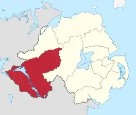 Le district en Irlande-du-Nord. | |
| Administration | |
|---|---|
| Pays | |
| Nation constitutive | Irlande-du-Nord |
| Comté | Fermanagh Tyrone |
| Chef-lieu | Enniskillen |
| Statut | District sans statut cérémoniel |
| Autorité Mandat |
Fermanagh and Omagh District Council 2019-2023 |
| Président Mandat |
Chris Smyth 2020-2021 |
| Démographie | |
| Population | 113 161 hab. (2011) |
| Densité | 40 hab./km2 |
| Géographie | |
| Coordonnées | 54° 32′ 42″ nord, 7° 29′ 38″ ouest |
| Superficie | 2 864,03 km2 |
| Histoire | |
| Date de création | |
| Liens | |
| Site web | Site officiel du conseil du district |
Géographie
Territoires limitrophes

Histoire
Un district de gouvernement local (local government district en anglais) regroupant ceux de Fermanagh et d’Omagh est proposé le par le Local Government (Boundaries) Act (Northern Ireland) du [1]. Il est formellement créé sous le nom de Fermanagh et d’Omagh (Fermanagh and Omagh District) à compter du par le Local Government (Boundaries) Order (Northern Ireland) du [2].
Administration
Conseil
Le Fermanagh and Omagh District Council, littéralement, le « conseil du district de Fermanagh and Omagh », est l’assemblée délibérante du district de Fermanagh and Omagh, composée de 40 membres (depuis 2015), appelés les conseillers (councillors).
Un président (chairman) et un vice-président (deputy chairman) sont élus parmi les conseillers à l’occasion de chaque réunion générale annuelle du conseil du district.
Circonscriptions électorales
Le district de gouvernement local est divisé en autant de sections électorales (wards en anglais) que de conseillers. Celles-ci sont distribuées par zone électorale de district (district electoral area).
| Zone | Depuis 2015[3] |
|---|---|
| Première zone et ses sections |
Enniskillen (6 sièges) |
| |
| Deuxième zone et ses sections |
Erne East (6 sièges) |
| |
| Troisième zone et ses sections |
Erne North (5 sièges) |
| |
| Quatrième zone et ses sections |
Erne West (5 sièges) |
| |
| Cinquième zone et ses sections |
Mid Tyrone (6 sièges) |
| |
| Sixième zone et ses sections |
Omagh (6 sièges) |
| |
| Septième zone et ses sections |
West Tyrone (6 sièges) |
|
Identité visuelle

Logotype (depuis ).
Notes et références
Notes
- Au sens littéral, il se traduit en français par « Fermanagh-et-Omagh ».
Références
- « Local Government (Boundaries) Act (Northern Ireland) 2008 », UK Statute Law Database, (lire en ligne [PDF]).
- « Local Government (Boundaries) Order (Northern Ireland) 2012 », UK Statute Law Database, (lire en ligne [PDF]).
- « The District Electoral Areas (Northern Ireland) Order 2014 », UK Statute Law Database, (lire en ligne [PDF]).