Comté de Foothills
Le comté de Foothills (anglais : Foothills County), anciennement le district municipal Foothills N° 31 (anglais : Foothills No. 31) est un district municipal.
| Comté de Foothills | |
.jpeg.webp)
| |
| Administration | |
|---|---|
| Pays | |
| Province | |
| Région | Région de Calgary |
| Statut municipal | district municipal |
| Maire | Larry Spilak |
| Démographie | |
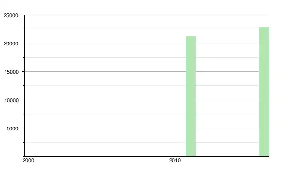
| Population | 23 199 hab. () |
| Densité | 6,4 hab./km2 |
| Géographie | |
| Coordonnées | 50° 34′ 51″ nord, 113° 52′ 28″ ouest |
| Superficie | 364 290 ha = 3 642,90 km2 |
| Divers | |
| Fuseau horaire | UTC-7 |
| Code géographique | 4806001 |
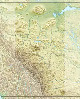
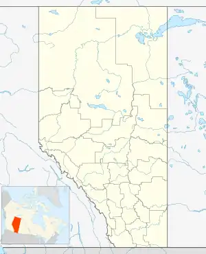
| Localisation | |
| Liens | |
| Site web | www.mdfoothills.com |
Communautés et localités
- Villages d'été
- Hameaux
- Localités
- Alder Heights
- Aspen Creek Estates
- Azure
- Caravelle Estates
- Connemara
- De Winton Heights
- Eltham
- Gladys
- Hartell
- Kew
- Leduc Lynnwood Ranch
- Leisure Lake
- Mazeppa
- Naphtha
- Naptha
- Pekisko
- Pineridge Estates
- Rio Frio
- Royalties
- Sandstone
- Valleyview Acres
Démographie
Références
- (en) Cet article est partiellement ou en totalité issu de l’article de Wikipédia en anglais intitulé « Foothills No. 31, Alberta » (voir la liste des auteurs).
Cet article est issu de wikipedia. Text licence: CC BY-SA 4.0, Des conditions supplémentaires peuvent s’appliquer aux fichiers multimédias.