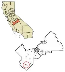
Coalinga
Coalinga (en anglais [ˌkoʊ.əˈlɪŋɡə] ou [kəˈlɪŋɡə]) est une municipalité américaine du comté de Fresno, en Californie. Sa population était de 13 380 habitants au recensement de 2010.
Coalinga


| Pays | |
|---|---|
| État | |
| Comté | |
| Superficie |
15,93 km2 () |
| Surface en eau |
0,5 % |
| Altitude |
205 m |
| Coordonnées |
36° 08′ 23″ N, 120° 21′ 37″ O |
| Population |
17 590 hab. () |
|---|---|
| Densité |
1 104,4 hab./km2 () |
| Statut | |
|---|---|
| Membre de |
Fresno County Rural Transit Agency (en) |
| Fondation |
|---|
| Code postal |
93210 |
|---|---|
| Code FIPS |
06-14274 |
| GNIS | |
| TGN | |
| Indicatif téléphonique |
559 |
| Site web |
(en) www.coalinga.com |

Démographie
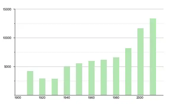
| Historique des recensements | |||
| Ann. | Pop. | %± | |
|---|---|---|---|
| 1910 | 4 199 | — | |
| 1920 | 2 934 | ▼ −30,13 % | |
| 1930 | 2 851 | ▼ −2,83 % | |
| 1940 | 5 026 | ▲ +76,29 % | |
| 1950 | 5 539 | ▲ +10,21 % | |
| 1960 | 5 965 | ▲ +7,69 % | |
| 1970 | 6 161 | ▲ +3,29 % | |
| 1980 | 6 593 | ▲ +7,01 % | |
| 1990 | 8 212 | ▲ +24,56 % | |
| 2000 | 11 668 | ▲ +42,08 % | |
| 2010 | 13 380 | ▲ +14,67 % | |
| Est. 2017 | 16 774 | ▲ +25,37 % | |
Liens externes
- Ressource relative à la géographie :
- (en) Site officiel
Notes et références
Cet article est issu de wikipedia. Text licence: CC BY-SA 4.0, Des conditions supplémentaires peuvent s’appliquer aux fichiers multimédias.