Borough londonien de Bromley
Le borough londonien de Bromley (London Borough of Bromley ) est un borough du Grand Londres. Cette circonscription, fondée en 1965, compte plus de 298 000 habitants.
| Borough londonien de Bromley | |
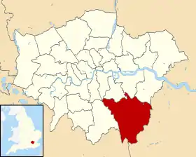 Carte de localisation dans le Grand Londres. | |
| Administration | |
|---|---|
| Pays | |
| Nation constitutive | |
| Comté | Grand Londres |
| Comté cérémonial | Grand Londres |
| Comté traditionnel | Kent |
| Statut | Borough |
| Gouvernement | Leader & Cabinet |
| Députés | Jo Johnson, Bob Stewart, Bob Neill, Jim Dowd |
| Assemblée · Membre |
Bexley and Bromley James Cleverly |
| Maire | George Taylor |
| Préfixe d'appel | 01689, 01959, 020 |
| Démographie | |
| Population | 312 400 hab. (2010) |
| Densité | 2 081 hab./km2 |
| Rang | 20e / 326 |
| Géographie | |
| Coordonnées | 51° 20′ 00″ nord, 0° 05′ 00″ est |
| Superficie | 15 015 ha = 150,15 km2 |
| Rang | 188e / 326 |
| Liens | |
| Site web | http://www.bromley.gov.uk/ |
Ce borough est composé de :
- Anerley
- Beckenham
- Bickley
- Biggin Hill
- Bromley
- Bromley Common
- Chelsfield
- Chislehurst
- Downe
- Elmstead
- Farnborough
- Green Street Green
- Hayes
- Keston
- Kevington
- Mottingham (en partie)
- Orpington
- Penge
- Petts Wood
- Pratt's Bottom
- Shortlands
- Southborough
- St Mary Cray
- St Paul's Cray
- Sundridge
- West Wickham
Lors de sa création, le district de Bromley a inclus le village de Knockholt. En 1969, après les protestations par les habitants locaux, ce village est retourné au Kent.
Liens externes
Cet article est issu de wikipedia. Text licence: CC BY-SA 4.0, Des conditions supplémentaires peuvent s’appliquer aux fichiers multimédias.