Zapotillo (canton)
Zapotillo est un canton d'Équateur situé dans la province de Loja.
| Canton de Zapotillo | ||

| ||
.jpg.webp) Guayacanes en fleurs, paroisse de Mangahurco, canton de Zapotillo | ||
| Administration | ||
|---|---|---|
| Pays | ||
| Province | ||
| Démographie | ||
| Population | 12 312 hab. (2010) | |
| Densité | 10 hab./km2 | |
| Langue(s) | Espagnol | |
| Géographie | ||
| Coordonnées | 4° 23′ sud, 80° 15′ ouest | |
| Altitude | 255 m |
|
| Superficie | 121 500 ha = 1 215 km2 | |
| Localisation | ||
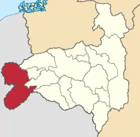 Carte du canton | ||
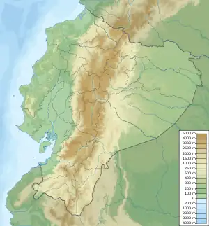
| Géolocalisation sur la carte : Équateur
| ||
| Liens | ||
| Site web | www.zapotillohermoso.com.ec/ | |
Géographie
Références
Cet article est issu de wikipedia. Text licence: CC BY-SA 4.0, Des conditions supplémentaires peuvent s’appliquer aux fichiers multimédias.