Ville de Mitcham
La Ville de Mitcham (City of Mitcham) est une zone d'administration locale au sud du centre ville d'Adélaïde en Australie-Méridionale en Australie.
| Ville de Mitcham | |
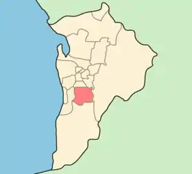
 Localisation de la zone d'administration locale. | |
| Administration | |
|---|---|
| Pays | |
| État ou Territoire | Australie-Méridionale |
| Région | Adélaïde |
| Nom du Conseil | Conseil de la Ville de Mitcham |
| Siège du Conseil | Torrens Park |
| Maire | Ivan Brooks |
| Démographie | |
| Population | 61 853 hab. (2006) |
| Densité | 818 hab./km2 |
| Géographie | |
| Coordonnées | 35° 01′ sud, 138° 38′ est |
| Superficie | 7 560 ha = 75,6 km2 |
| Liens | |
| Site web | http://www.mitcham.sa.gov.au/ |
Elle accueille l'université Flinders.
Quartiers
|
|
Références
Cet article est issu de wikipedia. Text licence: CC BY-SA 4.0, Des conditions supplémentaires peuvent s’appliquer aux fichiers multimédias.