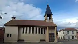
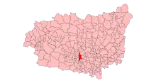
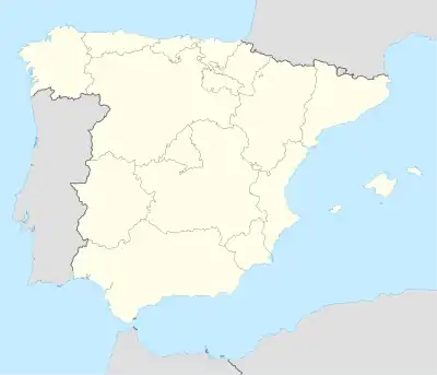
Villazala
Villazala est une commune d'Espagne dans la province de Leテウn, communautテゥ autonome de Castille-et-Leテウn. Elle s'テゥtend sur 45,42 km2 et comptait environ 749 habitants en 2015.
Villazala
.svg.png.webp)
.svg.png.webp)
| Nom officiel |
(es) Villazala |
|---|
| Pays | |
|---|---|
| Communautテゥ autonome | |
| Province | |
| Partie de | |
| Chef-lieu |
Villazala (d) |
| Superficie |
45,42 km2 |
| Altitude |
796 m |
| Coordonnテゥes |
42ツー 21窶?nbsp;40窶?nbsp;N, 5ツー 51窶?nbsp;22窶?nbsp;O |
| Population |
619 hab. () |
|---|---|
| Densitテゥ |
13,6 hab./km2 () |
| Statut | |
|---|---|
| Chef de l'exテゥcutif |
Josテゥ Antonio Guerrero Villoria (d) |
| Contient les localitテゥs |
| Code postal |
24763 |
|---|---|
| INE |
24228 |
| Immatriculation |
LE |
| Site web |
Localisation sur la carte d窶僞spagne
 |
Cet article est issu de wikipedia. Texte licence: CC BY-SA 4.0, Des conditions supplテゥmentaires peuvent s窶兮ppliquer aux fichiers multimテゥdias.