Tomorrnitsa
Tomorrnitsa, également connue sous les noms bulgares Koprinista et Pronista, est une ancienne forteresse et une forteresse bulgare ex post facto. C'est la dernière source de résistance avant la domination byzantine sur les terres bulgares.
| Tomorrnitsa | ||

| ||
| Nom local | Kalaja е Tomorrit | |
|---|---|---|
| Période ou style | Forteresse | |
| Début construction | Empire romain | |
| Fin construction | 1467 [1] | |
| Coordonnées | 40° 42′ 10″ nord, 20° 06′ 33″ est | |
| Pays | ||
| District | District de Berat | |
| Localité | Berat | |
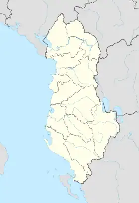
| Géolocalisation sur la carte : Albanie
| ||
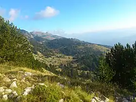
Les ruines sont situées près de la ville albanaise actuelle de Berat, sur les pentes nord-ouest du mont Tomorr.
La forteresse remonte à l'époque romaine et s'est élevée sur une plate-forme rocheuse escarpée de 50 mètres et n'est accessible que par un chemin étroit. Les murs de l'acropole diffèrent entre les pierres et il existe plusieurs couches archéologiques. L'acropole mesurait 210 mètres de long, ses murs étaient épais de 1,3 mètre et avait la forme d'un trapèze irrégulier.
La position de la forteresse est la clé du contrôle de la Via Egnatia. Elle dominait le système défensif de la région, qui comprenait 8 petites fortifications, et avec le château de Berat, le nombre de fortifications s'élevait à 10.
Dans cette forteresse, le 15 août 1018, le voïvode-duc Ibatzès est insidieusement aveuglé après un siège infructueux de 55 jours — l'aveuglement est l'œuvre d'Eustathe Daphnomèle.
La forteresse avait sa propre source d'eau autonome et un réservoir pour 100 000 litres d'eau. Malheureusement, aucune fouille archéologique sérieuse n'a été effectuée sur le site et les informations à son sujet proviennent uniquement de sources écrites[2].
Références
- Aurel Sasu (ed.), Dicționarul biografic al literaturii române, vol. II, p. 151. Pitești: Editura Paralela 45, 2004. (ISBN 973-697-758-7)
- It is above the village of Tomorri i Madh. The castle has been inhabited since the ancient times and rises over a steep and 50 m high rocky platform and can only be reached through a narrow Pedestrian Street. Over the rocky mass one can find the distinct walls of the acropolis, walls which don't belong only to one single period of time. The acropolis has a perimeter of 210 m, its walls are 1-1.3 m and it has the shape of an irregular trapezoid. The ancient wall dates from the pre Byzantine era. This castle was placed a very good strategic location, not only for protection, but in an important passageway from the sea cost to Constantinople as well. The castle dominates the view over all the castles of Berat, including Mbjeshtova, Peshtan, Mbolan, Vojak, Gradishta of Qereshnik and the castle of Vokopola. This castle was writen about in the chronicles during the time of the fall of Bulgarian Empire in 1018, as well as being mentioned during the events of 1336 as the location of a series of important battles. The Castle was used by the Turks during the period of the Turkish rule. In the castle can be found the ruins of an ancient water cistern, which once had a capacity of 100,000 liters of water. Unfortunantly, any serious attempt to study the castle and it's history has been put on hold for a long time. In recent years the place has become very attractive for tourists. Some tour operators organize tours around the area. BERATI, History and Culture; I.Sollaku Kurti; 2016, pages 58 и 59.
