Subdivisions de la Namibie
Cet article traite des subdivisions de la Namibie.
Régions
Carte des 14 régions de Namibie.
Depuis le , la Namibie est divisée administrativement en quatorze régions[1] - [2] ; capitale entre parenthèses (les numéros correspondent à ceux de la carte) :
| N° | Région | Capitale | Population (2011)[3] | Superficie (km²)[4] | Densité de population
(habitants/km²) |
Remarque |
|---|---|---|---|---|---|---|
| 1 | Kunene | Opuwo | 86,856 | 115,260 | 0.8 | |
| 2 | Omusati | Outapi | 243,166 | 26,551 | 9.1 | |
| 3 | Oshana | Oshakati | 176,674 | 8,647 | 20 | |
| 4 | Ohangwena | Eenhana | 245,446 | 10,706 | 22 | |
| 5 | Oshikoto | Omuthiyagwiipundi | 181,973 | 38,685 | 4.7 | |
| 6 | Kavango West | Nkurenkuru | 107,905 | 23,166 | 4.7 | Issue de la scission de Kavango |
| 7 | Kavango East | Rundu | 115,447 | 25,576 | 4.5 | |
| 8 | Zambezi | Katima Mulilo | 90,596 | 14,785 | 6.1 | Appelée « Caprivi » jusqu'au |
| 9 | Erongo | Swakopmund | 150,809 | 63,539 | 2.4 | |
| 10 | Otjozondjupa | Otjiwarongo | 143,903 | 105,460 | 1.4 | |
| 11 | Omaheke | Gobabis | 71,233 | 84,981 | 0.8 | |
| 12 | Khomas | Windhoek | 342,141 | 36,964 | 9.2 | |
| 13 | Hardap | Mariental | 79,507 | 109,781 | 0.7 | |
| 14 | ǁKaras | Keetmanshoop | 77,421 | 161,514 | 0.5 | Appelée « Karas » jusqu'au |
Circonscriptions
Les quatorze régions sont elles-mêmes divisées en 121 circonscriptions :
| N° | Carte | Région | Circonscriptions |
|---|---|---|---|
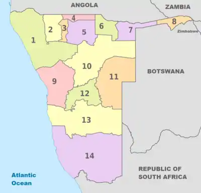
| 1 | 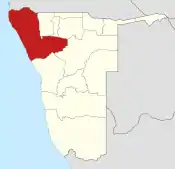 |
Kunene |
|
| 2 | 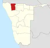 |
Omusati | |
| 3 | 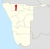 |
Oshana | |
| 4 | 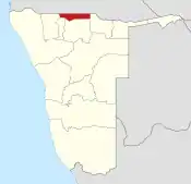 |
Ohangwena | |
| 5 | 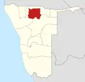 |
Oshikoto |
|
| 6 | 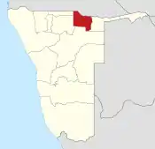 |
Kavango West |
|
| 7 | 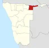 |
Kavango East |
|
| 8 | 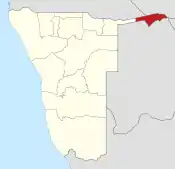 |
Zambezi |
|
| 9 | 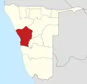 |
Erongo |
|
| 10 | 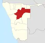 |
Otjozondjupa |
|
| 11 | 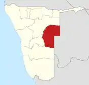 |
Omaheke |
|
| 12 | 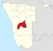 |
Khomas |
|
| 13 | 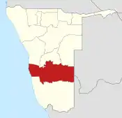 |
Hardap |
|
| 14 | 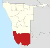 |
ǁKaras |
|
Notes et références
- (en) Government Gazette of the Republic of Namibia - no 5261, (lire en ligne [PDF])
- (en) « Regions of Namibia », sur statoids.com (consulté le ) — 2013-08-08: Caprivi region renamed to Zambezi; Karas region renamed to ǃKaras; Kavango region (former ISO code NA-OK, FIPS WA34) split into Kavango East and Kavango West. Capital of Oshikoto moved from Tsumeb to Omuthiyagwiipundi (sometimes known as Omuthiya).
- Namibia at GeoHive « https://web.archive.org/web/20120522094645/http://www.geohive.com/cntry/namibia.aspx »(Archive.org • Wikiwix • Archive.is • Google • Que faire ?),
- « Namibia's Population by Region », Institute for Public Policy Research, no 1, , p. 3
Cet article est issu de wikipedia. Text licence: CC BY-SA 4.0, Des conditions supplémentaires peuvent s’appliquer aux fichiers multimédias.