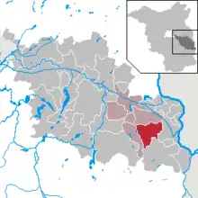
Schlaubetal
Schlaubetal est une commune d’Allemagne située dans l'est de l'arrondissement d'Oder-Spree, au Brandebourg.
Schlaubetal


| Pays | |
|---|---|
| Land | |
| Arrondissement en Brandebourg | |
| Superficie |
52,56 km2 () |
| Altitude |
118 m |
| Coordonnées |
52° 07′ N, 14° 30′ E |

| Population |
1 832 hab. () |
|---|---|
| Densité |
34,9 hab./km2 () |
| Statut |
Non-urban municipality in Germany (d) |
|---|
| Code postal |
15890 |
|---|---|
| Indicatif téléphonique |
033654 |
| Immatriculation |
LOS |
| Site web |

Notes et références
Cet article est issu de wikipedia. Text licence: CC BY-SA 4.0, Des conditions supplémentaires peuvent s’appliquer aux fichiers multimédias.