Parma Heights
Parma Heights est une ville située dans le comté de Cuyahoga, dans l'État de l'Ohio, aux États-Unis. Elle se trouve dans la banlieue sud de Cleveland.
| Parma Heights | ||||
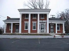 Maison de Robert W.Henry sur la route Pearl | ||||
| Administration | ||||
|---|---|---|---|---|
| Pays | ||||
| État | ||||
| Comté | Cuyahoga | |||
| Type de localité | City | |||
| Maire | Michael P. Byrne[1] | |||
| Code ZIP | 44130 | |||
| Code FIPS | 39-61028 | |||
| GNIS | 1056914 | |||
| Indicatif(s) téléphonique(s) local (locaux) | 440 | |||
| Démographie | ||||
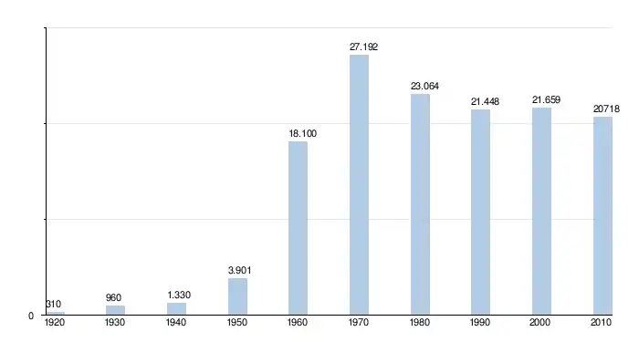
| Population | 20 718 hab. (2010) | |||
| Densité | 1 901 hab./km2 | |||
| Géographie | ||||
| Coordonnées | 41° 23′ 10″ nord, 81° 45′ 48″ ouest | |||
| Altitude | 261 m |
|||
| Superficie | 1 090 ha = 10,9 km2 | |||
| · dont terre | 10,9 km2 (100 %) | |||
| · dont eau | 0 km2 (0 %) | |||
| Fuseau horaire | EST (UTC-5) | |||
| Divers | ||||
| Fondation | 1818 | |||
| Localisation | ||||
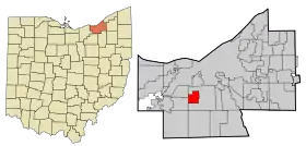 Carte du comté de Cuyahoga. | ||||
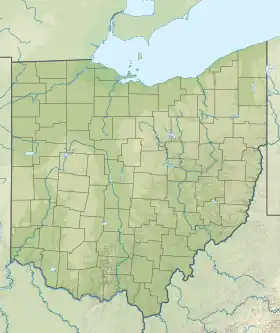
| Géolocalisation sur la carte : États-Unis
Géolocalisation sur la carte : États-Unis
Géolocalisation sur la carte : Ohio
| ||||
| Liens | ||||
| Site web | http://www.parmaheightsoh.gov | |||
_relief_location_map.png.webp)
_location_map.svg.png.webp)
Sa population était estimée à 20 718 habitants lors du recensement de 2010, ce qui donne une densité de 1 991,8 hab/km2.
Histoire
Parma Heights a été fondé en 1818[2].
Démographie
Situation
 |
Parma | | ||
| Middleburg Heights, Brook Park |
N | Parma | ||
| O Parma Heights E | ||||
| S | ||||
| Parma |
Références
- Mayor's Office - City of Parma Heights, Ohio, Consulté le 4 août 2012
- Columbia-Lippincott Gazeteer, p. 1433
Cet article est issu de wikipedia. Text licence: CC BY-SA 4.0, Des conditions supplémentaires peuvent s’appliquer aux fichiers multimédias.