Liste des lieux patrimoniaux du Nunavut
Cet article recense les lieux patrimoniaux du Nunavut inscrit au répertoire des lieux patrimoniaux du Canada, qu'ils soient de niveau provincial, fédéral ou municipal.
Liste des lieux patrimoniaux
| [1] | Lieu patrimonial | Illustration | Municipalité | Adresse | Coordonnées | No | Constr. | Prot.[2] | Rec. | Notes |
|---|---|---|---|---|---|---|---|---|---|---|
| F | Épave du HMS Breadalbane | 
|
Baffin, Unorganized | Île Beechey | à géolocaliser | 15149 | 1843 | LHN | 1983 | |
| T | Fort Conger | 
|
Baffin, Unorganized | Fort Conger | 81.75 -64.75 |
16360 | Territorial Historic Site | 1978 | ||
| F | Hutte Dedrick | 
|
Baffin, Unorganized | Fort Conger | 81.7449 -64.7858 |
18073 | 1900 | ÉFP classé | 1991 | [3] |
| P | Île Beechey | 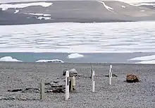 |
Baffin, Unorganized | Île Beechey | 74 -91.9167 |
7105 | Territorial Historic Site | 1975 | ||
| P | Île Dealy | 
|
Baffin, Unorganized | Île Dealy | 74.9578 -108.707 |
7104 | Territorial Historic Site | 2009 | ||
| F | Île Kodlunarn | 
|
Baffin, Unorganized | Île Kodlunarn | 62.8175 -65.4288 |
11908 | 1578 | LHN | 1964 | |
| F | Inuksuk | 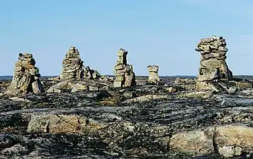 |
Baffin, Unorganized | Enukso Point | 64.5667 -78.2 |
18947 | LHN | 1969 | ||
| F | Port Refuge | 
|
Baffin, Unorganized | Port Refuge, île Devon | 77.0047 -96.1637 |
16024 | LHN | 1978 | ||
| F | Poste de pêche à la baleine de l'île Blacklead | 
|
Baffin, Unorganized | Île Blacklead (en) | 64.9827 -66.21 |
15787 | 1860 | LHN | 1985 | |
| F | Poste de peche à la baleine de l'ile Kekerten | 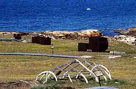 |
Baffin, Unorganized | Île Kekerten | 65.7016 -65.8193 |
15682 | 1857 | LHN | 1985 | |
| F | Sites de l'île Beechey | 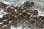 |
Baffin, Unorganized | Île Beechey | 74 -91.9167 |
17342 | LHN | 1993 | ||
| F | Dortoir Atwell, bâtiment HAL B02C | 
|
Hall Beach | North Warning Systems - FOX-M DEW Line Station | 68.733 -81.2608 |
3290 | 1957 | ÉFP classé | 2000 | |
| F | Entrepôt 2 HAL B13B | 
|
Hall Beach | North Warning Systems - FOX-M DEW Line Station | 68.733 -81.2608 |
3087 | 1960 | ÉFP classé | 2000 | |
| F | FOX-M, Édifice de l'aérogare | 
|
Hall Beach | North Warning Systems - FOX-M DEW Line Station | 68.7 -81.26 |
3289 | 1960 | ÉFP classé | 2000 | |
| F | Gare | 
|
Hall Beach | North Warning Systems - FOX-M DEW Line Station | 68.733 -81.2608 |
2998 | 1956 | ÉFP classé | 2000 | |
| F | Hangar | 
|
Hall Beach | North Warning Systems - FOX-M DEW Line Station | 68.733 -81.2608 |
3058 | 1956 | ÉFP classé | 2000 | |
| F | Train modulaire A | 
|
Hall Beach | North Warning Systems - FOX-M DEW Line Station | 68.733 -81.2608 |
3082 | 1956 | ÉFP classé | 2000 | |
| F | Train modulaire B | 
|
Hall Beach | North Warning Systems - FOX-M DEW Line Station | 68.733 -81.2608 |
3084 | 1956 | ÉFP classé | 2000 | |
| F | Erebus et Terror | 
|
Kitikmeot, Unorganized | Baie Erebus, île du Roi-Guillaume | à géolocaliser | 16563 | LHN | 1992 | ||
| F | Arvia'juaq et Qikiqtaarjuk | 
|
Kivalliq, Unorganized | Île Sentry | 61.1516 -93.92 |
1161 | LHN | 1995 | ||
| P | Île Marble | 
|
Kivalliq, Unorganized | Île Marble | 62.6833 -91.1333 |
7102 | Territorial Historic Site | 1973 | ||
| F | Passage de caribous en automne | 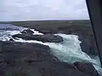 |
Kivalliq, Unorganized | Rivière Kazan entre les chutes Kazan et le lac Thirty Mile | 63.6435 -96.0495 |
9165 | LHN | 1995 |
Notes et références
- Niveau de la désignation: F: Fédéral, P: Provincial, M: Municipal
- (fr) Répertoire canadien des lieux patrimoniaux : Manuel de normes de documentation, Annexe A : Vocabulaires contrôlés, p.59-78
(en) Canadian Register of Historic Places: Documentation Standards Handbook, Appendix A: Controlled Vocabulary, p.57-75 - Situé dans le fort Conger
Annexes
Articles connexes
Liens externes
Pour l'ensemble des points mentionnés sur cette page : voir sur OpenStreetMap (aide) ou télécharger au format KML (aide).
Cet article est issu de wikipedia. Text licence: CC BY-SA 4.0, Des conditions supplémentaires peuvent s’appliquer aux fichiers multimédias.