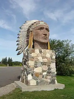
Indian Head (Saskatchewan)
Indian Head est une ville du sud-est de la Saskatchewan, au Canada, à environ 69 km à l'est de Regina, au nord de la route Transcanadienne.
Indian Head

| Pays | |
|---|---|
| Province | |
| Superficie |
3,17 km2 |
| Coordonnées |
50° 32′ 00″ N, 103° 40′ 01″ O |
| Population |
1 910 hab. () |
|---|---|
| Densité |
602,5 hab./km2 () |
| Fondation |
|---|
| CGT |
4706039 |
|---|---|
| Indicatif téléphonique |
306 |
| Site web |
Localisation sur la carte du Canada
 |
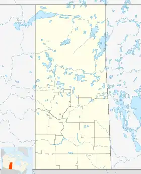
Localisation sur la carte de la Saskatchewan
 |
Histoire
Devenue ville en 1902, la localité est à ce moment l'un des principaux lieux d'exportation du blé au monde.
Démographie
En 2016, Statistique Canada recense 1 910 habitants de la localité[1].
| Recensement du Canada – Indian Head (Saskatchewan) | |||
|---|---|---|---|
| 2011 | 2006 | 2001 | |
| Population : | 1 815 (+11,11 % depuis 2006) | 1 634 (-7,1 % depuis 2001) | 1 758 (-4,1 % depuis 1996) |
| Superficie : | 3,17 km2 (1 mi2) | 3,17 km2 (1 mi2) | 3,17 km2 (1 mi2) |
| Densité : | 572,1 hab/km2 | 515,0 hab/km2 | 554,2 hab/km2 |
| Âge médian : | 43,7 Homme : 40,5 Femme : 47,8 |
46,2 Homme : 42,8 Femme : 49,8 |
43,9 Homme : 41,0 Femme : 46,1 |
| Total des logements privés : | 809 | 802 | 815 |
| Revenu familial médian : | 39,892 CAD | 33,213 CAD | |
| Références : 2011[2] 2006[3] 2001[4] | |||
| Évolution de la population | ||
|---|---|---|
| Année | Pop. | ±% |
| 1901 | 768 | — |
| 1906 | 1 545 | +101.2% |
| 1910 | 1 285 | −16.8% |
| 1916 | 1 334 | +3.8% |
| 1921 | 1 439 | +7.9% |
| 1996 | 1 833 | +27.4% |
| 2001 | 1 758 | −4.1% |
| 2006 | 1 634 | −7.1% |
| 2011 | 1 815 | +11.1% |
| 2016 | 1 910 | +5.2% |
| [5] - [6] - [7] - [8] - [9] | ||

Notes et références
- (en) Cet article est partiellement ou en totalité issu de l’article de Wikipédia en anglais intitulé « Indian Head, Saskatchewan » (voir la liste des auteurs).
- (en)(en) Government of Canada, Statistics Canada, « Census Profile, 2016 Census », sur www12.statcan.gc.ca (consulté le )
- « Profils des communautés de 2011 », Recensement du Canada de 2011, Statistique Canada, (consulté le )
- « Profils des communautés de 2006 », Recensement du Canada de 2006, Statistique Canada, (consulté le )
- « Profils des communautés de 2001 », Recensement du Canada de 2001, Statistique Canada,
- (en)J Adamson, « Saskatchewan in 1921 and the 1921 Census. The Forgotten Depression. », (consulté le )
- (en) « 2011 Community Profiles », Statistics Canada, Government of Canada, (consulté le )
- (en)(en) « 2001 Community Profiles », Statistics Canada, Government of Canada, (consulté le )
- (en)J. de Labroquerie (print version) Taché et Julia (online version) Adamson, « Census of Prairie Provinces Population and Agriculture Manitoba Saskatchewan Alberta », Printer to the King's Most Excellent Majesty, Ottawa, , Table 3 Towns page 121 Alameda, Sk to Watson, Sk (lire en ligne)
- (en)Statistics Canada, « Statistics Canada, 2016 Census of Population », (consulté le )
- « Statistique Canada - Profils des communautés de 2006 - Indian Head » (consulté le )
- « Statistique Canada - Profils des communautés de 2016 - Indian Head » (consulté le )
Bibliographie
- (en)McLennon, David. "Indian Head." Encyclopedia of Saskatchewan. Retrieved 9 May 2009.
- (en)N.a. (1984), Indian Head: History of Indian Head and District. Digitalised online by Our Roots/Nos Racines, University of Calgary, 2006. Retrieved 10 May 2009.
Liens externes
- (en) Site officiel
Cet article est issu de wikipedia. Text licence: CC BY-SA 4.0, Des conditions supplémentaires peuvent s’appliquer aux fichiers multimédias.