Arrondissement administratif d'Interlaken-Oberhasli
L'arrondissement administratif d'Interlaken-Oberhasli, appelé Verwaltungskreis Interlaken-Oberhasli en allemand, est l'un des dix arrondissements administratifs du canton de Berne en Suisse.
| Arrondissement administratif d'Interlaken-Oberhasli | ||||
 Héraldique |
||||
| Administration | ||||
|---|---|---|---|---|
| Pays | ||||
| Canton | ||||
| Chef-lieu | Interlaken | |||
| Préfet(s) | Martin Künzi[1] | |||
| No OFS | B0250 | |||
| Démographie | ||||
| Population permanente |
47 645 hab. (2020[2]) | |||
| Densité | 39 hab./km2 | |||
| Géographie | ||||
| Coordonnées | 46° 38′ nord, 8° 02′ est | |||
| Superficie | 1 231,5 km2 | |||
| Subdivisions | ||||
| Communes | 28 | |||
| Localisation | ||||
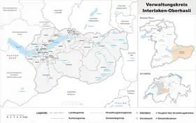 Carte de la subdivision. | ||||
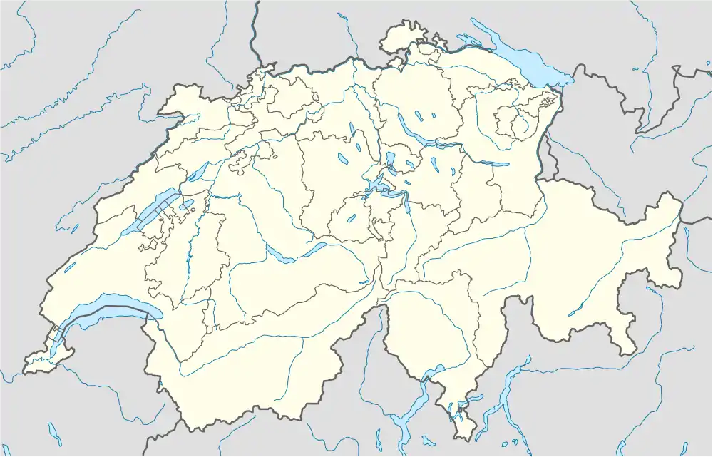
| Géolocalisation sur la carte : Suisse
Géolocalisation sur la carte : Suisse
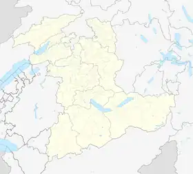
Géolocalisation sur la carte : canton de Berne
| ||||
Arrondissement germanophone, il est créé le en remplacement de l'ancien district d'Interlaken et d'une partie du district d'Oberhasli.
La commune d'Interlaken est le chef-lieu de l'arrondissement qui compte 28 communes et une population de 48 763 habitants au , pour une superficie de 1 231,5 km2.
Liste des communes
| Blason | Bannière | Nom | N° OFS[3] | Population (décembre 2020)[2] | Superficie en km²[4] | Habitants par km² |
|---|---|---|---|---|---|---|
| Beatenberg | 571 | 1 199 | 29,25 | 42 | ||
| Bönigen | 572 | 2 569 | 15,08 | 168 | ||
| Brienz | 573 | 3 158 | 48,06 | 66 | ||
| Brienzwiler | 574 | 481 | 17,64 | 28 | ||
| Därligen | 575 | 415 | 6,93 | 59 | ||
| Grindelwald | 576 | 3 800 | 171,38 | 22 | ||
| Gsteigwiler | 577 | 402 | 7,03 | 60 | ||
| Gündlischwand | 578 | 351 | 16,68 | 21 | ||
| Guttannen | 782 | 245 | 200,85 | 1 | ||
| Habkern | 579 | 634 | 50,96 | 12 | ||
| Hasliberg | 783 | 1 158 | 41,74 | 27 | ||
| Hofstetten bei Brienz | 580 | 531 | 8,77 | 60 | ||
| Innertkirchen | 784 | 1 072 | 236,59 | 5 | ||
| Interlaken | 581 | 5 719 | 4,27 | 1363 | ||
| Iseltwald | 582 | 415 | 21,91 | 19 | ||
| Lauterbrunnen | 584 | 2 301 | 164,66 | 14 | ||
| Leissigen | 585 | 1 171 | 10,38 | 111 | ||
| Lütschental | 586 | 214 | 12,28 | 18 | ||
| Matten bei Interlaken | 587 | 4 060 | 5,91 | 695 | ||
| Meiringen | 785 | 4 666 | 40,63 | 115 | ||
| Niederried bei Interlaken | 588 | 368 | 4,13 | 91 | ||
| Oberried am Brienzersee | 589 | 461 | 20,14 | 24 | ||
| Ringgenberg | 590 | 2 588 | 8,88 | 291 | ||
| Saxeten | 591 | 92 | 19,38 | 5 | ||
| Schattenhalb | 786 | 552 | 31,54 | 17 | ||
| Schwanden bei Brienz | 592 | 625 | 7,06 | 92 | ||
| Unterseen | 593 | 5 760 | 13,99 | 410 | ||
| Wilderswil | 594 | 2 638 | 13,19 | 205 | ||
| Total | 47 645 | 1229,31 | 39 | |||
Notes et références
- « Arrondissement d'Interlaken-Oberhasli - Contact », sur https://www.jgk.be.ch (consulté le )
- « Bilan démographique selon le niveau géographique institutionnel », sur Office fédéral de la statistique (consulté le ).
- [xls] « Liste officielle des communes de la Suisse - 01.01.2016 », sur Office fédéral de la statistique (consulté le )
- Bundesamt für Statistik Generalisierte Grenzen 2020.
Cet article est issu de wikipedia. Text licence: CC BY-SA 4.0, Des conditions supplémentaires peuvent s’appliquer aux fichiers multimédias.