Aiyang Tlang
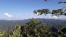
Aiyang Tlang (en bengali : আইয়াং ত্লং) est une montagne située à la frontière entre le Bangladesh et la Birmanie.
| Aiyang Tlang | |||
| |||
| Géographie | |||
|---|---|---|---|
| Altitude | 1 005 m | ||
| Massif | Chittagong Hill Tracts | ||
| Coordonnées | 21° 40′ 24″ nord, 92° 36′ 16″ est | ||
| Administration | |||
| Pays | |||
| Division État |
Chittagong Chin |
||
| District District |
Bandarban Mindat |
||
| Ascension | |||
| Première | 13 novembre 2019 par Jyotirmoy Dhar | ||
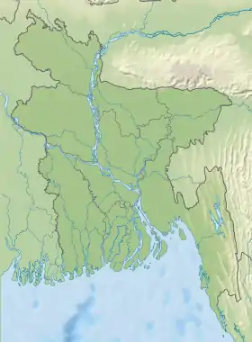
| Géolocalisation sur la carte : Bangladesh
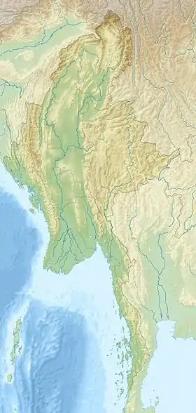
Géolocalisation sur la carte : Birmanie
| |||
Van Rausang Bawm, de la communauté ethnique locale bawm, est le premier homme à l'avoir découverte[1].
Le 13 novembre 2019, l'ingénieur bangladais Jyotirmoy Dhar parvient à gravir le sommet. Il détermine ses coordonnées et mesure son altitude à 3 298 pieds avec un dispositif de système mondial de positionnement (GPS)[2] - [3] - [4] - [5] - [6] - [7] - [8].
Le chef du Dalian Para de Remakri mouja, Lal Ram Bawm, assure l'authenticité de cette expédition. Elle est enregistrée dans le camp du BGB à proximité[9] - [10].
Jyotirmoy Dhar dédie sa découverte et le sommet à sa bien-aimée, Rini Dhar, et attribue son nom en langue bengali Rinir Chura[11] - [12] - [13] - [4] - [14] - [15] - [16] - [17] - [18] - [19] - [20].
Notes et références
- (bn) ৩২৯৮ ফুটের নতুন পর্বতশৃঙ্গের খোঁজ মিলল থানচিতে
- (bn) “আইয়াং ত্লং” অভিযানের কাহিনী
- (bn) বাংলাদেশের নতুন পর্বতশৃঙ্গের সন্ধান দিলেন জ্যোর্তিময়
- (bn) থানচিতে মিলল নতুন পর্বতশৃঙ্গের খোঁজ
- (bn) থানচিতে মিলল নতুন পর্বতশৃঙ্গের খোঁজ
- (bn) এক শৃঙ্গ অভিযান
- (bn)
- (en) 3300 feet highest hill discovered in Bandarban
- (bn) থানচিতে মিলেছে নতুন পর্বতশৃঙ্গের খোঁজ
- (bn) বাংলাদেশের অন্যতম সর্বোচ্চ পর্বত শৃঙ্গ “আইয়াং ত্নং” জয়ের আত্মকাহিনী
- (bn) থানচিতে ৩২৯৮ ফুটের নতুন পর্বতশৃঙ্গ ‘রিনির চূড়া’
- (bn) থানচিতে মিলল ৩২৯৮ ফুটের নতুন পর্বতশৃঙ্গের খোঁজ
- (bn) দেশের অন্যতম সর্বোচ্চ পর্বতশৃঙ্গ ‘আইয়াং ত্নং’
- (bn) থানচিতে মিলল নতুন পর্বতশৃঙ্গের খোঁজ
- (en) ‘One highest hill’ spotted by young Engineer
- (bn) থানচিতে মিলল ৩২৯৮ ফুটের নতুন পর্বতশৃঙ্গের খোঁজ
- (bn)
- (bn)
- (bn) থানচিতে মিলল নতুন পর্বতশৃঙ্গের খোঁজ
- (en) New highest hill spotted in Bandarban