État d'Oyo
L'État d'Oyo est un État du sud-ouest du Nigeria.
| Oyo | |
| Administration | |
|---|---|
| Pays | |
| Capitale | Ibadan |
| Date de création | |
| Gouverneur | Abiola Ajimobi |
| Code ISO | NG-OY |
| Démographie | |
| Population | 6 617 712 hab. (2005) |
| Densité | 243 hab./km2 |
| Géographie | |
| Coordonnées | 8° nord, 4° est |
| Superficie | 2 724 900 ha = 27 249 km2 |
| Latitude | 8 |
| Longitude | 4 |
| Température | 26 °C |
| Pluviométrie | min. 800 mm/an max. 1 800 mm/an |
| Localisation | |
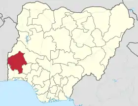 Carte de localisation de l'État. | |
| Liens | |
| Site web | https://www.oyostate.gov.ng |
Histoire
L'État d'Oyo a été créé le Lors de la division de l'ancienne région de l'Ouest. Le la partie est de l'État est extraite pour former l'État d'Osun.
Géographie
L'État d'Oyo est bordé au sud par l'État d'Ogun, à l'est par l'État d'Osun, au nord par l'État de Kwara, et à l'ouest par le Bénin.
Les principales villes sont : Ibadan, Ogbomosho, Oyo, Iseyin, Shaki Igboho, Kisi, Igbo-Ora, Okeho, Lalupon et Ileto.
Divisions
L'État est divisé en 32 zones de gouvernement local : Afijo, Akinyele, Egbeda, Ibadan Central, Ibadan North-East, Ibadan South-West, Ibadan South-East, Ibarapa, Ido, Ifedapo, Ifeloju, Irepo, Iseyin, Kajola, Lagelu, Ogbomosho North, Ogbomosho South, Oyo West, Atiba, Atigbo, Saki East, Itesiwaju, Iwajowa, Ibarapa North, Iyamapo/Olorunsogo, Oluyole, Ogo-Oluwa, Surulere, Orelope, Orire, Oyo et Ona-Ara.
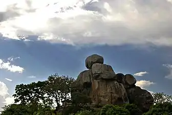 Formations rocheuses dans le jardin Moshra à Okeho, État d'Oyo. Mars 2018.
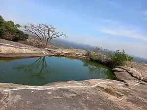 Le lac suspendu Ado-Awaye dans l'État d'Oyo. Janvier 2022.
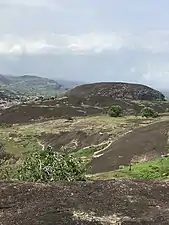 La colline d'Imofin dans l'État d'Oyo. Elle culmine à 272m. Avril 2022.