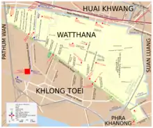
Watthana
Watthana ou Vadhana (thaï: วัฒนา, API :[wát.tʰā.nāː]) est l’un des 50 khets de Bangkok, Thaïlande.
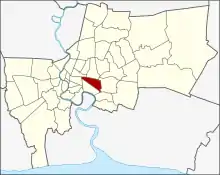
Carte de Watthana
Watthana
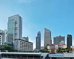
_Asok_Montri_Road_(aka_Sukhumwit_21_Alley).jpg.webp)
Asok Montri Road
| Nom officiel |
(th) เขตวัฒนา |
|---|---|
| Nom local |
(th) เขตวัฒนา |
| Pays | |
|---|---|
| Ville | |
| Superficie |
12,57 km2 |
| Subdivisions | |
| Coordonnées |
13° 44′ 32″ N, 100° 35′ 09″ E |
| Population |
81 623 hab. () |
|---|---|
| Densité |
6 496,1 hab./km2 () |
| Statut |
District de Bangkok (d) |
|---|
| Origine du nom | |
|---|---|
| Fondation |
| Devise |
En thaï : เศรษฐกิจฟูเฟื่อง ร้านอาหารเลื่องชื่อ การท่องเที่ยวระบือ ธ ประทานชื่อเขตวัฒนา |
|---|
| Code postal |
10110, 10260 |
|---|---|
| Site web |

Points d'intérêts
Galerie
 A gauche, le gratte-ciel de l'Université Srinakharinwirot SWU
 Gratte ciel de l'Université Srinakharinwirot
 Faculté de médecine sur le campus Ongkharak (Université Srinakharinwirot)
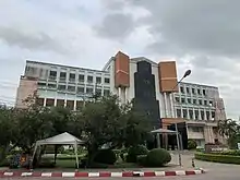 Faculté de pharmacie SWU
.jpg.webp) Soi Cowboy, la nuit
Soi Cowboy, la nuit
Notes et références
Cet article est issu de wikipedia. Text licence: CC BY-SA 4.0, Des conditions supplémentaires peuvent s’appliquer aux fichiers multimédias.