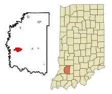
Washington (Indiana)
La ville américaine de Washington est le siège du comté de Daviess, dans l’État de l’Indiana. Sa population s’élevait à 11 509 habitants lors du recensement de 2010, estimée à 12 114 habitants en 2017.

| Pays | |
|---|---|
| État | |
| Comté | |
| Capitale de | |
| Superficie |
12,35 km2 () |
| Surface en eau |
0,78 % |
| Altitude |
153 m |
| Coordonnées |
38° 39′ 30″ N, 87° 10′ 30″ O |
| Population |
12 017 hab. () |
|---|---|
| Densité |
973,2 hab./km2 () |
| Statut |
|---|
| Code postal |
47501 |
|---|---|
| Code FIPS |
18-80504 |
| GNIS | |
| Indicatif téléphonique |
812 |
| Site web |
(en) www.washingtonin.us |

Histoire
La construction de Washington est ordonnée en 1815[1]. La ville est alors nommée d'après le township de Washington (en)[2].
Un chemin de fer traversant Washington est construit en 1857[3]. En 1889, la ville était devenue un important dépôt et atelier de réparation du Ohio and Mississippi Railroad. Le Baltimore and Ohio Railroad reprend la gestion de la ligne en 1893. Durant cette période, la compagnie de chemin de fer emploie plus de 1 000 salariés[4].
Le , une tornade d'intensité EF2 frappe la partie ouest de la ville et détruit 20 maisons et en endommage une vingtaine d'autres[5] - [6].
Démographie
| Historique des recensements | |||
| Ann. | Pop. | %± | |
|---|---|---|---|
| 1870 | 2 901 | — | |
| 1880 | 4 323 | ▲ +49,02 % | |
| 1890 | 6 064 | ▲ +40,27 % | |
| 1900 | 8 551 | ▲ +41,01 % | |
| 1910 | 7 854 | ▼ −8,15 % | |
| 1920 | 8 743 | ▲ +11,32 % | |
| 1930 | 9 070 | ▲ +3,74 % | |
| 1940 | 9 312 | ▲ +2,67 % | |
| 1950 | 10 987 | ▲ +17,99 % | |
| 1960 | 10 846 | ▼ −1,28 % | |
| 1970 | 11 358 | ▲ +4,72 % | |
| 1980 | 11 325 | ▼ −0,29 % | |
| 1990 | 10 838 | ▼ −4,3 % | |
| 2000 | 11 380 | ▲ +5 % | |
| 2010 | 11 509 | ▲ +1,13 % | |
| Groupe | Washington | ||
|---|---|---|---|
| Blancs | 89,2 | 84,3 | 72,4 |
| Autres | 6,5 | 2,7 | 6,4 |
| Afro-Américains | 1,1 | 9,1 | 12,6 |
| Métis | 1,9 | 2,0 | 2,9 |
| Asiatiques | 1,1 | 1,6 | 4,8 |
| Amérindiens | 0,3 | 0,3 | 0,9 |
| Total | 100 | 100 | 100 |
| Latino-Américains | 9,6 | 6,0 | 16,7 |
Selon l'American Community Survey, pour la période 2011-2015, 89,88 % de la population âgée de plus de 5 ans déclare parler anglais à la maison, alors que 8,95 % déclare parler l'espagnol et 1,17 % une autre langue[9].
Source
- (en) Cet article est partiellement ou en totalité issu de l’article de Wikipédia en anglais intitulé « Washington, Indiana » (voir la liste des auteurs).
- (en) Paul T. Hellmann, Historical Gazetteer of the United States, Routledge, , 888 p. (ISBN 1-135-94859-3, lire en ligne), p. 332.
- (en) Ronald L. Baker, From Needmore to Prosperity : Hoosier Place Names in Folklore and History, Indiana University Press, , 371 p. (ISBN 978-0-253-32866-3), p. 338.
- (en) History of Knox and Daviess County, Indiana : From the Earliest Time to the Present; with Biographical Sketches, Reminiscences, Notes, Etc. ; Together with an Extended History of the Colonial Days of Vincennes, and Its Progress Down to the Formation of the State Government, Goodspeed, , p. 678.
- (en) Douglas Wissing, Scenic Driving Indiana, Globe Pequot, (ISBN 978-1-56044-906-5), p. 4.
- (en) « Tornado Destroys 20 Homes, Cuts Power In Washington, Ind. », sur Indiana Public Media, (consulté le ).
- (en) « Preliminary reports show 11 tornadoes hit Indiana », sur Fox 59 News, (consulté le ).
- (en) « Washington, IN Population - Census 2010 and 2000 », sur censusviewer.com.
- (en) « Population of Indiana - Census 2010 and 2000 », sur censusviewer.com.
- (en) « Language spoken at home by ability to speak English for the population 5 years and over », sur factfinder.census.gov.
Liens externes
- Ressource relative à la géographie :
- (en) Site officiel