Taneytown
Taneytown est une localité du comté de Carroll au Maryland.
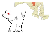
Taneytown
_at_Maryland_State_Route_140_(Baltimore_Street)_in_Taneytown%252C_Carroll_County%252C_Maryland.jpg.webp)
| Pays | |
|---|---|
| État | |
| Comté | |
| Superficie |
7,88 km2 () |
| Surface en eau |
0,23 % |
| Altitude |
154 m |
| Coordonnées |
39° 39′ 26″ N, 77° 10′ 14″ O |
| Population |
7 234 hab. () |
|---|---|
| Densité |
918,2 hab./km2 () |
| Statut |
|---|
| Fondation |
|---|
| Code postal |
21787 |
|---|---|
| Code FIPS |
24-76725 |
| GNIS | |
| TGN | |
| Indicatif téléphonique |
410 |
| Site web |
(en) www.taneytown.org |

La population était de 6 728 habitants en 2010.
Le Bullfrog Road Bridge (en) qui la relie à Emmitsburg est classé au National Register of Historic Places depuis 1978.
Démographie
| Historique des recensements | |||
| Ann. | Pop. | %± | |
|---|---|---|---|
| 1850 | 285 | — | |
| 1860 | 365 | ▲ +28,07 % | |
| 1870 | 413 | ▲ +13,15 % | |
| 1880 | 519 | ▲ +25,67 % | |
| 1890 | 566 | ▲ +9,06 % | |
| 1900 | 665 | ▲ +17,49 % | |
| 1910 | 824 | ▲ +23,91 % | |
| 1920 | 800 | ▼ −2,91 % | |
| 1930 | 938 | ▲ +17,25 % | |
| 1940 | 1 208 | ▲ +28,78 % | |
| 1950 | 1 420 | ▲ +17,55 % | |
| 1960 | 1 519 | ▲ +6,97 % | |
| 1970 | 1 731 | ▲ +13,96 % | |
| 1980 | 2 618 | ▲ +51,24 % | |
| 1990 | 3 695 | ▲ +41,14 % | |
| 2000 | 5 128 | ▲ +38,78 % | |
| 2010 | 6 728 | ▲ +31,2 % | |
| Est. 2016 | 6 760 | ▲ +0,48 % | |
Liens externes
Cet article est issu de wikipedia. Text licence: CC BY-SA 4.0, Des conditions supplémentaires peuvent s’appliquer aux fichiers multimédias.