MacArthur (Leyte)
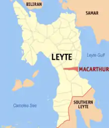
MacArthur est une municipalité des Philippines située dans l'est de la province de Leyte, sur le golfe de Leyte. Elle tire son nom du général américain Douglas MacArthur.
MacArthur

| Nom officiel |
(en) Municipality of MacArthur |
|---|
| Pays | |
|---|---|
| Groupe d'îles | |
| Région | |
| Province | |
| Superficie |
57,57 km2 |
| Altitude |
125 m |
| Coordonnées |
10° 50′ 08″ N, 124° 59′ 47″ E |
| Population |
21 578 hab. () |
|---|---|
| Densité |
374,8 hab./km2 () |
| Statut |
|---|
| Code postal |
6509 |
|---|---|
| Indicatif téléphonique |
53 |
| Site web |

Subdivisions
MacArthur est divisée en 31 barangays :
- Batug
- Burabod
- Capudlosan
- Casuntingan
- Causwagan
- Danao
- General Luna
- Kiling
- Lanawan
- Liwayway
- Maya
- Oguisan
- Osmeña
- Palale 1
- Palale 2
- Poblacion District 1
- Poblacion District 2
- Poblacion District 3
- Pongon
- Quezon
- Romualdez
- Salvacion
- San Antonio
- San Isidro
- San Pedro
- San Vicente
- Santa Isabel
- Tin-awan
- Tuyo
- Doña Josefa
- Villa Imelda
Notes et références
Cet article est issu de wikipedia. Text licence: CC BY-SA 4.0, Des conditions supplémentaires peuvent s’appliquer aux fichiers multimédias.