Liste des lieux patrimoniaux du comté de Cumberland
Cet article recense les lieux patrimoniaux du comté de Cumberland en Nouvelle-Écosse inscrit au répertoire des lieux patrimoniaux du Canada, qu'ils soient de niveau provincial, fédéral ou municipal.
Liste
| [1] | Lieu patrimonial | Illustration | Municipalité | Adresse | Coordonnées | No | Constr. | Prot.[2] | Rec. | Notes |
|---|---|---|---|---|---|---|---|---|---|---|
| M | Advocate United Church | 
|
Advocate Harbour | 3680 Highway 209 | 45.3352 -64.7807 |
11874 | Municipally Registered Property | 1998 | ||
| M | Dewis House |
|
Advocate Harbour | 3291 Highway 209 | 45.3444 -64.7996 |
11319 | Municipally Registered Property | 2001 | ||
| M | 1 Ratchford Street |
|
Amherst | 1 Ratchford Street | 45.8342 -64.2111 |
8275 | 1906 | Municipally Registered Property | 1991 | |
| M | 100 Victoria Street East | 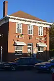 |
Amherst | 100 Victoria Street East | 45.8344 -64.2127 |
14801 | 1906 | Municipally Registered Property | 1983 | |
| M | 150 Church Street |
|
Amherst | 150 Church Street | 45.8285 -64.2018 |
8298 | Municipally Registered Property | 1982 | ||
| M | 177 Victoria Street East |
|
Amherst | 177 Victoria Street East | 45.8381 -64.2065 |
8257 | 1907 | Municipally Registered Property | 1986 | |
| M | 233 Victoria Street East |
|
Amherst | 233 Victoria Street East | 45.8412 -64.1986 |
8255 | Municipally Registered Property | 1989 | ||
| M | 27 Victoria Street West |
|
Amherst | 27 Victoria Street West | 45.8328 -64.2133 |
15656 | Municipally Registered Property | 1989 | ||
| M | 30 Hickman Street |
|
Amherst | 30 Hickman Street | 45.8234 -64.215 |
8259 | Municipally Registered Property | 1999 | ||
| M | 46 Victoria Street West |
|
Amherst | 46 Victoria Street West; Amherst | 45.8278 -64.2162 |
8254 | Municipally Registered Property | 1987 | ||
| M | 50 Victoria Street East |
|
Amherst | 50 Victoria Street East | 45.8332 -64.2131 |
8263 | 1886 | Municipally Registered Property | 1983 | |
| M | 54 Victoria Street East |
|
Amherst | 54 Victoria Street East | 45.8333 -64.2131 |
8258 | 1888 | Municipally Registered Property | 1983 | |
| M | 60 Victoria Street East |
|
Amherst | 60 Victoria Street East | 45.8335 -64.2129 |
8262 | 1846 | Municipally Registered Property | 1983 | |
| M | 66 Victoria Street East |
|
Amherst | 66 Victoria Street East | 45.8337 -64.2128 |
8260 | 1895 | Municipally Registered Property | 1983 | |
| M | 79 Victoria Street East |
|
Amherst | 79 Victoria Street East | 45.8339 -64.2126 |
8261 | 1907 | Municipally Registered Property | 1985 | |
| M | 91 Victoria Street East |
|
Amherst | 91 Victoria Street East | 45.8342 -64.2124 |
8256 | 1897 | Municipally Registered Property | 1992 | |
| M | 96 Church Street |
|
Amherst | 96 Church Street | 45.8312 -64.2079 |
15306 | Municipally Registered Property | 1986 | ||
| P | Amherst Dominion Public Building |
|
Amherst | 98 East Victoria Street | 45.8342 -64.2128 |
14641 | 1936 | Provincially Registered Property | 2004 | |
| M | Little Red Schoolhouse |
|
Amherst | 571 Highway 6 | 45.8496 -64.1792 |
11002 | Municipally Registered Property | 2001 | ||
| F | Manège militaire |
|
Amherst | 45.8341 -64.2082 |
9708 | 1915 | Recognized Federal Heritage Building | 1990 | ||
| P | Old Amherst Post Office |
|
Amherst | 50 East Victoria Street | 45.8331 -64.2136 |
7268 | 1886 | Provincially Registered Property | 1996 | |
| P | The Bank of Montreal Building |
|
Amherst | 100 Victoria Street; Amherst | 45.8344 -64.2127 |
6497 | 1904 | Provincially Registered Property | 1996 | |
| F | VIA Rail/Canadien National, gare de | 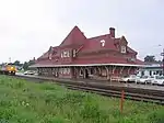 |
Amherst | Station Street | 45.83 -64.212 |
4564 | 1908 | GFP | 1992 | |
| P | Victoria |
|
Amherst | 177 Victoria Street | 45.8379 -64.2062 |
7289 | 1907 | Provincially Registered Property | 1990 | |
| M | Amherst Point Baptist Church |
|
Amherst Point | 908 Southampton Road | 45.7982 -64.2595 |
10996 | 1853 | Municipally Registered Property | 1992 | |
| F | Fort Lawrence |  |
Cumberland | 45.8478 -64.2618 |
13271 | 1750 | Lieu historique national | 1923 | ||
| P | Cannon House |
|
Diligent River | 10215 Highway 209 | 45.4127 -64.4575 |
7814 | Provincially Registered Property | 1989 | ||
| P | Fort Lawrence Terminus |  |
Fort Lawrence | Fort Lawrence Road; Route 4 | 45.8401 -64.267 |
7832 | 1891 | Provincially Registered Property | 1985 | |
| F | Beaubassin | 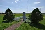 |
Fort Lawrence | Highway 4 | 45.8481 -64.2666 |
13964 | LHN | 2005 | ||
| M | Warren Baptist Church |
|
Hastings | 56 Hastings Cross Rd | 45.8446 -64.1246 |
11195 | Municipally Registered Property | 2001 | ||
| P | Falaises fossilifères de Joggins | 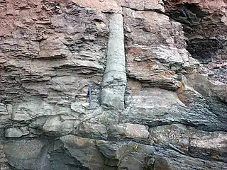 |
Joggins | 100 Main St | 45.6919 -64.4436 |
14787 | Special Place | 1980 | ||
| M | Hanna House |
|
Lakelands | 5755 Highway 2 | 45.4883 -64.3505 |
11913 | Municipally Registered Property | 2001 | ||
| M | Renwick United Church |
|
Linden | 6429 Highway 6 | 45.8791 -63.8363 |
15223 | 1865 | Municipally Registered Property | 1990 | |
| P | Stone House |
|
Lower Gulf Shore | Gulf Shore Road | 45.8752 -63.5229 |
7282 | 1833 | Provincially Registered Property | 1990 | |
| M | Howard House |
|
Middleboro | 216 Fountain Road | 45.7522 -63.5679 |
11318 | 1872 | Municipally Registered Property | 1995 | |
| M | A.T. Seaman House | 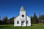 |
Minudie | 5355 Barronsfield Road | 45.7729 -64.3395 |
11862 | 1843 | Municipally Registered Property | 1991 | |
| P | Amos Thomas Seaman House | |
Minudie | Barronsfield Road | 45.7738 -64.3398 |
7815 | 1843 | Provincially Registered Property | 1992 | |
| M | King Seaman Church | 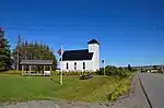 |
Minudie | 5508 Barronsfield Road | 45.7754 -64.3473 |
11253 | Municipally Registered Property | 1999 | ||
| P | King Seaman Church | |
Minudie | 5508 Barronsfield Road | 45.7756 -64.3481 |
7720 | Provincially Registered Property | 2003 | ||
| P | Minudie School Museum | |
Minudie | 5518 Barronsfield Road | 45.7756 -64.3488 |
7723 | 1847 | Provincially Registered Property | 1999 | |
| P | St. Denis Church | 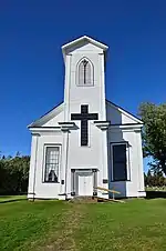 |
Minudie | 5534 Barronsfield Road | 45.7756 -64.3499 |
7264 | 1848 | Provincially Registered Property | 1993 | |
| F | Bâtiment 16 |
|
Nappan | Highway 302 | 45.759 -64.2391 |
11260 | 1892 | Recognized Federal Heritage Building | 2000 | |
| P | Mullins Point Upper Range Lighthouse |
|
North Wallace | North Wallace Road | 45.8243 -63.4435 |
7090 | 1894 | Provincially Registered Property | 1990 | |
| M | Civic Building |
|
Parrsboro | 4030 Eastern Ave | 45.4062 -64.3252 |
7016 | Municipally Registered Property | 1987 | ||
| P | Manning Block |
|
Parrsboro | 151 Main Street | 45.4033 -64.327 |
6847 | Provincially Registered Property | 1996 | ||
| M | Old Post Office | 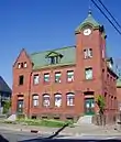 |
Parrsboro | 168 Main Street | 45.4036 -64.3266 |
7017 | Municipally Registered Property | 1986 | ||
| P | Ottawa House |  |
Parrsboro | 1155 Whitehall Road | 45.3752 -64.3294 |
13852 | Provincially Registered Property | 2007 | ||
| M | Ottawa House |
|
Parrsboro | 1155 Whitehall Road; Partridge Island | 45.3752 -64.3294 |
7019 | Municipally Registered Property | 1992 | ||
| M | St. George's Anglican Church | 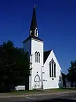 |
Parrsboro | 216 Main Street | 45.4046 -64.3263 |
7018 | Municipally Registered Property | 1987 | ||
| P | Acadia Lodge No. 13 A.F. & A.M. |
|
Pugwash | 14 Victoria Street | 45.8503 -63.662 |
10939 | Provincially Registered Property | 2008 | ||
| M | Acadia Lodge No.13 A.F. & A.M. |
|
Pugwash | 14 Victoria Street | 45.8501 -63.6628 |
12775 | Municipally Registered Property | 2001 | ||
| M | Melville United Church Cemetery |
|
Pugwash | 2036 Gulf Shore Road; RR #2 | 45.522 -63.3358 |
11806 | 1854 | Municipally Registered Property | 1990 | |
| P | Pugwash Train Station | 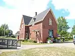 |
Pugwash | 10222 Durham Street; Pugwash | 45.85 -63.6607 |
14921 | 1892 | Provincially Registered Property | 2009 | |
| M | Pugwash Train Station | |
Pugwash | 10222 Durham Street | 45.85 -63.6607 |
11803 | Municipally Registered Property | 1996 | ||
| F | Thinkers' Lodge | 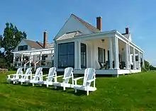 |
Pugwash | 247 Water Street | 45.8534 -63.665 |
12561 | 1899 | LHN | 2008 | |
| M | River Philip United Church | 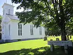 |
River Philip | 2808 Wyvern Road | 45.6606 -63.9058 |
11856 | 1862 | Municipally Registered Property | 1992 | |
| M | Lorne Smith House |
|
Southampton | 11 Highway 302 | 45.5963 -64.2483 |
11317 | 1845 | Municipally Registered Property | 1991 | |
| M | Spencer's Island Lighthouse | 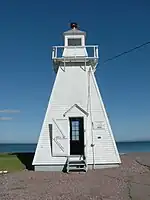 |
Spencers Island | Spencer's Beach Road | 45.354 -64.7129 |
11808 | 1904 | Municipally Registered Property | 1992 | |
| F | Exploitation houillère de Springhill |
|
Springhill | Industrial Park Drive Memorial Crescent |
45.64472 -64.065 |
17988 | 1873 | LHN | 1998 | |
| P | Lamp Cabin Building |
|
Springhill | 31 Industrial Park Drive | 45.6451 -64.0645 |
9809 | Provincially Registered Property | 1998 | ||
| F | Ferme expérimentale de Nappan, édifice des céréales-plates fourragères |
|
Subdistrict B | , Cumberland | 45.759 -64.239 |
2010 | 1935 | Recognized Federal Heritage Building | 2002 | |
| F | Lieu historique national du Canada de la Maison-Chapman |
|
Subdistrict C | Chapman Road, Cumberland | 45.8747 -64.246 |
7568 | 1780 | National Historic Site of Canada | 1968 | |
| F | Phare |
|
Subdistrict C | 45.962 -63.866 |
9682 | 1890 | Édifice fédéral du patrimoine reconnu | 1991 | ||
| P | Tidnish Dock Site |  |
Tidnish | Route 366 at Tidnish Cross Roads | 45.9978 -64.0079 |
7830 | 1891 | Provincially Registered Property | 1985 | |
| P | Tidnish Bridge |  |
Tidnish Bridge | Route 366 | 45.9762 -64.0437 |
7831 | 1891 | Provincially Registered Property | 1985 | |
| M | Church of the Good Shepherd |
|
Tidnish Cross Roads | 842 Tidnish Head Road | 45.994 -64.0106 |
11001 | 1892 | Municipally Registered Property | 1991 | |
| M | Trueman House |
|
Truemanville | 2721 Highway 6 | 45.8645 -64.0499 |
11493 | Municipally Registered Property | 2002 | ||
| P | Saint Matthew's Presbyterian Church |
|
Wallace | 3863 No. 307 Highway | 45.8126 -63.4733 |
8086 | 1828 | Provincially Registered Property | 1995 | |
| M | St. Andrew's Anglican Church |
|
Wallace | 13611 Highway 6 | 45.811 -63.4948 |
11850 | 1856 | Municipally Registered Property | 1998 | |
| M | Davison-Kennedy House |
|
Wallace Bay | 13440 Highway 6 | 45.8113 -63.5016 |
11519 | Municipally Registered Property | 2001 | ||
| P | Wallace River Railway Swing Bridge |
|
Wallace River | Route 6; Wallace River | 45.7924 -63.5325 |
6941 | Provincially Registered Property | 2004 | ||
| M | Port Greville Lighthouse |
|
Wards Brook | 8334 Highway 209 | 45.4143 -64.5535 |
11321 | 1907 | Municipally Registered Property | 2001 | |
| M | Wentworth United Baptist Church |
|
Wentworth | 13755 Highway 4 | 45.6461 -63.5512 |
11315 | 1874 | Municipally Registered Property | 1992 | |
| M | Wentworth Valley Schoolhouse |
|
Wentworth | 80 Barclay Road | 45.6059 -63.562 |
11316 | 1903 | Municipally Registered Property | 2003 |
Notes et références
- Niveau de la désignation: F: Fédéral, P: Provincial, M: Municipal
- (fr) Répertoire canadien des lieux patrimoniaux : Manuel de normes de documentation, Annexe A : Vocabulaires contrôlés, p.59-78
(en) Canadian Register of Historic Places: Documentation Standards Handbook, Appendix A: Controlled Vocabulary, p.57-75
Annexes
Articles connexes
Liens externes
Pour l'ensemble des points mentionnés sur cette page : voir sur OpenStreetMap (aide) ou télécharger au format KML (aide).
- « Lieux patrimoniaux du Canada »
- « Annuaire des désignations patrimoniales fédérales », sur Parcs Canada
- (en) « Nova Scotia Register of Historic Places », sur The Nova Scotia Historic Places Initiative
Cet article est issu de wikipedia. Text licence: CC BY-SA 4.0, Des conditions supplémentaires peuvent s’appliquer aux fichiers multimédias.