Liste des lieux patrimoniaux de Fraser Valley
Cet article recense les lieux patrimoniaux du district régional de Fraser Valley inscrit au répertoire des lieux patrimoniaux du Canada, qu'ils soient de niveau provincial, fédéral ou municipal.
Liste des lieux patrimoniaux
| [1] | Lieu patrimonial | Illustration | Municipalité | Adresse | Coordonnées | No | Constr. | Prot.[2] | Rec. | Notes |
|---|---|---|---|---|---|---|---|---|---|---|
| M | Abbotsford Sikh Temple | 
|
Abbotsford | 33089 South Fraser Way | 49.0511 -122.307 |
5878 | 1912 | Community Heritage Register | 2005 | |
| M | Clayburn Church | 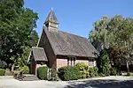 |
Abbotsford | 4304 Wright Street | 49.0803 -122.261 |
5881 | 1912 | Heritage Designation | 1978 | |
| M | Clayburn School |  |
Abbotsford | 4315 Wright Street | 49.0807 -122.262 |
5882 | 1908 | Heritage Designation | 1978 | |
| F | Temple sikh d'Abbotsford | 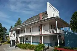 |
Abbotsford | 33089 South Fraser Way | 49.0513 -122.307 |
9358 | 1912 | LHN | 2002 | |
| M | Trethewey House |  |
Abbotsford | 2313 Ware Street | 49.0437 -122.305 |
5880 | 1920 | Heritage Designation | 1981 | |
| F | Bâtiment 24 | 
|
Chilliwack | 45420 Vedder Mountain Street | 49.1025 -121.975 |
11008 | 1943 | Recognized Federal Heritage Building | 1997 | |
| F | Hôtel de ville de Chilliwack | 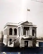 |
Chilliwack | 45820 Spadina Avenue | 49.1687 -121.956 |
7408 | 1912 | LHN | 1984 | |
| P | Kilby Store and Farm |  |
Harrison Mills | 215 Kilby Road | 49.2378 -121.96 |
1748 | 1906 | Provincial Heritage Site (Designated) | 1988 | |
| F | Église Christ Church | 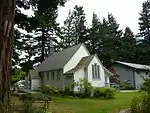 |
Hope | 681 Fraser Avenue | 49.381 -121.444 |
12564 | 1861 | LHN | 1994 | |
| P | Othello Tunnels | 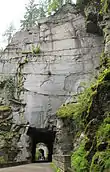 |
Hope | Parc provincial de Coquihalla Canyon | 49.3706 -121.366 |
18065 | 1914 | Provincial Park (Establishment) | 1986 | |
| P | Royal Engineers' Road |  |
Hope | Parc provincial E. C. Manning | 49.2344 -121.123 |
18056 | 1861 | Provincial Park (Establishment) | 1941 | |
| F | Station de recherches Agassiz, bâtiment no 13 | 
|
Kent | 6947 Highway 7 | 49.245 -121.762 |
4381 | 1911 | Recognized Federal Heritage Building | 1993 | |
| F | Installation hydroélectrique de Stave Falls | 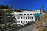 |
Mission | 49.2285 -122.356 |
13213 | 1912 | LHN | 2003 | ||
| F | Xá:ytem / Hatzic Rock | 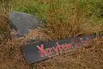 |
Mission | 35087 Lougheed Highway | 49.1512 -122.251 |
2256 | LHN | 1992 | ||
| F | Église Holy Cross | 
|
Skookumchuck | 49.9362 -122.397 |
7410 | 1906 | LHN | 1981 | ||
| P | Alexandra Bridge | 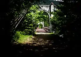 |
Spuzzum | Parc provincial du Pont Alexandra | 49.7075 -121.417 |
18067 | 1926 | Lieu patrimonial provincial (désigné) | 1974 | |
| P | Royal Engineers' Road at Alexandra Bridge | 
|
Spuzzum | Parc provincial du Pont Alexandra | 49.7071 -121.414 |
18042 | 1926 | Provincial Park (Establishment) | 1984 | |
| P | Church of St. John the Divine | 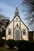 |
Yale | Douglas Street | 49.5627 -121.432 |
6190 | 1863 | Other Prescribed Heritage Property | 1979 |
Notes et références
- Niveau de la désignation: F: Fédéral, P: Provincial, M: Municipal
- (fr) Répertoire canadien des lieux patrimoniaux : Manuel de normes de documentation, Annexe A : Vocabulaires contrôlés, p.59-78
(en) Canadian Register of Historic Places: Documentation Standards Handbook, Appendix A: Controlled Vocabulary, p.57-75
Annexes
Articles connexes
Pour l'ensemble des points mentionnés sur cette page : voir sur OpenStreetMap (aide) ou télécharger au format KML (aide).
Liens externes
Cet article est issu de wikipedia. Text licence: CC BY-SA 4.0, Des conditions supplémentaires peuvent s’appliquer aux fichiers multimédias.