Forêt nationale de Bridger-Teton
La forêt nationale de Bridger-Teton se trouve dans l'État du Wyoming aux États-Unis. Sa superficie totale est de 13 800 km2. La forêt a été constituée le .
| Forêt nationale de Bridger-Teton | |||
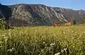
 Lac dans la forêt de Bridger-Teton | |||
| Localisation | |||
|---|---|---|---|
| Coordonnées | 43° 26′ 00″ nord, 110° 41′ 00″ ouest | ||
| Pays | |||
| État | |||
| Géographie | |||
| Superficie | 1 377 017 ha[2] | ||
| Compléments | |||
| Protection | 3 aires sauvages | ||
| Statut | Forêt national des États-Unis | ||
| Administration | Service des forêts des États-Unis | ||
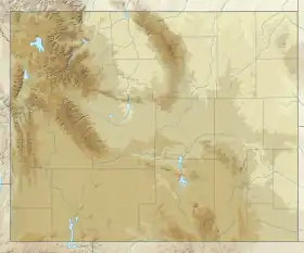
| Géolocalisation sur la carte : États-Unis
Géolocalisation sur la carte : Wyoming
| |||
_relief_location_map.png.webp)
Protection du territoire
Bridger-Teton comprend 3 aires sauvages : Bridger (1 732,40 km2), Gros Ventre (1 286,39 km2) et Teton (2 368,37 km2).


Notes et références
- (en) « Table 4 - Areas by State (30-Sep-2009) », sur United States Forest Service, (consulté le )
- [1]
Annexes
Cet article est issu de wikipedia. Text licence: CC BY-SA 4.0, Des conditions supplémentaires peuvent s’appliquer aux fichiers multimédias.