East Northamptonshire
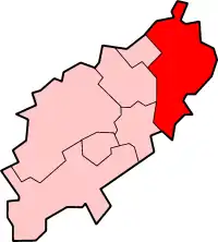
Le East Northamptonshire est un ancien district non métropolitain du Northamptonshire, en Angleterre. Comme son nom l'indique, il était situé tout à l'est du comté, à la frontière du Cambridgeshire. Son chef-lieu était Thrapston.
East Northamptonshire

| Pays | |
|---|---|
| Nation constitutive | |
| Région | |
| Comté cérémonial | |
| Chef-lieu | |
| Superficie |
509,79 km2 () |
| Coordonnées |
52° 27′ N, 0° 30′ O |
| Population |
93 906 hab. () |
|---|---|
| Densité |
184,2 hab./km2 () |
| Statut | |
|---|---|
| Assemblée délibérante |
East Northamptonshire Council (d) |
| Fondation | |
|---|---|
| Remplacé par | |
| Dissolution |
| Site web |
|---|

Histoire
Ce district est créé le par le Local Government Act 1972. Il est issu de la fusion du borough municipal de Higham Ferrers avec les districts urbains d'Irthlingborough, Oundle, Raunds et Rushden, ainsi que les districts ruraux d'Oundle et Thrapston et une partie du district rural de Wellingborough. Il disparaît le et laisse place à l'autorité unitaire du North Northamptonshire.
Géographie
Le district est composé des villes et paroisses civiles suivantes :
- Aldwincle, Apethorpe, Ashton
- Barnwell, Benefield, Blatherwycke, Brigstock, Bulwick
- Chelveston cum Caldecott, Clopton, Collyweston, Cotterstock
- Deene, Deenethorpe, Denford, Duddington with Fineshade
- Easton on the Hill
- Fotheringhay
- Glapthorn, Great Addington
- Hargrave, Harringworth, Hemington, Higham Ferrers
- Irthlingborough, Islip
- King's Cliffe
- Laxton, Lilford cum Wigsthorpe, Little Addington, Lowick, Luddington, Lutton
- Nassington, Newton Bromswold
- Oundle
- Pilton, Polebrook
- Raunds, Ringstead, Rushden
- Southwick, Stanwick, Stoke Doyle, Sudborough
- Tansor, Thorpe Achurch, Thrapston, Thurning, Titchmarsh, Twywell
- Wadenhoe, Wakerley, Warmington, Woodford, Woodnewton
- Yarwell
Lien externe
Cet article est issu de wikipedia. Text licence: CC BY-SA 4.0, Des conditions supplémentaires peuvent s’appliquer aux fichiers multimédias.