Brokopondo (district)
Brokopondo est un district du Suriname ayant pour capitale Brokopondo.
Brokopondo
| Pays | |
|---|---|
| Chef-lieu | |
| Superficie |
7 364 km2 |
| Coordonnées |
4° 46′ 21″ N, 55° 07′ 46″ O |
.svg.png.webp)
| Population |
8 340 hab. |
|---|---|
| Densité |
1,1 hab./km2 |
| Statut |
|---|
| ISO 3166-2 |
SR-BR |
|---|
| TGN |
|---|

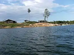
Il encercle complètement le lac du même nom, occasionné par la construction d'un barrage hydroélectrique.
Subdivisions
Le district comporte 6 subdivisions (en néerlandais ; ressorten) :
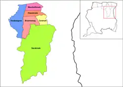
Subdivisions du district de Brokopondo
Liens externes
Cet article est issu de wikipedia. Text licence: CC BY-SA 4.0, Des conditions supplémentaires peuvent s’appliquer aux fichiers multimédias.